Disaster strikes when a natural hazard meets a vulnerable population. Therefore, regions that experience frequent hazards can reduce their disaster risk through adequate preparation. In Southern Africa, communities are hit with severe storms, flooding, droughts, wildfires, and biological hazards every year, creating the need for reliable hazard information. To address this need, the United Nations’ Space-based Information for Disaster Risk Management and Emergency Response (UN-SPIDER) teamed up with the Center for Remote Sensing of Land Surfaces of the University of Bonn (ZFL) to organize a regional forum July 13-15 on the use of space-based technologies and information for disaster risk management in Southern Africa.
During the three-day forum, two teams from the NASA Disasters program presented their work on disaster risk assessment within Southern Africa. The Disasters program promotes the innovative use of Earth observations to reduce disaster risk, improve response, and hasten recovery. Thus, taking part in this meeting contributes to NASA’s goal to foster resilience worldwide.
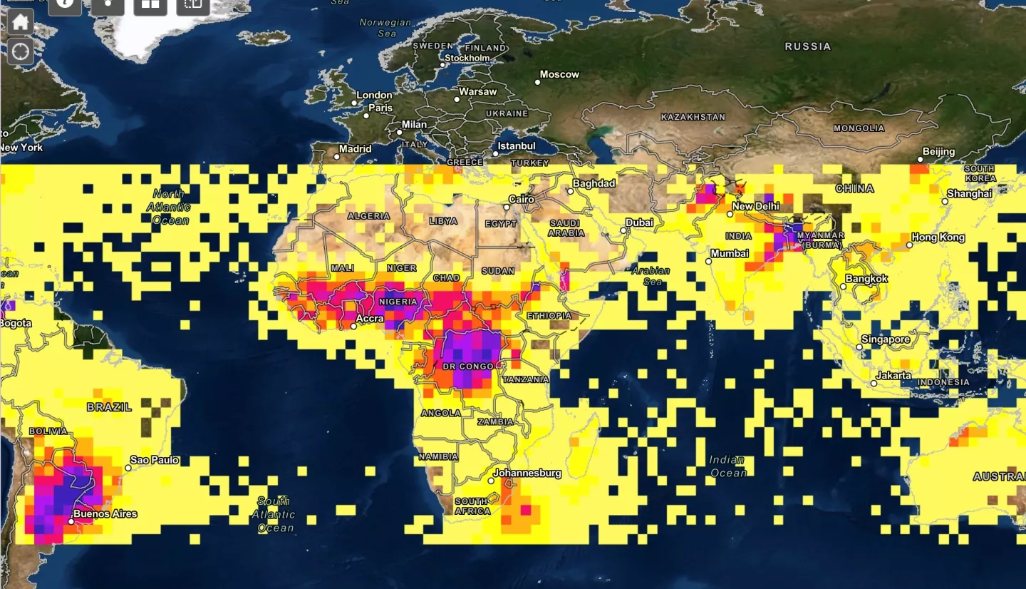
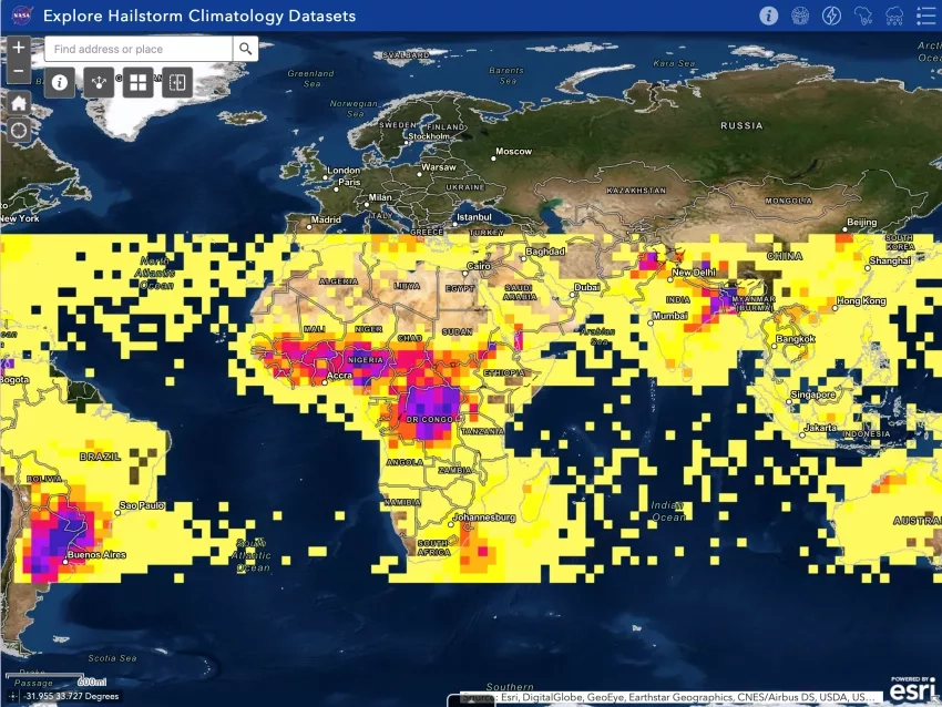
Principal investigator Kristopher Bedka discussed how his project, “Hail Storm Risk Assessment Using Space-Borne Remote Sensing Observations and Reanalysis Data,” uses satellite observations, reanalyses, and models to improve severe storm understanding and warning in regions that do not have adequate weather radar coverage. He also talked about NASA’s collaboration with the reinsurance industry to better model risk from hailstorms to insured assets. Bedka’s team created a geographic information systems (GIS)-based hailstorm data visualization portal where users can interact with climatologies from various sensors to better understand when and where hailstorms occur most often on a global scale.
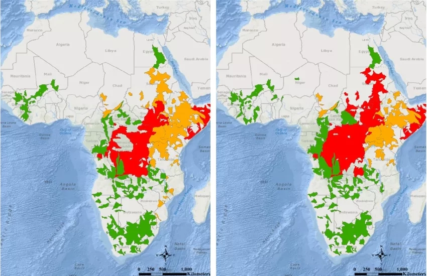
Margaret Glasscoe, principal investigator for “Advancing Access to Global Flood Modeling and Alerting using the Pacific Disaster Center’s (PDC) DisasterAWARE (All-hazard Warnings, Analysis, and Risk Evaluation) Platform and Remote Sensing Technologies,” explained how her project provides a single source of global information on floods that is supported by a common, normalized data model. In 2020, Glasscoe used her model-of-models approach to respond to flooding in Eastern and Central Africa and was able to create flood severity alerts for the local regions.
The NASA Disasters program generates data and products to increase situational awareness and supporting global decision-making. Bringing NASA capabilities to regions outside of the United States requires working with international partners, which means collaboration is essential to NASA’s mission. Sharing Earth observation data with agencies in Southern Africa and the United Nations pushes NASA one step closer to its goal, while enabling disaster management, risk reduction, and resilience in Southern African communities.
Read more about the Southern African forum for disaster resilience here: “UN-SPIDER and ZFL carry out Virtual Regional Expert Meeting for Southern Africa”


