
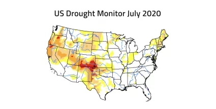
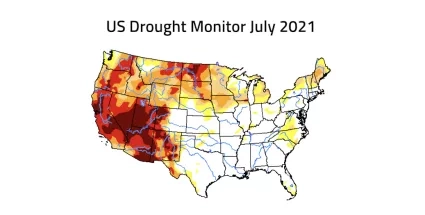
The American west is experiencing an exceptional drought. Following one of the planet’s hottest years on record, and with rainfall and snowfall in the western U.S. well below average, water managers, policymakers, government agencies and scientists are facing strapped water supplies and anticipating potentially devastating wildfires.
Using its satellites, aircraft and computer models, NASA is helping water managers respond. NASA’s drought resource page will be updated throughout the year. It details how NASA is helping farmers, reservoir managers and decision makers track and monitor the ongoing drought, predict how much water will be available, and help improve how we use the water we have.
Supporting this is NASA’s expertise in water science, partnerships with water managers across the country, and leadership in space and remote-sensing technology.
More information at our drought resource page: NASA Strengthens Our Resilience to Drought.


