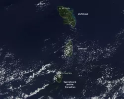
The La Soufrière volcano has produced multiple explosive eruptions over the past week, blanketing the island of Saint Vincent in volcanic ash and propelling ash and gas high into the atmosphere over the Caribbean sea. On Saturday, April 10, NASA’s Terra satellite passed over the volcano, capturing observations of the volcanic plume with its Multi-angle Imaging SpectroRadiometer (MISR) instrument.
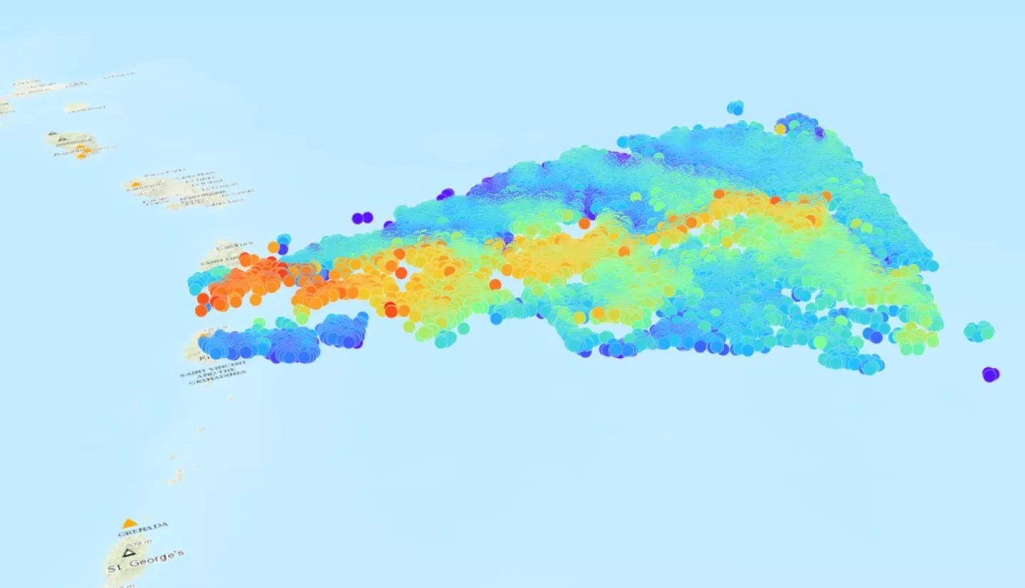
Researchers from the NASA Goddard Space Flight Center MISR Active Aerosol Plume-Height (AAP) Project analyzed these MISR observations to gain insights into the properties of the volcanic plume, its dispersion, and its impact on the atmosphere. The researchers also worked with Geographic Information Systems (GIS) specialists from NASA’s Earth Science Applied Sciences Disasters program area to translate the MISR measurements into an interactive 3D map of the smoke plume – the most advanced 3D visualization of MISR observations a volcanic plume yet developed.
View fullscreen on the NASA Disasters Mapping Portal
Analysis of the MISR data shows a large plume reaching heights to over 12 miles (~20 km) into the atmosphere, with winds dispersing the plume eastward. The dense plume appears in this satellite overpass over 180 miles (300km) downwind, extending past the island of Barbados. In the visualization, the colors of each data point indicate the elevation of the plume, with blues and greens indicating elevations of 6 to 11 miles (10 to 18 km), and oranges and reds indicating particles at 11 to 12 miles (18 to 20 km) above the ocean’s surface. The data indicate that some of the plume reached up into the stratosphere, where it can stay aloft for many months and travel great distances. MISR data analysis also show that the plume is composed mainly of large, non-spherical, light-absorbing particles, which indicates a plume rich in volcanic ash – as distinct from other volcanic plumes that are dominated by sulfate and water particles, such as the eruption plumes that typically emanate from the Kīlauea volcano in Hawai’i.
NASA has been monitoring the volcanic activity at Saint Vincent since January, and worked closely with regional stakeholders to provide Earth-observing data and analysis as the volcano became more active over the past week. Sulfur dioxide released by the eruption poses an air-quality hazard, irritating the human nose and throat. And volcanic ash high in the atmosphere presents a risk to aircraft. In addition, observations of volcanic plume height are an important input to air quality models that predict where the plume will go, and who might be affected downwind. By harnessing the power of Earth observations, NASA provides critical information for decision-makers to aid response and recovery efforts.
Learn more at NASA's Earth Observatory: Tracking La Soufrière’s Plume
View other NASA updates and resources for the La Soufrière eruption.