Published
UAVSAR aboard the NASA502 aircraft imaged Napa County, California on October 16 to observe areas affected by several wildfires that started on October 8 and burned thousands of buildings as well as vineyards and forests.
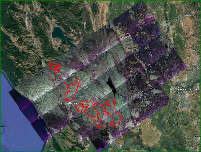
The fire perimeters (red) are from the USGS Geospatial Multi-Agency Coordination website as of October 17.
The fires from north to south are: Pocket, Tubbs, Nunn, and Atlas respectively..
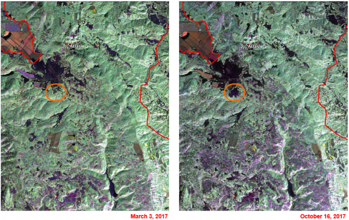
Close-up view of Atlas fire before (2017.3.3) and after the fire (2017.10.16) – after image shows fire scars (purple) throughout the area south of Atlas.


