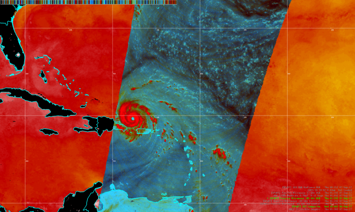
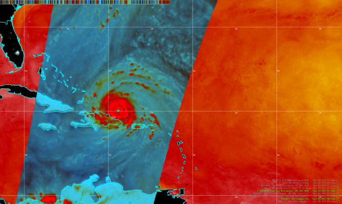
The NASA SPoRT program has been providing Passive Microwave data to the National Hurricane Center for use in the NWS Automated Weather Interactive Processing System (AWIPS), which allows for data-layering capabilities, and has helped improve the method for tracking center fixes on tropical systems. These data have been provided to the NHC as part of an on-going collaborative effort for several years now. These first two images are 89 GHz RGBs taken over Cat-5 Irma from this morning. Importantly, these data/imagery help forecasters to better analyze the internal hydrometeorological structure of tropical systems over other traditional satellite imagery.
Sea surface temperatures to the west of the system, and ultimately where it will be tracking are on the order of about 85-87 degrees F, according to the SPoRT data. The warmest waters are found generally in the SW portions of the Bahamas.
Lastly, here are the 89 GHz Horizontal and Vertical data/imagery for each of these times, that comprise the RGB.


