California, which has long been suffering through a strong, multi-year drought, is finally beginning to see some much needed relief as a result of a recent series of storms that are part of a weather pattern known as the “Pineapple Express.” The Pineapple Express is known as an atmospheric river. A large, slow-moving low pressure center off of the West Coast taps into tropical moisture originating from as far south as the Hawaiian Islands. This moisture is then channeled northeast by the subtropical jet steam towards the West Coast where the topography aids in squeezing out the moisture as air flows over the mountain ranges. Though these rains are certainly welcome and very much needed, they have also led to flooding and mudslides. The first storm in the series arrived in the middle of last week and brought rain to northern and central California. The next storm occurred over the weekend and brought heavy rains again to mostly northern and central California although southern California also received significant amounts. This event lead to widespread flooding, down trees and mudslides, especially in the Sierra Nevada where hurricane force winds occurred and Interstate 80 was closed due to a massive mudslide. Blizzard, winter storm, high wind, and flood warnings are already in effect as the third plume of moisture in this series is already making its way through the interior part of the state where several feet of snow are expected in the Sierra Nevada.
The Tropical Rainfall Measuring Mission satellite (known as TRMM) was launched into service back in November of 1997. It was designed to measure rainfall over the global Tropics using both passive and active sensors, including the first and at the time only precipitation radar in space. With its combination of passive microwave and active radar sensors, TRMM was used to calibrate rainfall estimates from other satellites to expand its coverage. The TRMM-based, near-real time Multi-satellite Precipitation Analysis (TMPA) at the NASA Goddard Space Flight Center has been used to monitor rainfall over the global Tropics for many years. By subtracting the long-term average rainfall or climatology, rainfall anomalies can be constructed to show deviations from the normal pattern.
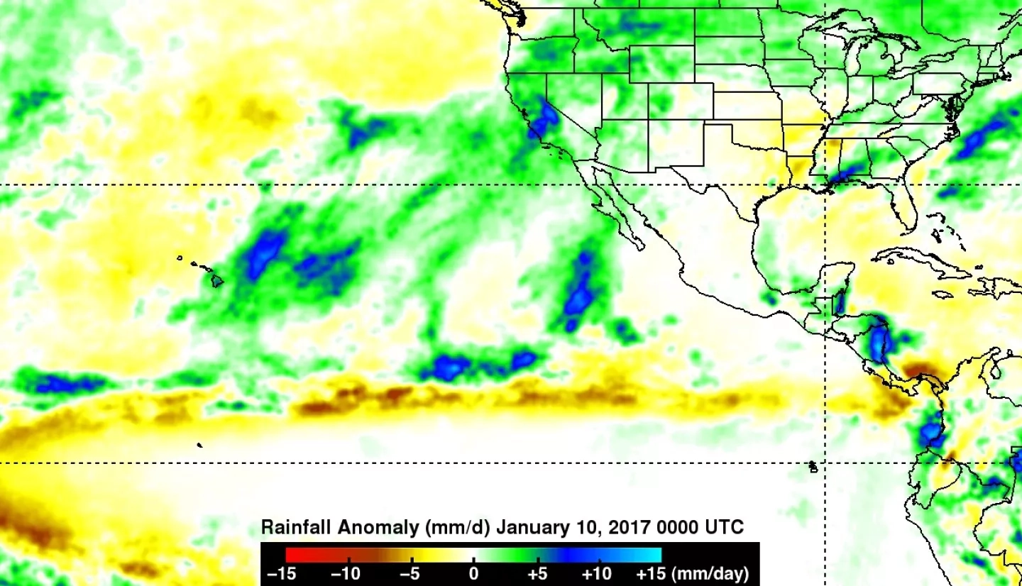
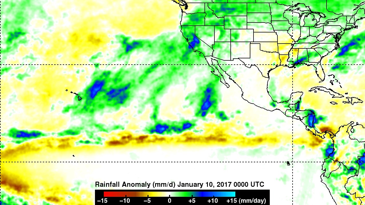
The first image shows rainfall anomalies for the one month period ending on 10 January 2017. During this period, higher-than-average precipitation extends from over and east of the Hawaiian Islands northeastward all the way into California and covers most of the state, eastern Oregon and much of the northern Rockies (green areas). Embedded within this region are areas of much higher than average rainfall (blue areas) located northeast of Hawaii and over parts of central California with most of this due to the recent, ongoing atmospheric river event.
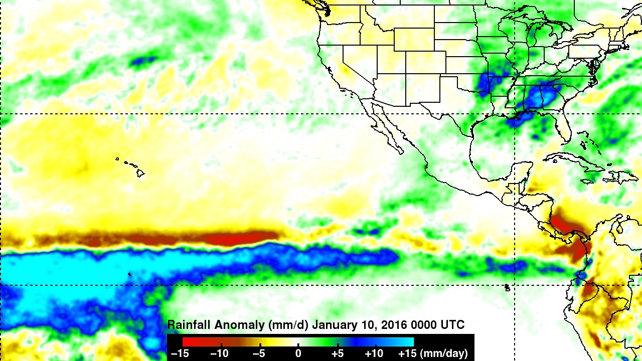
The second image shows rainfall anomalies for this same period a year ago. In contrast to the current situation, average to slightly below average rainfall (yellow areas) had fallen over the central and interior parts of California during this period. Also evident is the well-pronounced, massive area of well above average rainfall associated with last year’s El Nino where well above average sea surface temperatures stretched across the central, equatorial Pacific bringing much enhanced shower activity. That has now been replaced by La Nina conditions, which tend to suppress rainfall in this region as shown by this year’s anomalies.
The current plume of moisture is expected to subside by this Friday with much drier conditions forecast for the weekend.
TRMM was a joint mission between NASA and the Japanese space agency JAXA.


