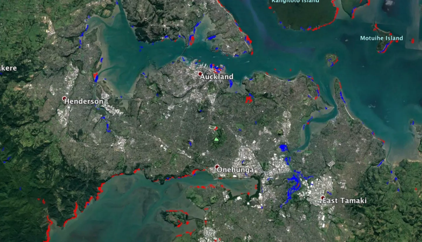
Following a Sentinel-1 acquisition over eastern North Island, covering Auckland on April 14, 2017 at 17:37h UTC, a synthetic aperture radar (SAR) flood proxy map (FPM) was developed as a KMZ overlay (available for download here)
This FPM covers an area of 175-by-500 km, derived from Sentinel-1's pre- (2016-04-02) and post-event (2017-04-14) SAR amplitude images. The colored pixels represent areas of possible floods mostly due to Cyclone Cook (Red: usually flooded vegetation, Blue: usually open water flood). Different irrigation conditions on the two data acquisition dates can produce errors on agricultural lands and may be less reliable over urban areas. No preliminary validation was implemented, including topographic corrections. As a result, the map may show flooded areas over sloped terrain.
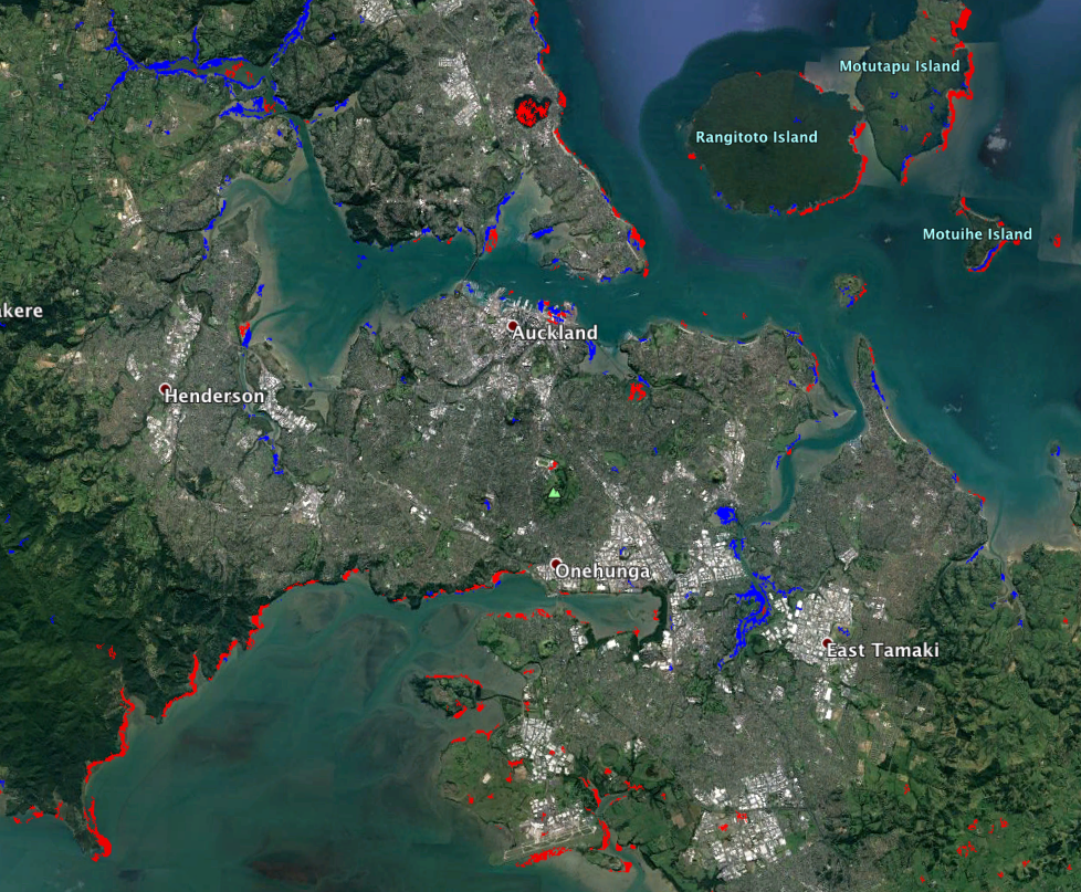
The FPM was created by the Advanced Rapid Imaging and Analysis (ARIA) team at JPL/Caltech. The FPM Contains modified Copernicus Sentinel-1 data 2017 and there are no restrictions on its release.


