A promising approach to mitigating the economic and human costs of flooding is to apply information from Earth-observing satellites and reduce a community’s risk before a flood happens. Flooding causes millions of dollars in economic costs and often affects more vulnerable communities. This May, SERVIR held a flood “Hack-a-thon” to expand upon methods for this more proactive approach.
SERVIR is a joint initiative between NASA and the U.S. Agency for International Development, (USAID). It partners with leading regional organizations around the world to help developing countries use Earth-observing data to manage environmental risks and land use.
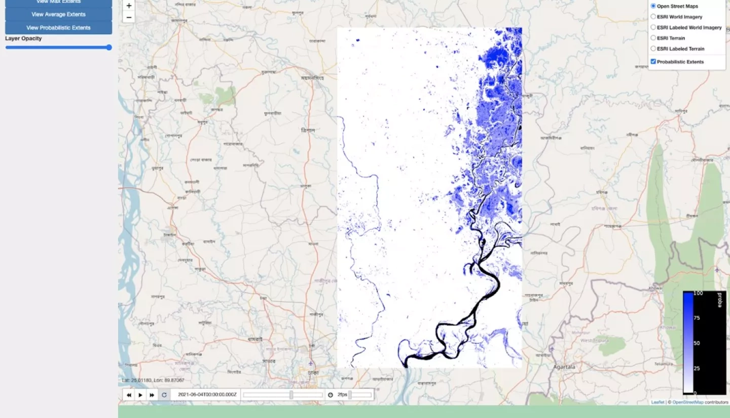
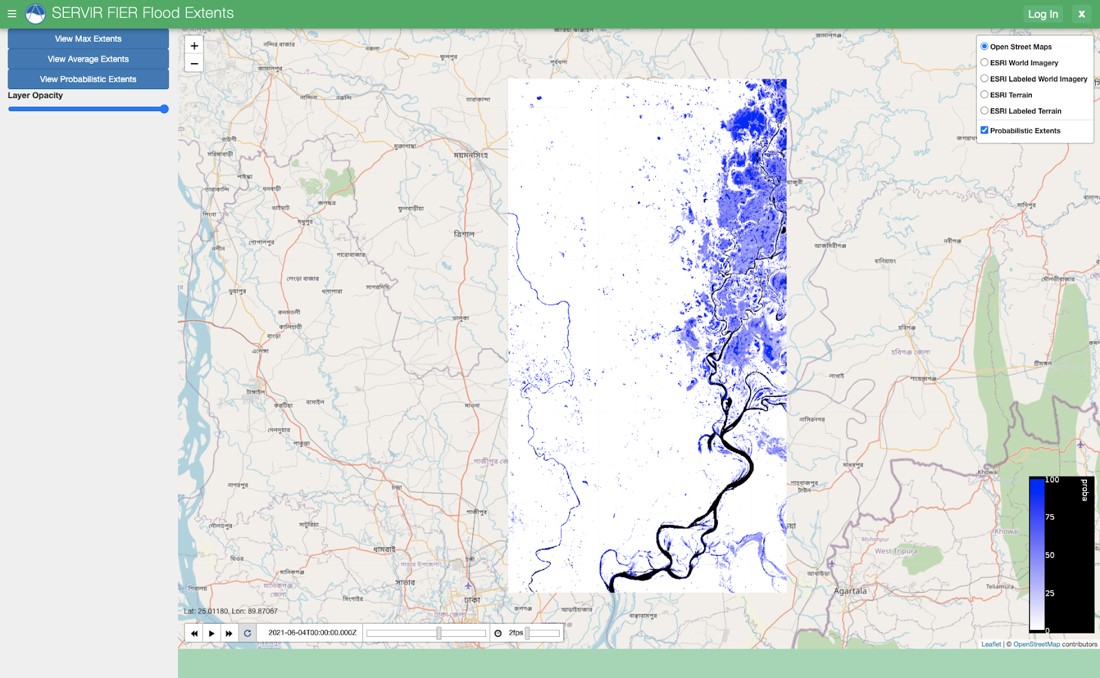
Almost two dozen members of the SERVIR Applied Sciences Team, its Science Coordination Office, and regional hubs participated in the flood Hack-a-Thon. They spent four days exchanging ideas and collaborating on improvements to Synthetic Aperture Radar (SAR)-based flood forecasting methods. Goals of the event included testing a methodology for forecasting the spatial extent of flooding and creating a web tool to visualize those forecasts to expand the use of SAR for flood applications.
“From this hack-a-thon it seems that we have many of the required tools to move forward in flood early warning systems,” said Mir Matin, Science & Data Lead for the SERVIR-Hindu Kush Himalaya hub. “We are one important step forward towards impact-based forecasting, and we are well-positioned to refine a product. We would like to work with this and test it during the next flood season in Bangladesh and Nepal.”
The May Hack-a-thon builds on a previous hack-a-thon hosted by SERVIR Applied Science Team members Jim Nelson of Brigham Young University, Franz Meyer of the University of Alaska Fairbanks and Hyongki Lee of the University of Houston. This collaboration aimed to support flood risk reduction by exploring ways to connect several satellite- and model-based methods into more reliable forecasts for early warning. By combining historical SAR observations with streamflow estimates, the team hopes to provide timely, accurate flood extent forecasts—equipping flood management agencies to take early action.
“I’d use the old proverb, ‘If you want to go fast, go alone, but if you want to go far, go together,” said Nelson, a hydrologist and member of SERVIR’s Applied Sciences Team (AST). He also helped organize the events. “I really think we are trying to combine the expertises of multiple AST’s and projects to make something greater than any one of us could do by ourselves.”
As flood early warning systems become more advanced and accessible around the world, moving resources towards preparedness and mitigation — rather than just immediate response — will become more feasible. Scientists at SERVIR hope that this means flood managers and communities will get more value out of their flood management investments, helping increase disaster resilience around the world.


