Published
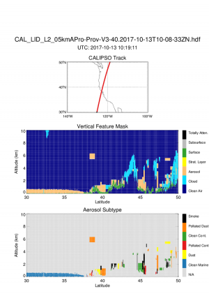
CALIPSO Ground Track on 10/13/2017
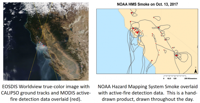
Vertical profiles of the near-field smoke plumes from the fires burning in California on October 13th, 2017. These CALIOP data (space-based lidar) can be used for Air Quality, Hazardous plume location, and for the potential initialization of transport models.
CALIOP Vertical Feature Mask and Subtype
At this time, the smoke is not hovering near the ground.