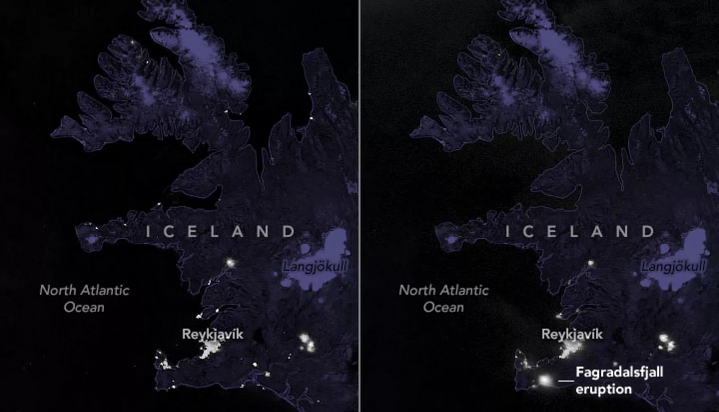
Swarms of small earthquakes in February 2021 on Iceland’s Reykjanes peninsula had experts warning that magma was moving beneath Geldingadalur valley and could soon erupt. Late on March 19, an eruption officially began as lava broke through the surface near Fagradalsfjall, one of several shield volcanoes on the peninsula.
While small in comparison to other recent eruptions in Iceland, the event was bright and large enough for NASA and NOAA satellites to observe. On March 21, 2021, the Suomi NPP satellite acquired a nighttime view of western Iceland through a thin layer of clouds. Reykjavik, Reykjanesbær, and other cities appear as bright spots in the image. The eruption appears as a new patch of light on the southwestern part of the island. For comparison, the image on the left shows the same area a few days before the eruption.
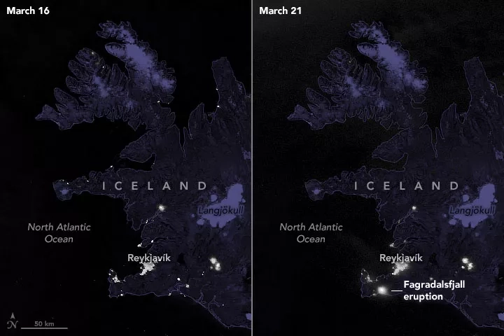
The images were acquired with the day-night band of the Visible Infrared Imaging Radiometer Suite (VIIRS), which detects light in a range of wavelengths from green to near-infrared and uses filtering techniques to observe faint signals such as fires, electric lights, and the glow emitted by lava. During the day, the Moderate Resolution Imaging Spectroradiometer (MODIS) acquired natural-color and false-color imagery as emissions from the eruption slightly brightened clouds in the area.
Read more at NASA's Earth Observatory:
Volcanic Eruption Lights Up Iceland
Landsat Views a Nighttime Eruption


