Imagen
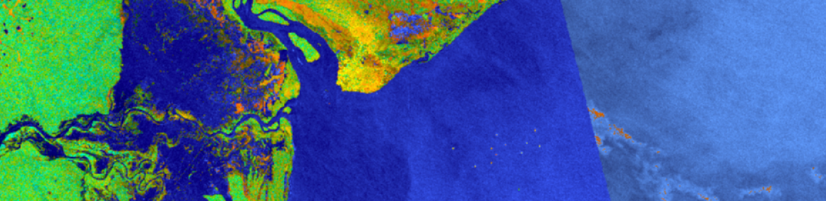
Water is shown in blue, highlighting the widespread flooding impacting Mozambique. Vegetation is shown as green and urban areas are orange. Use the swipe tool to identify where flooding has occurred. The Alaska Satellite Facility has developed a false color Red, Green, Blue (RGB) composite image of the Sentinel-1A/B Synthetic Aperture Radar (SAR) instrument which assigns the co- and cross-polarization information to a channel in the RGB composite. When used to support a flooding event, such as Cyclone Idai, areas in blue denotes water present at the time of the satellite overpass.


