Jean-Paul Vernier never expected he’d have a career in tracking volcanos and fires from space, but as an atmospheric scientist, that’s where the winds took him.

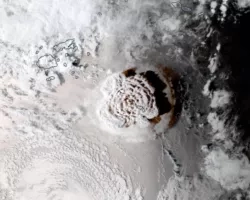
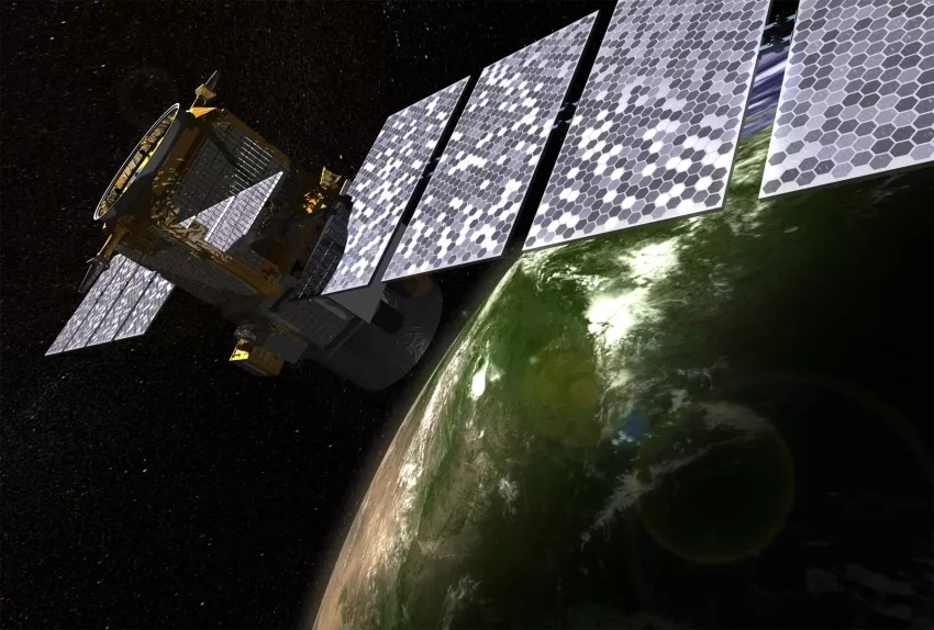
Based at NASA’s Langley Research Center with the National Institute of Aerospace, Vernier works as a scientist with the Cloud-Aerosol Lidar and Infrared Pathfinder Satellite Observation (CALIPSO) team. He’s also a coordinator for NASA’s Earth Applied Sciences Disasters program area. Vernier is keenly interested in long and short-term changes in the atmosphere. Whether he is helping characterize the recent record-breaking plume from the recent Hunga Tonga-Hunga Ha‘apai eruption in the South Pacific, or monitoring volcanic activity and tracking impacts from other events around the globe, he connects people everywhere with NASA data products that can satisfy their needs.
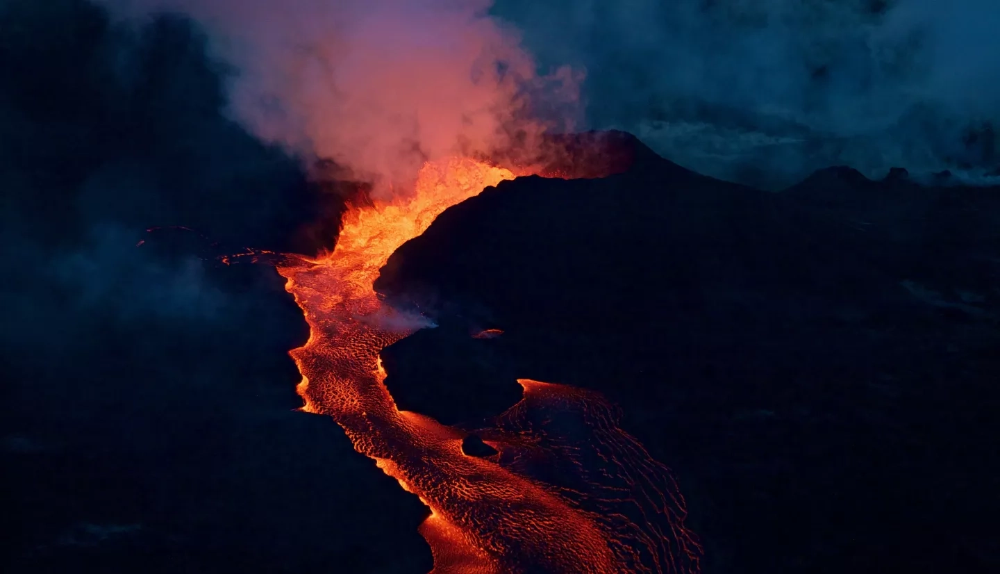
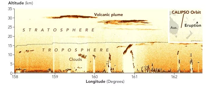
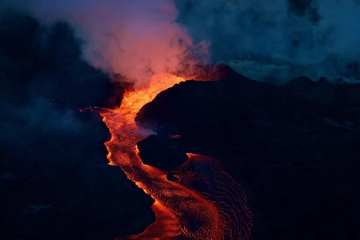
Volcanic eruptions can send ash plumes far up into the atmosphere where aircraft travel. If planes fail to avoid that abrasive ash, their engines can be quickly damaged before safely landing. Through his work with the NASA’s Disasters program, Vernier maintains relationships with Volcanic Ash Advisory Centers (VAACs) worldwide, and providing NASA satellite data products and guiding end-users in the most efficient and effective use of the data. The VAACs use this information to issue advisories for airlines and pilots to avoid air space contaminated by ash. Thanks to cooperation among organizations such as these, and advanced Earth-Observation tools such as CALIPSO, the scientific community has made considerable strides in tracking ash plumes over the last decade.
The 2010 volcanic eruption of Eyjafjallajökull in Iceland provides an example of the community’s progress. While the eruption itself was not particularly large, “the wind direction made it very annoying for European countries,” Vernier explains. Ash from Eyjafjallajökull disbursed over European airspace for several weeks, grounding over 100,000 flights. In the past, scientists qualitatively tracked the ash, using simple proxy maps to define a region of air space “more or less” contaminated. The response to Eyjafjallajökull illustrated that a better understanding of volcanic ash concentration could have significant economic impacts as well as safety considerations. Implementation of such research is still new, and various regions continue to apply differing response methods, but the scientific community is moving closer to quantifying such a threshold.
It’s not just about aircraft safety, either. Volcanic eruptions can also lead to air-quality issues that impact human health, power outages, and even wildfires. Vernier helps coordinate NASA with other agencies to provide imagery, damage proxy maps and additional information that helps communities make informed decisions about such impacts.
His expertise also goes well beyond volcanic eruptions. The increase of extreme wildfires in recent years, such as those in Australia and the Western U.S., has global implications. Vernier’s insights on smoke transport in our atmosphere are valuable to decision-makers who need to understand both the short and long-term effects of these massive events. The devastation on the ground may be evident during a fire, but as the resulting smoke rises, ash can reduce visibility for firefighters and other responders. With data from CALIPSO, responders can better direct planes, helicopters, or drones to the fires.
Vernier’s long-term research also includes his role on the SAGE III/ISS science team. SAGE stands for “Stratospheric Aerosol and Gas Experiment.” Roughly the size and shape of a cast-iron stove, SAGE III is mounted onto the International Space Station. The instrument uses sunbeams from sunsets and sunrises to infer atmospheric composition. SAGE III has witnessed numerous notable stratospheric aerosol events, from space, including wildfires and volcanic eruptions.
NASA’s Upper Atmospheric Composition Observation program also supports Vernier, enabling him to conduct balloon campaigns that study volcanic plumes. Sensors aboard the balloons on these campaigns measure properties of plumes in more detail, including optical, microphysical, and chemical properties of their aerosols.
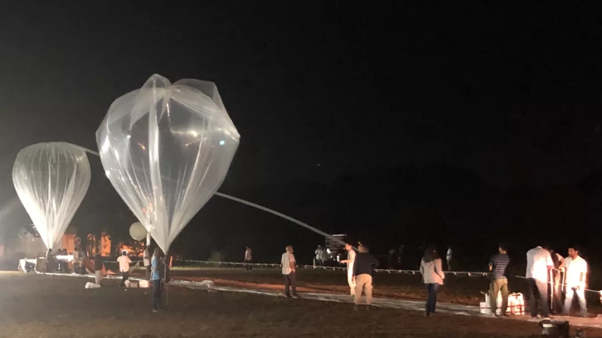
These balloon campaigns are also beneficial in studying aerosol layers in the atmosphere beyond those originating from ash plumes. In 2010, Vernier and his colleagues were the first to detect an aerosol layer above the Asian monsoon. The layer, called the Asian Tropopause Aerosol Layer (ATAL), was discovered with CALIPSO satellite data. Through the “Balloon Measurement Campaigns of the Asian Tropopause Aerosol Layer” (BATAL) project, Vernier and his colleagues began to make in-situ measurements to both validate the original satellite observations and provide more insight into the layer’s physical and chemical properties. Beyond BATAL, Vernier has continued to elevate satellite observations to the next level by employing numerous balloon campaigns and pursuing additional fieldwork to validate and complement the satellite data.
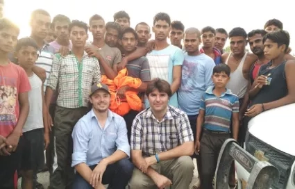
Vernier’s work as an atmospheric scientist has taken him far and wide. Looking back on his many travels, Vernier remarks that his life “has been tied to India.” India is where he researched the Asian monsoon and underwent scientific training while earning his master’s degree. It’s even where met his wife. Far above India, orbiting Earth, CALIPSO has also been a consistent theme in his life. “I started my Ph.D. with CALIPSO–and here we are–becoming old, with four kids, and CALIPSO is still there, 15 years later,” Vernier laughs.
(NASA Disasters Science Writer Intern, Sierra Steele contributed to this story.)