Earth observations help the city manage its water and urban forests
The City of Trees. Hotlanta. The Big Peach.
 Whatever you call it, Atlanta is a bustling American metropolis of concrete and steel. It also boasts extensive parks, gardens, and urban forests. As with other growing metro areas, the city has been seeking ways to balance this green canopy and its vital infrastructure—especially as its population is expected to double by 2060.
Fortunately for A-Town, the Georgia chapter of The Nature Conservancy (TNC) has already been formulating a plan for one of the city’s potential challenges—its water supply. “The Nature Conservancy is developing an urban conservation program focused on reducing stormwater impacts in the Atlanta metro area,” explained Sara Gottlieb of TNC.
This conservation plan is part of TNC’s North American Cities program, which emphasizes a greater role for nature in urban settings. By promoting greenspace as an alternative to traditional stormwater infrastructure, like costly culverts and drains, TNC advocates re-introducing natural buffers while protecting existing ones. This “green” infrastructure helps decrease urban runoff and also reduces the amount of pollutants entering local waterways.
It’s an ambitious plan; and the greater Atlanta region is huge—about the size of Connecticut. It also has one of the most extensive urban canopies in the U.S. Where should TNC and its partners concentrate their conservation efforts? For that question, TNC turned to NASA DEVELOP for help.
 Green Guidance
DEVELOP teams integrated data from Landsat and Terra into land-use models to locate reforestation targets as well as identify locations that impacted local water quality. The teams applied the results to create a land-use prioritization map of metropolitan Atlanta’s major watersheds for TNC and its partners.
DEVELOP Lead Christopher Cameron said the project identified a few specific areas where TNC could focus its conservation efforts. “Reforestation and green space development opportunities exist along several waterways adjacent to Atlanta,” he noted. The project also indicated which communities were major sources of runoff that additional green infrastructure could help minimize.
Cameron added, “The majority of open or managed land with the highest potential to affect water quality occurs north of Atlanta. The downstream effects of any land management practices at these locations could be significant.”
Seeing the Forest for its Trees
TNC received that crucial, fine-detailed information it was lacking. Myriam Dormer, an urban conservation associate at TNC, remarked, “Now we have a smaller subset of places within Atlanta where we can target reforestation projects and then target engagement strategies.”
Gottlieb affirmed, “The results of these analyses will be used immediately to inform decisions about land protection and reforestation to benefit communities by protecting drinking water supplies, providing opportunities for outdoor recreation, and serving as educational settings to demonstrate the importance of maintaining greenspace in urban areas.”
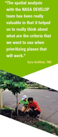
Keeping ATL peachy-keen takes a team effort, it seems. As Gottlieb stressed, “We could not have completed these analyses without access to NASA’s resources and Earth observations.”
DEVELOP is a national training and development program for individuals to gain experience applying Earth observations through 10-week interdisciplinary projects with state and local governments, and other organizations. https://develop.larc.nasa.gov/


