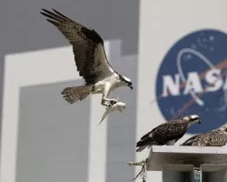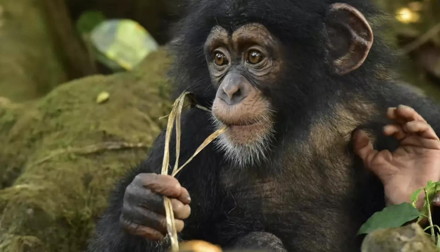
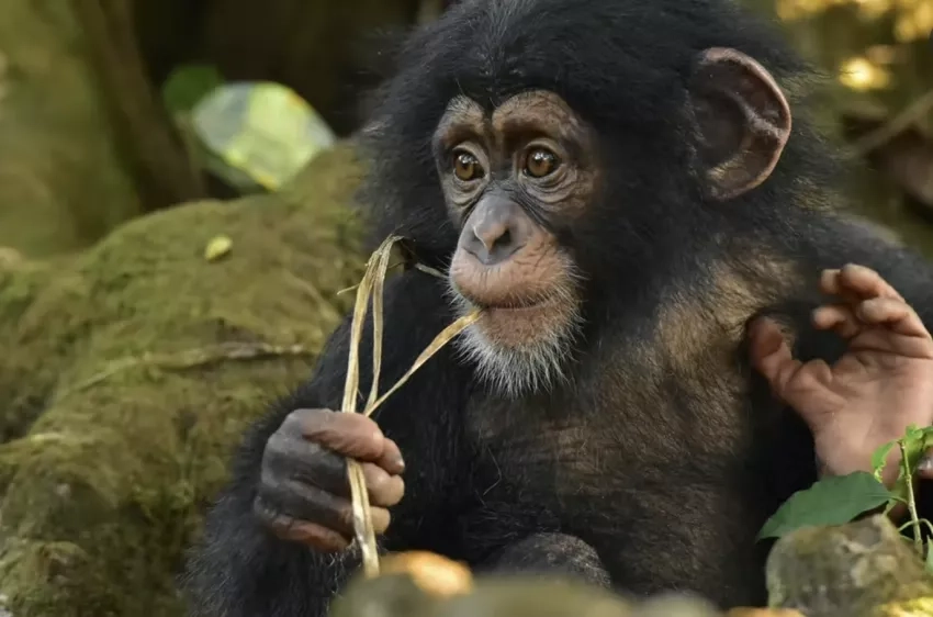
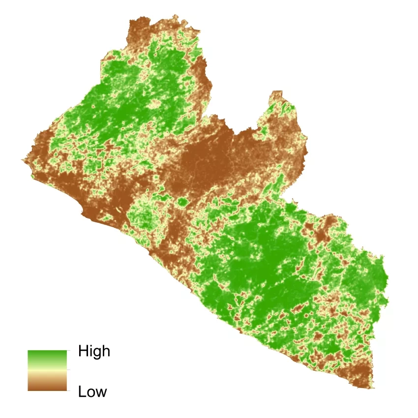
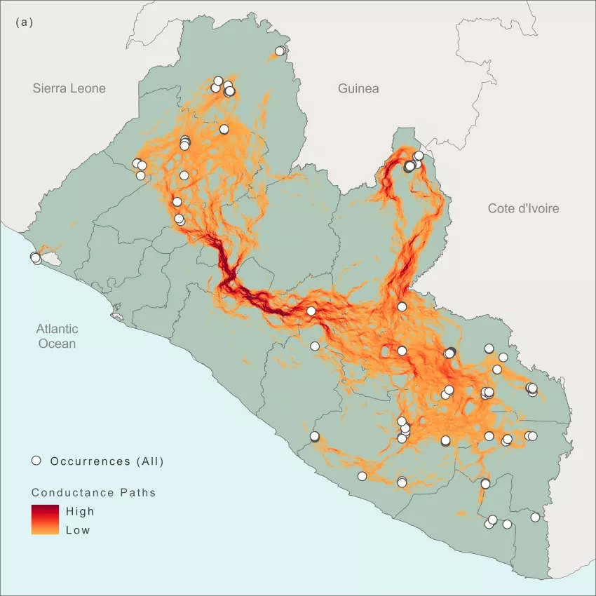
There are only about 52,800 Western chimpanzees living in Western Africa and so it’s crucial for conservationists to know, not only where the different communities of chimpanzees live, but also to find the ‘chimpanzee highways’ that the animals rely on to move from group to group.
“If groups lose the ability to freely travel across the landscape, they become isolated from each other. This increases the likelihood they reproduce with close relatives, leading to inbreeding and the negative genetic and physical consequences it has on the health of the next generation,” said Keith Gaddis, Ecological Forecasting program manager.
“So, protected areas must not just preserve areas where chimpanzees live but must also protect the pathways they use to move from place to place.”
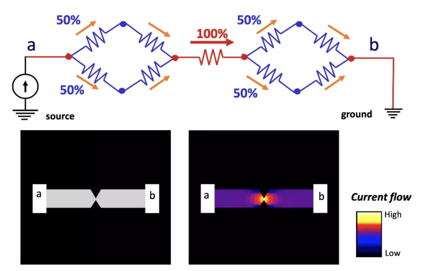
Gaddis and a team of scientist led by Amy Frazier at Arizona State University and collaborators at Conservation International applied a software called Circuitscape to map these pathways and inform conservation planning in the west African nation of Liberia.
Circuitscape has revolutionized the ability of conservation managers and scientists to understand movement patterns, Gaddis said. It does that by borrowing a page from electrical engineers. The software uses circuit theory, a mathematical approach that finds the most effective ways electricity moves across a complex circuit board.
"You see, animals and even plants don’t move from place to place along one single pathway, they may take any number of routes," Gaddis said. While rivers, roads or cities may act as barriers, other factors like continuous forest, optimal climate, or the presence of other species may facilitate travel. Circuitscape allows researchers to calculate the impact of these features in the same way electrical engineers calculate the impact of resistors and transistors on a computer chip. The resulting product identifies areas essential for maintaining connectivity from place to place.
"This can help conservationists make decisions on which areas to protect," Gaddis said. "From a conservation standpoint, the goal is investing in protecting or restoring habitats where there’s lots of ways to get from one place to another."
The Circuitscape software, originally developed by Brad McRae and Viral Shah, underwent a recent revamp thanks to support from NASA’s Ecological Forecasting program area. Circuitscape 5.0, written in the Julia computer language, brings high performance computing to conservation by allowing scientists to apply the massive amounts of NASA and other Earth science data they have has more effectively, said Kim Hall of the nonprofit group The Nature Conservancy.
"This helps us to understand how animals and other species move across a landscape, and how to protect them," Hall said. She is the principal investigator on the project, following the loss of her colleague Brad McRae to cancer in 2017.
“Brad used his background in electrical engineering to craft a tool that helps us think about, and display, landscapes as networks,” Hall said. “Data that NASA collects about landscapes are delivered as images made up of many millions of little cells. Circuitscape allows you to assign a resistance to each cell type based on how difficult it would be for an organism to move through that area."
"You then add “current” to the system and see where it flows as it is pushed out of areas with high resistance and flows into and highlights networks of paths with the lower resistances,” Kim said.
Maps based on Circuitscape are a critical component of The Nature Conservancy’s blueprint for land protection for the United States, as they help us see areas to protect that can help ensure that species can shift their locations as climate change influences where animals can survive.
Speed and computational power provided by re-writing the software in the high-performance Julia computer language makes it easier to use NASA’s extensive datasets that the previous software was unable to process.
"You can now examine broad geographic regions using multiple NASA data products as inputs and even process very high-resolution data," Gaddis said. The improved tool is freely available and runs on many different types of computer systems, from a laptop to a supercomputer, which opens the door to more users around the world, Hall added.
Researcher Angela Brennan agrees. “[We went] from 30 hours for one species to 6 hours for all species,” she said. Brennan is a conservation scientist at The University of British Columbia in Canada and a fellow with the nonprofit World Wildlife Fund.
“It allowed us to quickly identify connectivity hotspots and evaluate likely movement pathways for multiple species with different habitat requirements in potential corridors,” Brennan said. “Speeding up these analyses was a groundbreaking moment,” Brennan said.
“The upgraded Circuitscape in Julia provides up to 20x speed improvement over alternative approaches,” said Bill Peterman, a Circuitscape user and professor in the School of Environment and Natural Resources at Ohio State University. “These improvements are making previously intractable analyses possible at broader scales and higher spatial resolutions.”
This is the kind of reaction that warms the heart of Gaddis because of its implications for the Ecological Forecasting program area overall. “Not only did NASA Applied Sciences fund the creation of this tool, which is the backbone for conservation decision making,” Gaddis said. “We’ve also opened up the capability of using more and more NASA Earth science data for conservation decision making. This truly is Earth Science in action.”
More about NASA’s work in Western chimpanzee conservation can be found at the story, Finding Chimpanzees in Africa’s Forests.
A profile of computer scientist Viral Shah can be found at the story, Conservation through Coding: 5 Questions with Viral Shah.