Wildland Fire intern Camila Rodriguez researched wildfire management in Portugal to see how first responders and decision-makers used remote sensing. The 2022 wildfire season was the worst season on record in Portugal, and thus her work seeks to see how NASA data could best be put to use.
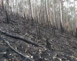
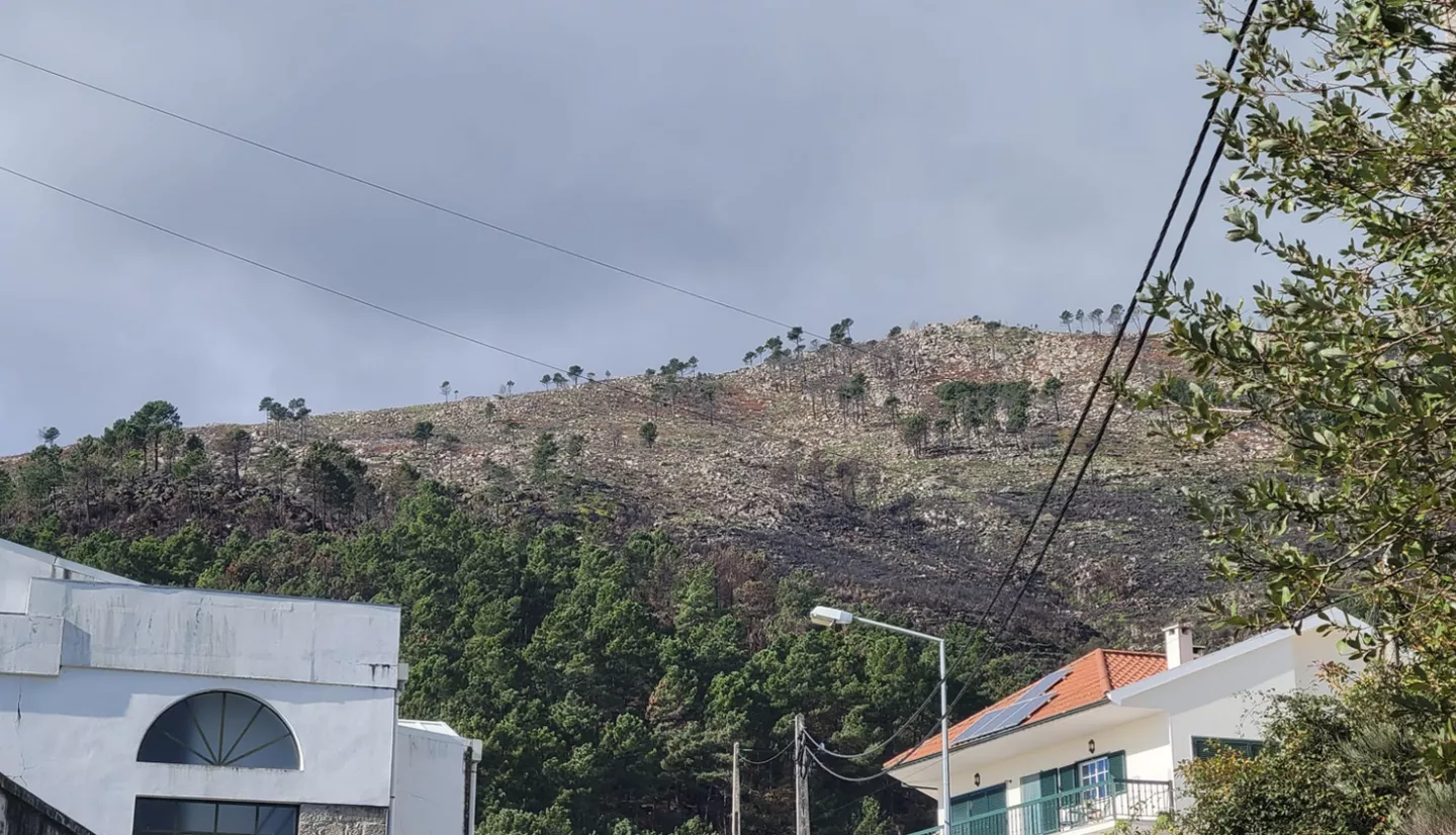
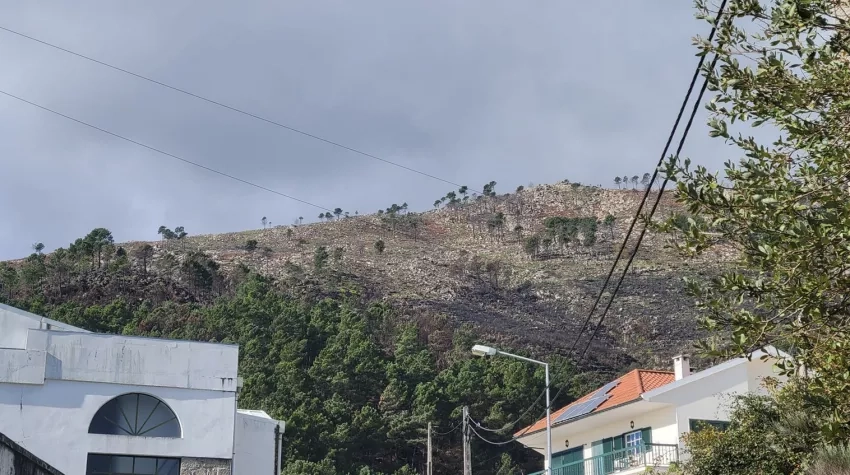
In 2022 Portugal experienced a particularly severe fire season, resulting in nearly 105,000 acres burned. The largest fire occurred in the Serra da Estrela in Central Portugal, burning nearly 17,000 hectares (42,000 acres), nearly 16% of the park. The fire began on August 6th, multiplying in size under record temperatures that reached nearly 40 °C (104°F). It eventually spread into the district of Guarda, in the municipalities of Manteigas, Belmonte, Gouveia, Guarda and Celorico da Beira.
As a member of NASA’s Wildland Fire Management team, in November 2022 I had the opportunity to visit the Serra da Estrela Natural Park while attending the IX International Forest Fire Research Conference in Coimbra, Portugal. The conference brought together scientists and experts to present the latest advancements in fire management and research. At the fire site within the park, the incident commander and several firefighters, discussed their experience managing the fire, including factors contributing to the reignition of the fire and the difficulties with suppressing the fire due to the rugged terrain in the mountain area. The unusual ‘ring’ behavior of the flames eventually led to the fire ending where it started, a rare occurrence.
Experts in Portugal point to several contributing factors to the increase in both large and more intense wildfires in Portugal. They include abandonment and depreciation of rural land, and planting of highly flammable vegetation such as eucalyptus due to economic incentives to plant vegetation with rapid harvest turnaround.
Jose Aranha, a researcher at Universidade de Trás-os-Montes e Alto Douro, explains that almost all fires in Portugal are human made and commonly occur in the fringe between forests and agricultural lands. He said it is mandatory to clean 100 meters around rural-urban areas and 50 meters around isolated houses, but there are no programs to remove the vegetation from the land, so citizens burn the vegetation after cutting the shrubs,” increasing the risk of accidental fire ignitions.
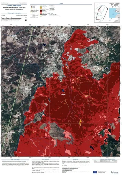
Remote sensing can support decision makers and first responders by providing data to delineate burn perimeters and fire movement during or after fires.
“University researchers in Portugal regularly use Sentinel 2 and Landsat images for fire science research such as the generation of burned index maps, and burned severity calculation,” said Aranha. “But remote sensing is underutilized for proactive fire management to help prevent or mitigate fires, such as for example through biomass accumulation estimates.”
[Editor note: Sentinel 2 is a European Space Agency mission. Landsat is a joint NASA and U.S. Geological Survey satellite mission.]
Data gathered through satellite remote sensing can be used to help monitor and understand the physical determinants of fire risk, such as fire intensity and behavior, and social risk factors that cause ignitions, according to Dr. Fantina Tedim, a professor at the University of Porto, Portugal.
Tedium explains that remote sensing could be useful in bridging gaps of knowledge in some of the social determinants of fire risk, such as helping to differentiate between voluntary and negligent fires, which have unique spatial characteristics that may be captured by satellites.
In addition Tedium said, “remote sensing could also help strengthen wildfire governance by providing much needed information for measuring the effectiveness of public policies, and the ability to connect specific interventions to changes in fire risk.”
Tedium is working directly with municipalities and helping establish agreements between the Portuguese National Guard, who conducts investigations of fire origin, and municipalities and has written extensively about the necessity of collaboration between academia and remote sensing scientists through translational science.
To help promote co-development of solutions, NASA’s Wildland Fire Management Program, focuses on engagement with wildfire stakeholders through the transfer of technology and co-development of solutions. The program is currently funding approximately 40 projects that have identified specific stakeholders to collaborate with to address wildfire-related challenges. We hope to share more in the near future regarding our recently funded projects.
More about 2022 fires in Portugal can be found at the Earth Observatory stories Heatwaves and Fires Scorch Europe, Africa, and Asia and Iberian Peninsula Drought.