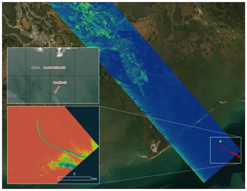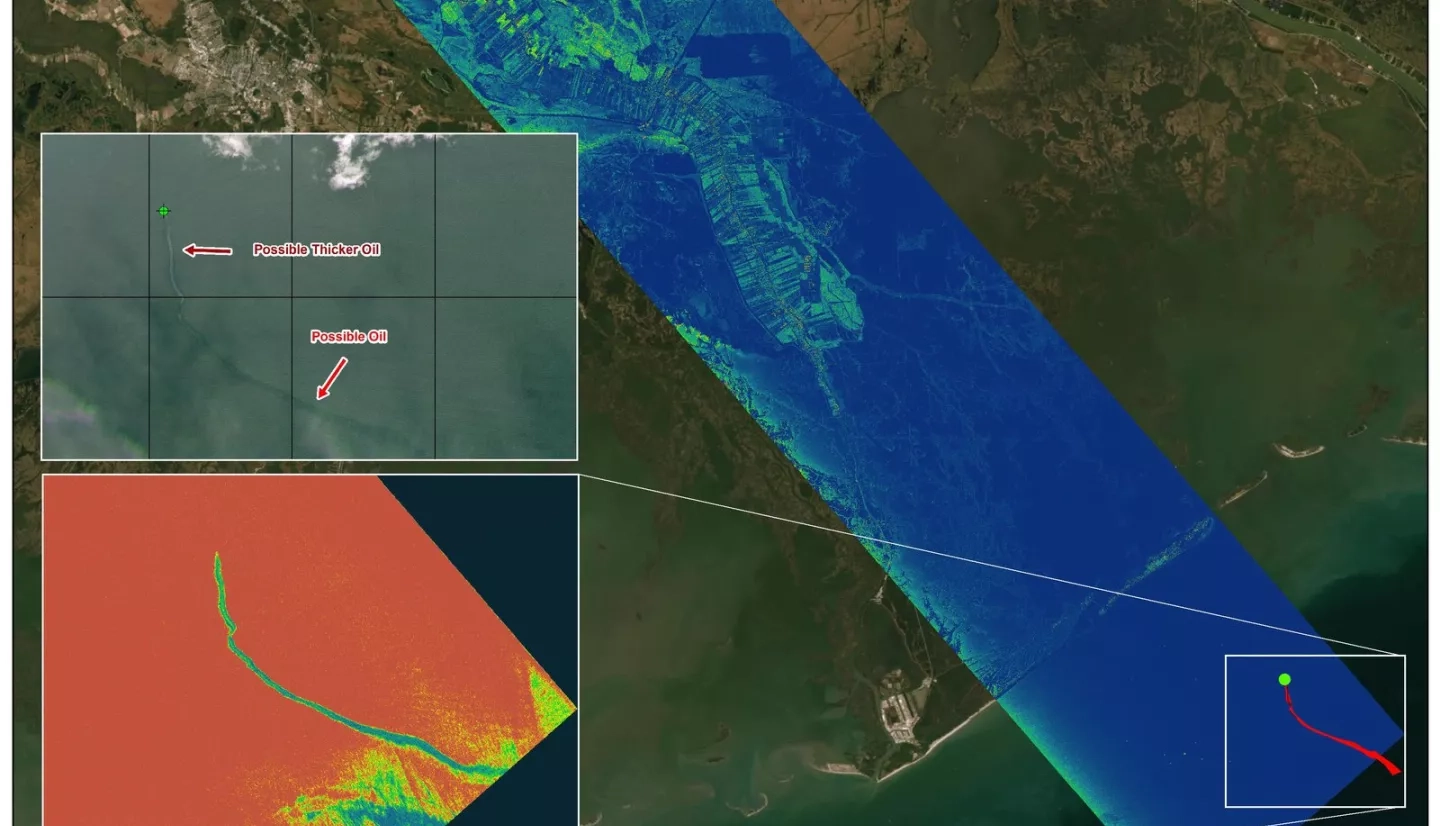
The National Oceanic and Atmospheric Administration (NOAA) regularly monitors U.S. coastal waters for potential spills. After Hurricane Ida struck southeast Louisiana as a powerful Category 4 storm in late August, NOAA noticed some oil slicks just off the coast. NOAA and NASA worked swiftly to leverage NASA’s Delta-X mission to add flight paths to previously planned schedules and use the mission’s advanced radar data to corroborate the presence and location of the oil slicks. NASA is using high-tech airborne systems, along with instruments aboard boats and on the ground, to collect data for models that will help shed light on which areas of Louisiana’s Atchafalaya and Terrebonne Basins are likely to gain or lose land under various climate impact and watershed management scenarios.
More details at NASA.gov story: NASA’s Delta-X Helps With Disaster Response in Wake of Hurricane Ida