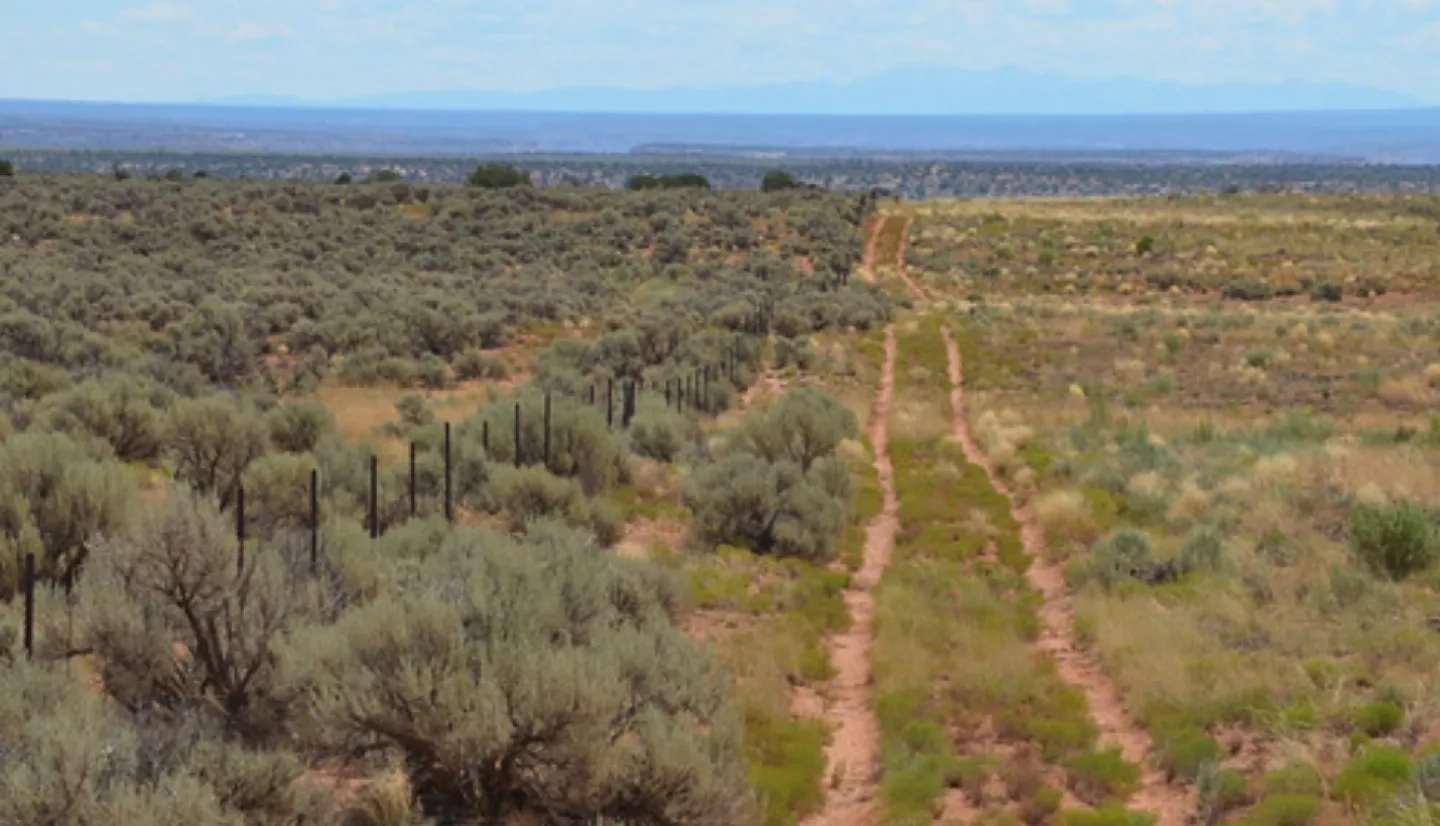
Stretching across the extreme southeastern corner of Utah is the northern extent of the Navajo Nation – the largest Native American territory in the United States. Nestled squarely in the arid Four Corners region, the Navajo Nation covers parts of three states and boasts magnificent topography.
“It's just beautiful,” said Teresa Showa, principal hydrologist at the Navajo Nation Department of Water Resources (NNDWR). “You see that blue sky with the red sandstone, clay stones and shales from these mesas. It's just remarkable how the Maker made the geology up here and how it looms over the whole reservation.”
Despite its magnificence, Showa said there is a downside. “The thing is … we're lacking water.”
The NNDWR partnered with NASA DEVELOP on an innovative project that taps into space-based views to help manage the Navajo Nation’s water resources. NASA Earth’s Applied Sciences DEVELOP program spearheads strategic partnerships seeking solutions to environmental and other Earth-science issues.
Comprised of five agencies and 110 chapters, the Navajo Nation spans 27,000 square miles (69,929 square kilometers). Its population of more than 250,000 is widely scattered across rugged and often isolating terrain – in Utah’s portion alone, there’s an average of only three people per square mile (1.2 people per square kilometer). Roughly 40% of Navajo Nation residents lack a running water supply.
Traditionally, the NNDWR has used a combination of widely spaced rain gauges and several national drought products – including a state-based Standardized Precipitation Index (SPI) product and the U.S. Drought Monitor – to produce its drought reports. Emergency managers, in turn, use these reports to request relief dollars for the Navajo Nation during drought emergencies.
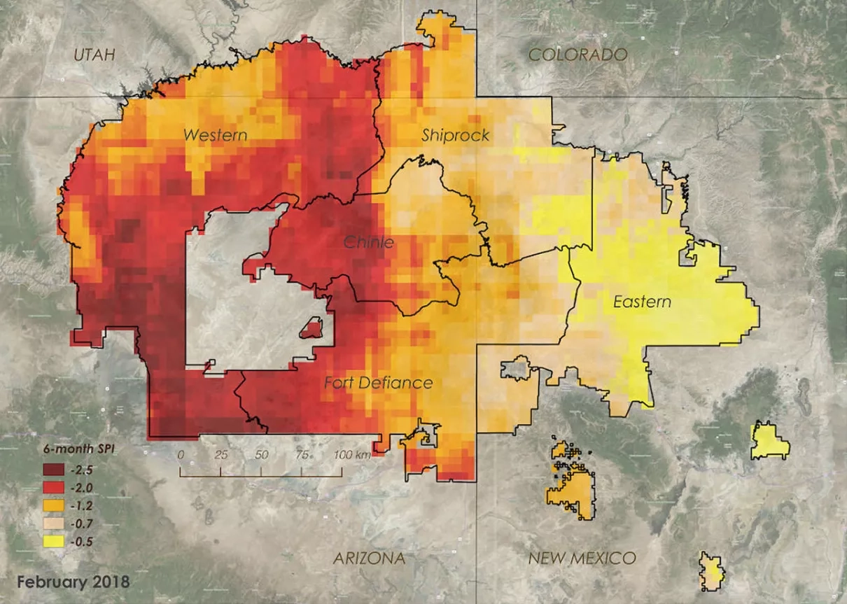
This method of collecting drought information, however, is not nearly detailed enough to resolve the variation of drought severity within the vast and varied landscape of the Navajo Nation.
What’s more, the Navajo Nation receives drought compensation in one lump sum. Where the drought dollars go from there has been difficult to determine. ”One of the things that we want to do is to show Navajo leadership – when we get emergency drought dollars – where we concentrate the resources,” said NNDWR hydrologist Robert Kirk.
As it stands now, drought mitigation dollars are equally distributed to all 110 chapters, regardless of drought severity – leaving some especially hard-hit chapters high and dry. “We want to make sure that the drought mitigation dollars go to the chapters that need it the most,” Kirk stressed.
In this partnership project, NASA DEVELOP collaborated with NNDWR to create a Drought Severity Assessment Tool (DSAT) to help see dryness and drought at a smaller scale. The DSAT integrates satellite precipitation data with a historical rainfall dataset.
“There simply is no effective way to collect precipitation data at ground level for all points around the globe. Assessing water resources globally, especially in remote areas, needs to rely on data collected by Earth-observing satellites,” DEVELOP project lead Vickie Ly. “[The satellite] data are used to calibrate [the historical rainfall] data, which are further calibrated using precipitation data from ground-based sensors.”
“There simply is no effective way to collect precipitation data at ground level for all points around the globe. Assessing water resources globally, especially in remote areas, needs to rely on data collected by Earth-observing satellites.”
–Vickie Ly, NASA DEVELOP
With this more-detailed rainfall data feeding into DSAT, the NNDWR can estimate its own SPI values within the Nation for its drought assessment – critical information it previously lacked.
The DSAT proved so promising, that NASA’s Western Water Applications Office is funding a follow-on project led by Amber McCullum of NASA’s Ames Research Center. This new collaboration is developing the Drought Severity Evaluation Tool (DSET) – the next phase of DSAT.
McCullum noted, “It will incorporate the NNDWR rain gauge data [for the first time], as well as provide comparisons of NNDWR data and remotely-sensed and modeled data. DSET will also create outputs that will be directly incorporated into NNDWR Drought Reports … This information can then be used to allocate drought relief dollars to regions that need it most.”
With DSAT, and its future transition into DSET, residents of the Navajo Nation have the vantage point of space to guide their water management – and NASA has a dedicated partner on the ground.
“The indigenous community has strong ties to their land and can provide unique insights about changes in natural resources, such as water availability or vegetation patterns,” McCullum added. “This project is extremely important for the Navajo Nation.”


