Following four decades of conflict, Afghanistan faces environmental challenges on many fronts, including a growing water crisis across the country. Less than a third of the country’s population has access to clean drinking water, causing thousands of deaths each year due to contamination and poor sanitation. Water resources are under severe stress due to recurrent drought, excessive water extraction for agriculture, and poor infrastructure. Climate change is also adding to these pressures, accelerating the melting of glaciers in the Hindu Kush mountain range, which has long been the country’s main source of water. Without substantial improvement in the development and management of Afghanistan’s water resources, this crisis will only deepen.
A key step in addressing this problem is accessing reliable data on water resources to guide the development of a sustainable management strategy. Afghanistan is a landlocked country made up of rugged, mountainous terrain. This difficult topography presents formidable challenges in collecting field-based data that are critical to understanding the complex issues impacting water resources.
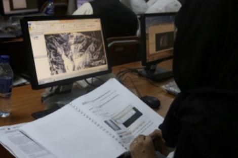
One way to work around these field obstacles is to use information collected and analyzed from Earth observation satellites and geospatial technologies to bridge these data and knowledge gaps. The results can guide decision makers to informed, evidence-based solutions that more effectively balance the needs of both the population and environment.
As part of an initiative to build new capacity for its partner organizations in Afghanistan, SERVIR - Hindu Kush Himalaya (SERVIR-HKH) at the International Centre for Integrated Mountain Development (ICIMOD) is providing training courses on the effective use of Geographic Information System (GIS) and Remote Sensing (RS) technologies. A central element to this strategy is a partnership with Kabul University to develop a training curriculum on GIS and RS technology applications for water resources management.
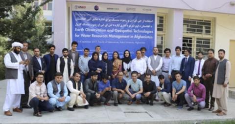
In support of these objectives, SERVIR-HKH piloted a series of courses with Kabul University, including a “training of trainers” workshop for the Geosciences faculty, with the goal of building the university’s own institutional capacity to independently deliver these type of trainings.
“With SERVIR’s support on GIS and RS applications, we have enhanced our capacity in analysing and generating useful climatic and hydrographic information for water resource management in agriculture and various other fields,’’ said Dr Zikruallah Safi, Professor of Agriculture, Kabul University.
In fact, with additional support from SERVIR-HKH in establishing dedicated training facilities, Kabul University is now fully equipped to organize its own GIS- and RS-related trainings. This new capacity was demonstrated in two consecutive trainings held in December 2017 and January 2018, respectively, which were independently organized by Kabul University with the combined attendance of over 70 participants. The university is now developing a curriculum for advanced courses on GIS and RS in water resources management specific to Afghanistan, which will soon be offered across the country.
“Until very recently, it was impossible for our faculty to deliver trainings on GIS/RS. Today we are in a position to conduct trainings to other faculties and universities because of this partnership,” said Ghias Safi, Dean of Faculty of Geosciences at Kabul University.
SERVIR-HKH will continue to support Kabul University in its efforts to build training capacity in the field of water management. In turn, this will help strengthen the technical skills of local decision makers to integrate Earth observation data and geospatial technologies in the sustainable management of Afghanistan’s precious water resources, helping to save lives by averting the country’s pending water crisis.


