Citizen scientists and NASA satellites join forces to track water supplies.
Bangladesh is a small country with a huge amount of water that moves over its surface. The Ganges, Brahmaputra, and Meghna rivers form the world’s largest river delta as they flow south to the Bay of Bengal and ultimately into the Indian Ocean. Bangladesh also has seasonal monsoon rains that create ecologically and agriculturally important wetlands known as haors. Just how much water fills these vast floodplains? That’s been a tricky question and one that Faisal Hossain is undertaking. Born in Bangladesh, Hossain is now a hydrologist and professor of civil and environmental engineering at the University of Washington in Seattle.
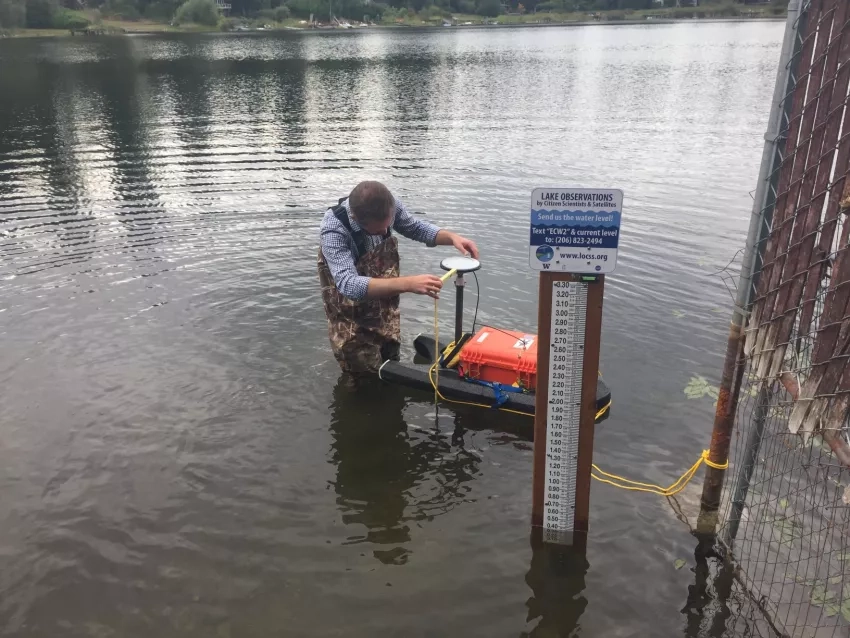
“We've never really had a very robust way of estimating the quantity of water on the surface,” Hossain said. But recently, he has started to find answers. As part of the NASA-funded Lake Observations by Citizen Scientists and Satellites (LOCSS) project, Hossain has combined data from satellites and observations from citizen scientists on the ground to quantify the total volume of water stored in Bangladesh's large wetland complexes for the first time.
This information has proved useful to the Bangladesh Water Development Board, which is navigating new challenges caused by climate change. Knowing how much water is stored on the country’s surface can help the government make critical water management and food security decisions. Hossain notes that this information is coming just in time, because sea level rise, cyclones, the erosion of coastlines and riverbanks and other climate-related disasters threaten Bangladesh’s population of more than 160 million. As part of an adaptation strategy called the Delta Plan 2100, the government found that improving its water storage capability in the dry season would help make it more resilient.
“In the wet season, Bangladesh gets a lot of excess water from the rains and the rivers, but it's all draining away,” Hossain said. “A lot of government officials say that maybe we need to harness this, because we could be a surface water superpower.”
This power could come through increasing freshwater availability to satisfy a huge demand for growing food, a primary source of revenue for the country, Hossain said. Improving the connectivity of rivers that have dried up and finding ways to store surplus water could help Bangladesh meet the water needs.
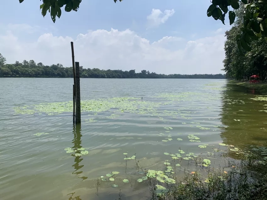
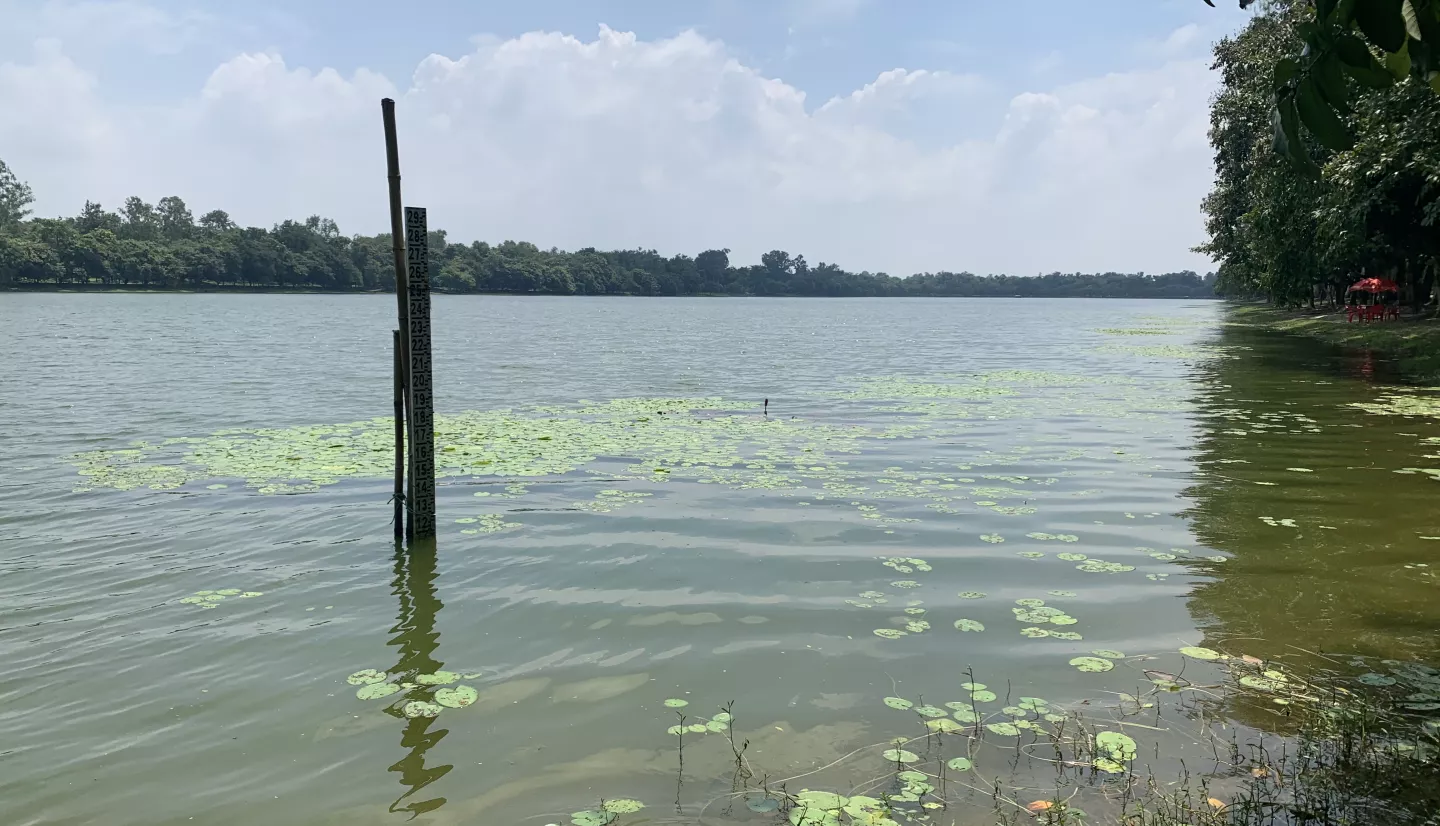
The Bangladesh government continues to support the LOCSS project and has already invested $150,000 to install and maintain 76 water gauges. These gauges are then checked by citizen scientists. These volunteers maintain regular monitoring of the area’s water resources.
Using LOCSS, Hossain combines this on-the-ground data with data from satellites like the Landsat series of satellites and the U.S. and European Jason-3 satellite mission. Thanks to this work, the Bangladesh Water Development Board now knows that, on average, the northeastern flood-prone region stores 30 cubic kilometers of water. That’s about the same amount of water than what’s in Lake Mead at full capacity. And this amount changes due to weather conditions.
Hossain and his collaborators were able to estimate that the 2022 historic floods brought that number up to 42 cubic kilometers. Also in 2022, the monsoon season brought devastating rains to Pakistan, putting about a third of the country underwater. Hossain says his team is bringing the techniques developed for Bangladesh to Pakistan and that planning is already underway to emulate the Bangladesh project to track water volume changes. Working with the Pakistan Council of Research in Water Resources, gauges were installed at two large lakes in Pakistan’s Sindh province. Thanks to the LOCSS project, Hossain’s team was able to use observations from these gauges to produce a preliminary estimate of the flood volume during the 2022 event that was not possible before.
Projects like Hossain’s are drumming up excitement for a recently launched NASA mission that’s expected to be a vanguard for tracking the world’s surface water. The Surface Water and Ocean Topography (SWOT) mission will be the first satellite to provide high-resolution surface water elevation maps, allowing scientists to monitor lakes, rivers and oceans with unprecedented accuracy. SWOT is jointly led by NASA and France’s space agency, the Centre National D’Etudes Spatiales (CNES), with contributions from the U.K. and Canadian space agencies.
“This pre-SWOT data was an appetizer,” Hossain says. “It's built more anticipation for SWOT.”
SWOT’s launch doesn’t erase the need for citizen scientists; in fact, networks of observers will be crucial for ground-truthing the new satellite.
“SWOT is a research mission, but there's incredible potential for applications in water resources, management, among other things,” said Tamlin Pavelsky, the principal investigator of LOCSS and a professor at the University of North Carolina at Chapel Hill. “Getting it to a place where people say, ‘I trust this data and it's useful for me,’ I think that's where having these on-the-ground measurements from programs like this citizen science project is going to be critical.”
For Hossain, SWOT will also fit nicely into one of his overall goals as a scientist: making information accessible to countries and easy-to-use.
“I'm from that region,” Hossain says. "Growing up in Bangladesh, I saw how lack of information has so much negative impact on livelihoods and decision making. And space can be that answer in many ways, because it's really fundamentally impossible to put lots and lots of gauges on the ground. I have seen firsthand what satellites can do in improving water management and flood forecasting.”