With a mean elevation of 6,800 feet (2,073 meters), Colorado is the loftiest state in the nation. It also boasts 53 fourteeners – mountaineering-speak for peaks of 14,000 feet (4,267 meters) or higher – more than any other state.
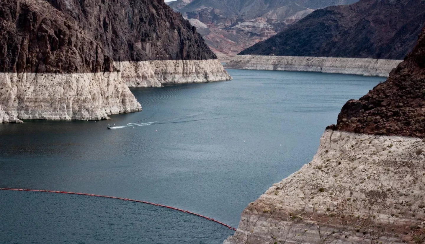
Just as impressive is the 1,450-mile-long (2,334 kilometers) Colorado River, with its massive watershed of canyons and rapids. The Colorado River Basin encompasses Colorado and six western states, providing water for tens of millions of Americans.
Its elevation and natural beauty make the basin a popular region to camp, hike and ski, due in no small part to its ample snowfall. This snow and the subsequent snowmelt are a vital component of this watershed, and account for more than two-thirds of the water flowing into the basin.
“The project’s data have already improved our runoff forecasts, which will benefit our stakeholders who manage reservoirs and water.”
–Kevin Werner, Colorado Basin River Forecast Center
Because of the importance of this snowmelt, agencies like the National Oceanic and Atmospheric Agency’s (NOAA) Colorado Basin River Forecast Center (CBRFC) have increasingly turned to satellite and airborne snow measurements to better forecast this runoff. In collaboration with a NASA Earth Applied Sciences-funded team, CBRFC now integrates remotely sensed snow data from NASA satellites into its daily and seasonal streamflow forecasts for the Colorado River and eastern Great Basin.
“We are entering another era in streamflow forecasting,” said Kevin Werner, a service coordination hydrologist at CBRFC. “We’ve never used remote-sensing data for real-time streamflow forecasting at our center.”
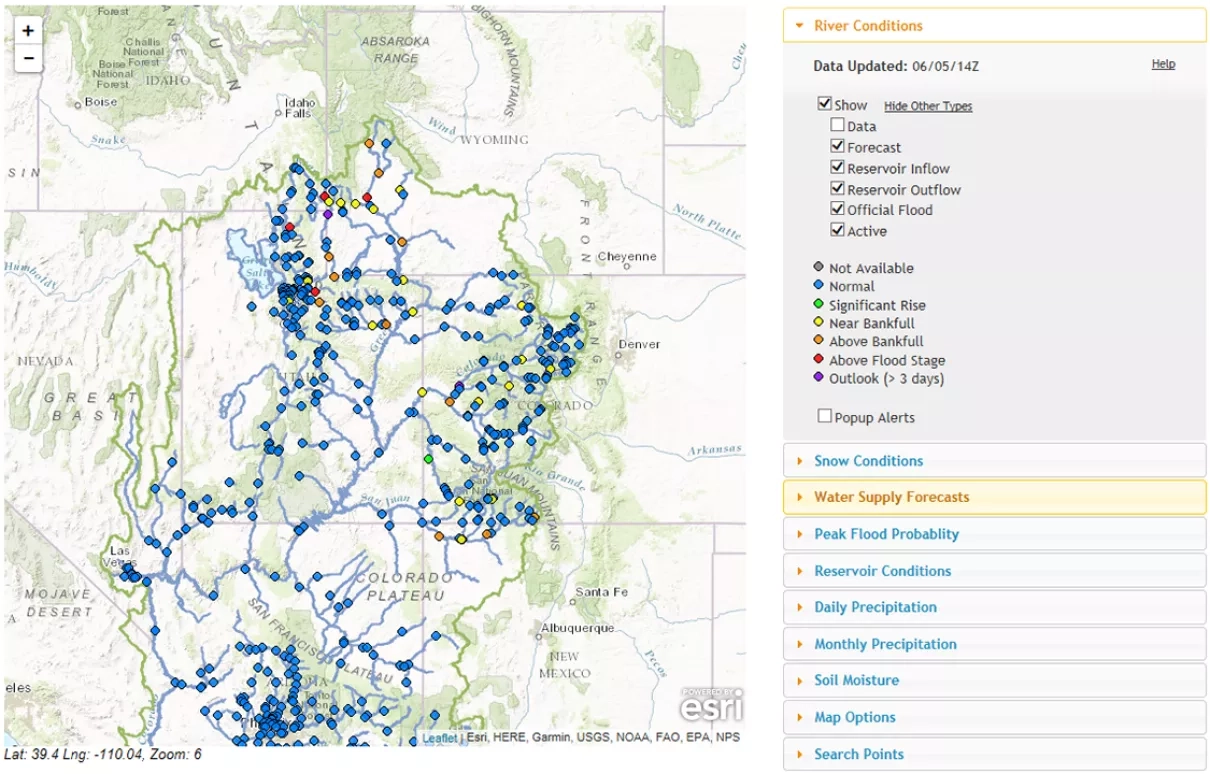
The satellite data products complement ground-based snowpack monitoring done at low-to-middle elevations using bladders called “snow pillows.” Unlike the snow pillows, which provide detailed information at specific locations, the satellite products measure snow-covered areas across the entire Colorado River Basin. This combination improves both the day-to-day and seasonal forecasting of runoff, to better predict conditions.
“The project’s data give us a better idea of the spatial distribution of snow,” noted Stacie Bender, a CBRFC hydrologist. “In mountainous basins, over variable terrain, remote sensing fills in gaps left by point measurements from in situ snow monitoring networks.”
In addition to using NASA information that shows the percentage of land covered by snow, CBRFC incorporates satellite data about snow surface conditions that can speed up its melt rate – such as the presence of dust, soot and other materials that absorb heat from the sun. This helps narrow discrepancies between computer model estimates and ground observations of streamflow, giving greater confidence to the forecasts.
“The project’s data have already improved our runoff forecasts,” added Werner, “which will benefit our stakeholders who manage reservoirs and water by allowing them to have better understanding of inflow into the reservoirs and the improved foundation by which to decide whether to capture, release or generate electricity with the flow.”
As NASA Earth observations continue to evolve, the Centennial State’s water managers will have the data to keep the water runoff forecasts flowing.
This story is part of our Space for U.S. collection. To learn how NASA data are being used in your state, please visit nasa.gov/spaceforus.


