In the spring of 2018, Hawaii’s Kilauea volcano began its biggest eruption in centuries. NASA satellites watched the months-long event from space. Satellites not only snapped images of the molten rock flowing from vents in Earth’s surface. They also observed plumes of gases and particles, which can disperse over vast areas.
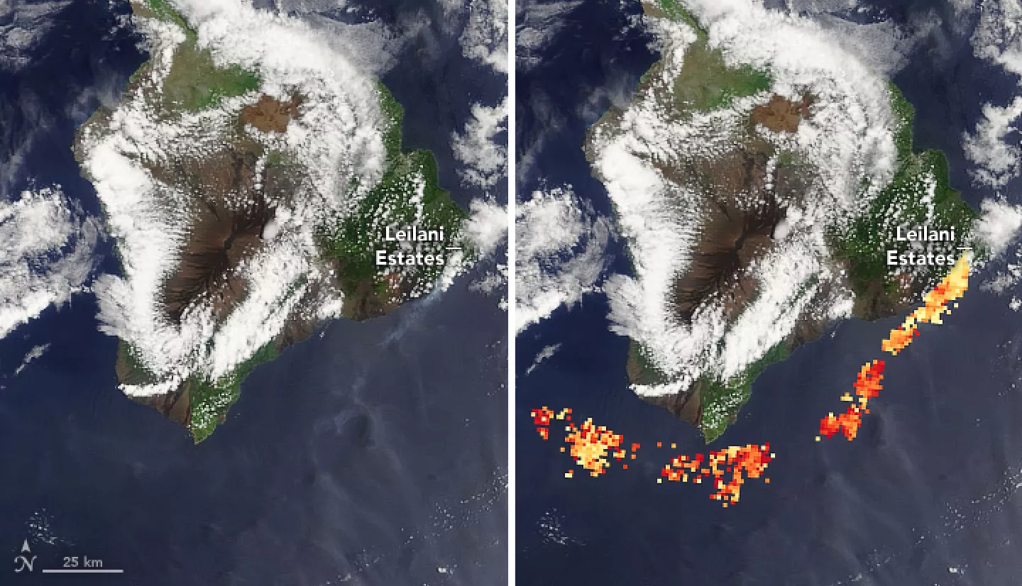
Several new fissure eruptions emerged from Kilauea on May 3, 2018. White plumes of water vapor mixed with toxic gas streamed into the air.
NASA’s Terra satellite snapped stereo images that measured the plumes' height and other properties. The Multi-angle Imaging Spectroradiometer (MISR) sensor on the satellite could detect sulfate aerosols. These particles form as sulfur dioxide reacts with sunlight and substances in the atmosphere, producing a haze called vog.
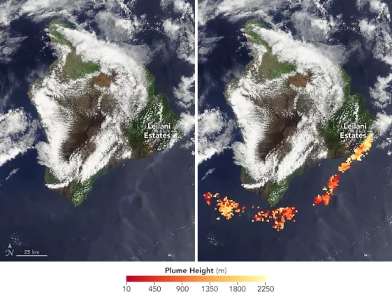
Because sulfur dioxide is heavier than air, sulfur-rich volcanic plumes tend to sink as they disperse. The MISR data indeed showed that, on May 6, 2018, the top of the plume reached roughly 1.5 kilometers (1 mile) above sea level. Then, it dropped several hundred meters as it moved 140 kilometers (90 miles) downwind. Winds blew the plume southwest along the coast, over the ocean and away from population centers. Low plumes such as this one tend to be closely watched because they can pose health hazards to humans. Particularly long-lived or intense plumes can also threaten ecosystems.
More information available at the NASA Earth Observatory story Probing Kilauea’s Plume.


