May through August is not only the growing season for central United States corn and soybean farmers but is also the time of year that brings the most severe thunderstorms. The combination of damaging winds and large hail pummels crops and causes several hundred million dollars of crop damage every year.
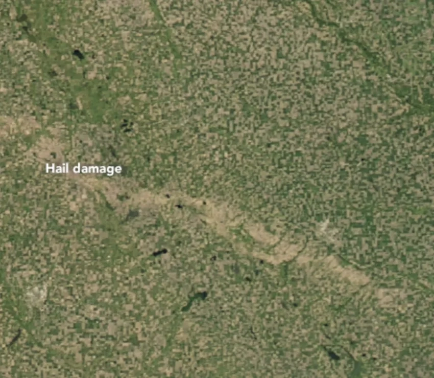
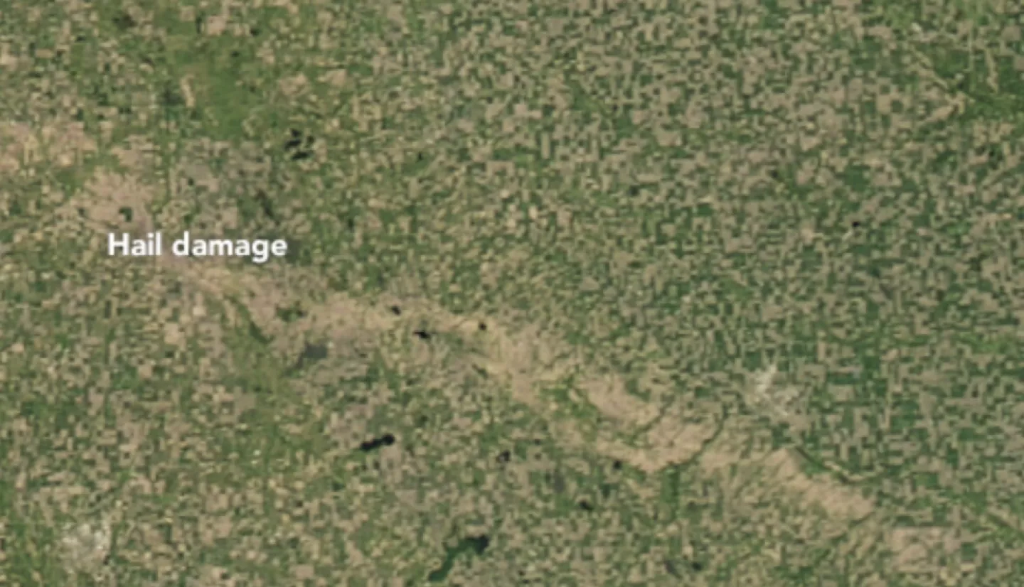
While the damage may be small and relatively localized, this was not the case for South Dakota and Minnesota farmers on June 22, 2017, when an early-morning storm system dropped a trail of destructive hail that damaged vegetation farther than 60 miles from Thomas, South Dakota, to Marshall, Minnesota.
Castlewood, South Dakota was one of the hardest hit areas with gusts of wind as high as 90 miles per hour and golf ball size hail. The effects of the thunderstorm broke windows, punched holes in the siding of homes, and severely damaged crops. The Operational Land Imager (OLI) on Landsat 8 captured an image of the aftermath on July 7, 2017.
“Hail damage is spotted frequently with satellites when there are major events that occur over a long distance. It is particularly evident in the Midwest during times when crops – corn especially – are tall and uniformly green across a large area,” said Andrew Molthan of NASA’s Short-Term Prediction Research and Transition Center (SPoRT) team. “It is notable that this damage swath is visible from such a broad suite of satellites and even appears quite well on relatively coarse imagers like GOES-16, MODIS, and VIRRS.”
After hail events, meteorologists and others can use satellite data and published research from members of the SPoRT team to assess crop damage. In addition, to make the process quicker and cheaper, the SPoRT team and the National Weather Service are working together on a NASA Applied Sciences project to feed relevant satellite imagery into a toolkit for damage assessment teams.
Read more at the Earth Observatory article, Using Satellites to Spot a Hail Scar.
This story is also part of our Space for U.S. collection.