Water pumping continues in Kansas despite the depletion of the High Plains Aquifer, also known as the Ogallala Aquifer. With approximately 30% of the water once stored under Kansas gone, farmers must drill even deeper wells. According to one recent study, the aquifer in Kansas is more strained than any other in the United States. If this trend continues, 40% of the entire aquifer will likely be gone within the next 50 years.
The MODIS sensors onboard the Aqua and Terra satellites and other data show that irrigation is increasing in some parts of the aquifer. “The higher resolution of the sensors on Landsat give us a more nuanced understanding of the annual and seasonal rhythms of irrigation than is possible with MODIS,” said Jillian Denies, a hydrologist at Michigan State University.
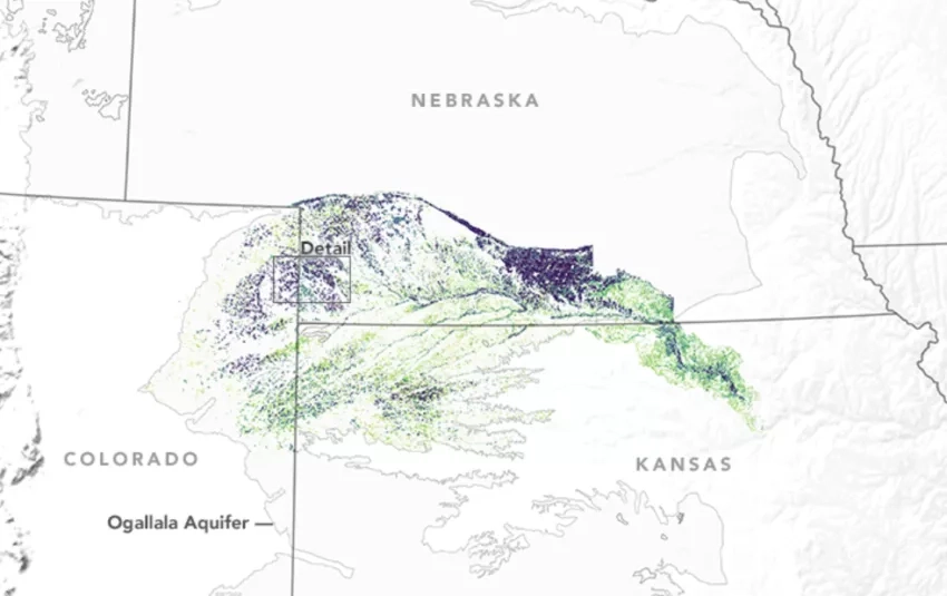
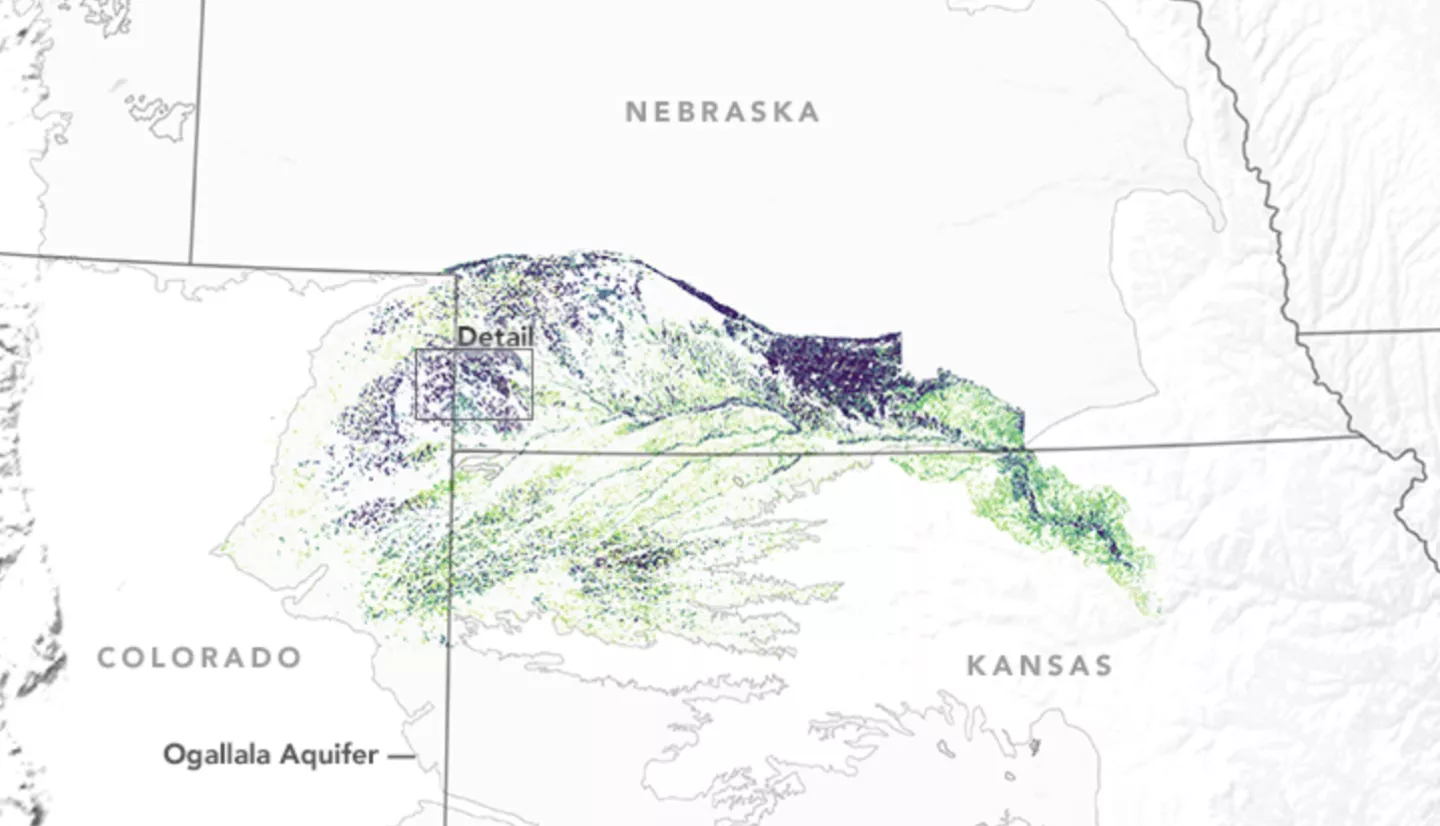
For this project, Denies partnered with two colleagues, David Hyndman and Anthony Kendall. Together they authored a study using Landsat data to track patterns in irrigation along the Republican River Basin. The basin’s declining water levels and litigation about water use impact changes in corn and wheat production.
Denies and her team used Landsat data to develop high-resolution annual irrigation maps for the entire basin. These maps detailed how often a field was irrigated and the first and last year it was irrigated. Hydrologists and water managers use these maps to better understand when and where irrigation occurs.
Denies and her colleagues think farmers expand irrigation when prices are high to increase yields and profits. This belief comes after analyzing some economic data. Denise said, “Farmers ended up irrigating more intensely on a smaller number of fields during drought years.”
More information available at the Earth Observatory story, Satellites Investigate Irrigation in a Stressed Aquifer.
This story is part of our Space for U.S. collection.