From the water we drink to the water used to irrigate our food, water is everywhere. What information do water managers need to better measure and manage their water resources?
Accurate, consistent, and timely data.
OpenET, a new web-based platform puts accurate, timely NASA data in the hands of farmers, water managers and conservation groups to accelerate improvements and innovations in water management.
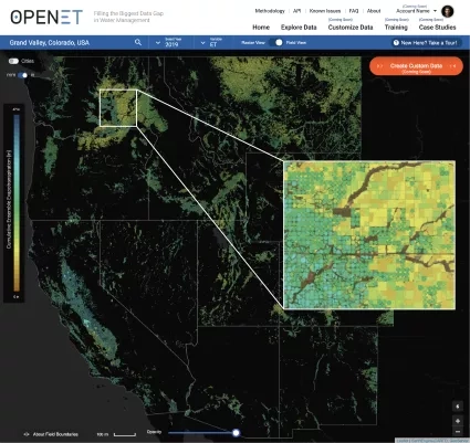
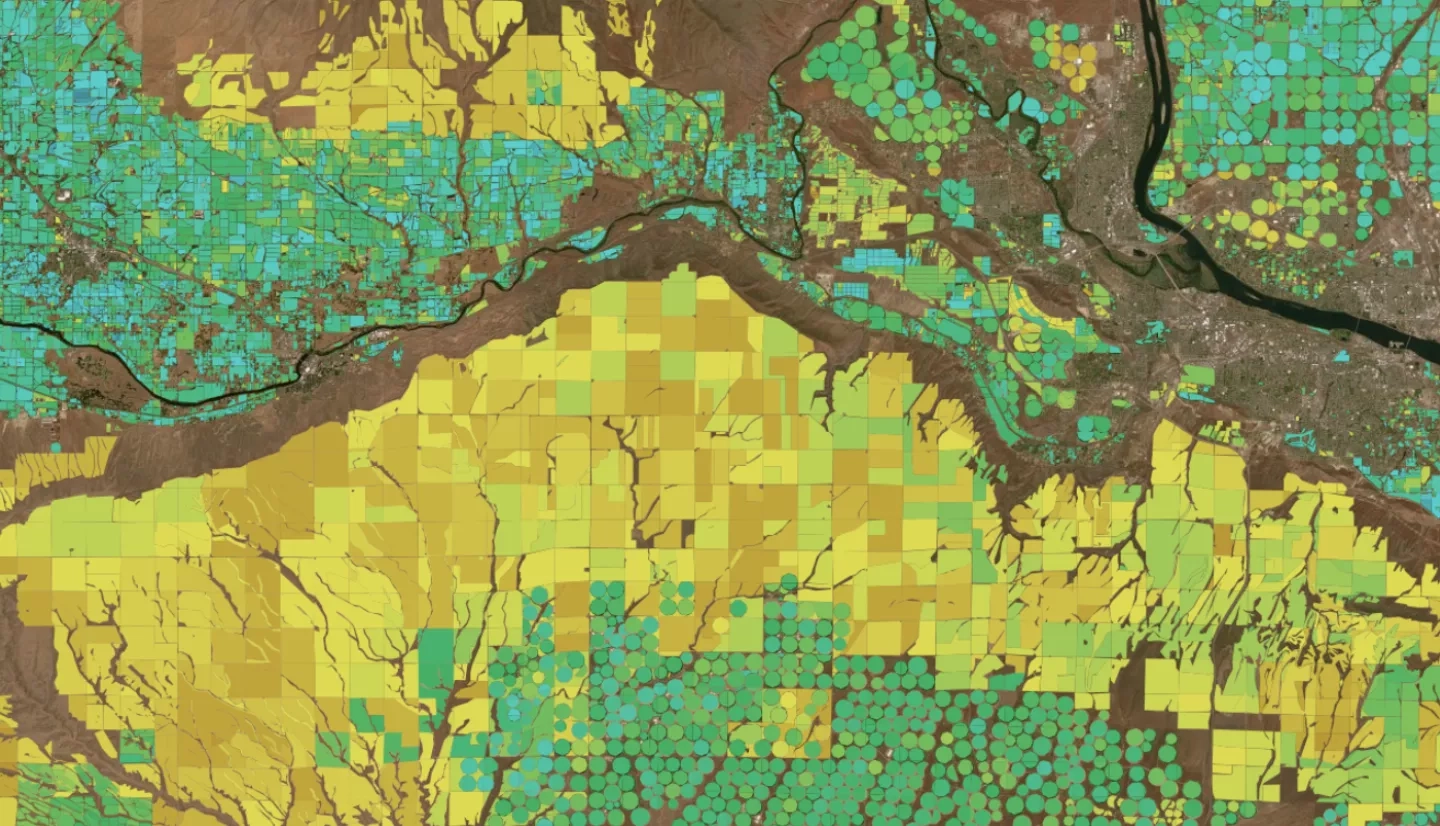
The platform uses satellite data to accurately measure evapotranspiration across the western landscape at the scale of individual agricultural fields. As water evaporates it cools things off, that cooling occurs because the process consumes energy. Satellites can measure these temperature differences on the land surface, providing a key piece of information needed by the numerical models that are used to calculate evapotranspiration using satellite and weather data.
OpenET is a collaboration of NASA, the nonprofit Environmental Defense Fund (EDF), the Desert Research Institute (DRI) and data applications developer HabitatSeven, with funding from the Water Funder Initiative and in-kind support from Google Earth Engine, OpenET primarily uses satellite datasets from the Landsat program, which is a partnership between NASA and the U.S. Geological Survey (USGS). Additional data comes from NASA's Terra and Aqua satellites, the National Oceanic and Atmospheric Administration (NOAA) GOES series of satellites and others.
In the arid western United States, where a majority of water used by people is for irrigation to grow crops, having an accurate measure of evapotranspiration is critical to balancing water supplies and water demand Access to OpenET’s evapotranspiration data is useful for farmers like Denise Moyle, an alfalfa farmer in Diamond Valley, Nevada.
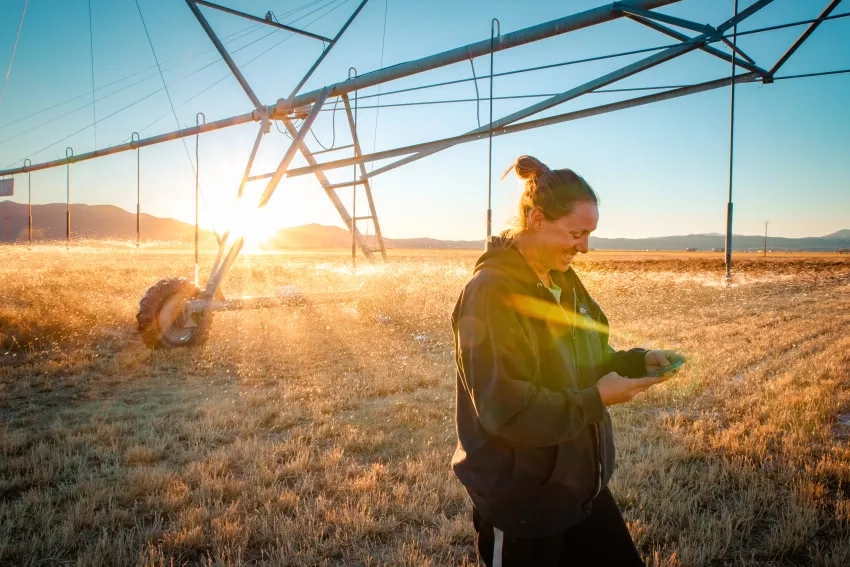
"What OpenET offers is a way for people to better understand their water usage and, more importantly, their water loss through evapotranspiration," Moyle said. "Giving farmers and other water managers better information is the greatest value of OpenET."
The OpenET team includes leading national and international experts in remote sensing of ET, cloud computing, and water resources, policy and markets, partnered with nationally recognized web development teams specializing in translating scientific data and information for advanced decision support.
The OpenET platform receives financial support from the NASA Applied Sciences Program, the S.D. Bechtel, Jr. Foundation, the Gordon and Betty Moore Foundation, the Walton Family Foundation, the Delta Water Agencies, and the Windward Fund. In-kind support is provided by partners in the agricultural and water management communities, Google Earth Engine, and the Water Funder Initiative.
OpenET is also featured in an article posted Forbes.com, "This New Web App Will Help Keep Food On The Table As Water Supplies Dwindle."
More information about the OpenET system can be found in the NASA.gov article, "Transforming Water Management in the U.S. West with NASA Data."
This story is part of our Space for U.S. collection. To learn how NASA data are being used in your state, please visit nasa.gov/spaceforus.


