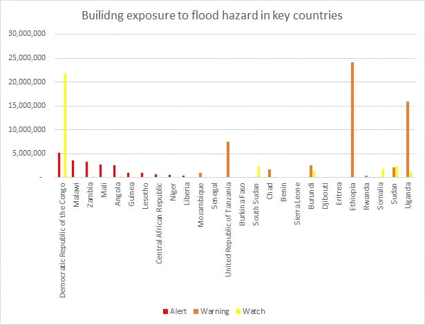
Researchers from the NASA Earth Applied Sciences Disasters Program are working with building exposure datasets developed by the “Modelling Exposure Through Earth Observation Routines” (METEOR) project to estimate the number and value of buildings in Africa affected by flooding rainfall in the spring of 2020.
METEOR is co-funded through the second iteration of the UK Space Agency’s International Partnership Programme (IPP), funded through the Global Challenges Research Fund (GCRF), which uses space expertise to deliver innovative solutions to real world problems across the globe. The primary objective of METEOR is to develop innovative applications of Earth Observation (EO) technologies to improve understanding of the built environment or exposure, with a specific focus on the countries of Nepal and Tanzania. The METEOR project consortium is composed of eight organizations crossing four continents, with expertise in the fields of natural hazard science, remote sensing, exposure development, risk modeling and disaster risk management.
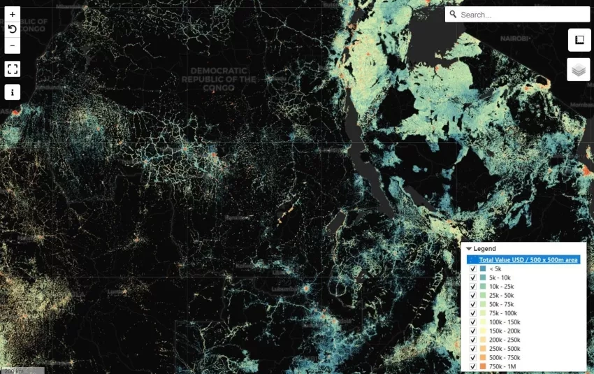
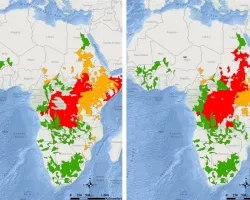
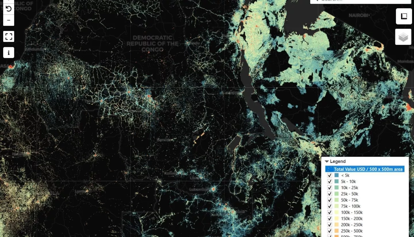
Building exposure maps developed by the METEOR project, in conjunction with flood extent data, can be used to gauge the impact of floods and identify regions of prioritization for mitigation or response. The flood information is provided by model outputs from the NASA Earth Applied Sciences Disasters Program “Advancing Access to Global Flood Modeling and Alerting” ROSES A.37 research project.
The building exposure datasets were created for 47 “Least Developed Countries” (LDCs), including 33 in Africa. The models combine multiple EO datasets, including data from the NASA / NOAA Visible Infrared Imaging Radiometer Suite (VIIRS), Landscan (ORNL), and Global Human Settlement layers (EC-JRC). Additional datasets include Global Impervious Surface Area (IMPSA), Global Rural-Urban Mapping Project (GRUMP), High Resolution Settlement Layer (HRSL), Global Human Settlement Layer (Landsat-8 and Sentinel-1 based), European Commission Joint Research Centre (EC-JRC) Global Sentinel-1 SAR RGB-based mosaic, and Global Urban Footprint (GUF).
This building exposure data is being used by in-country pilot project partners in Nepal and Tanzania, with specific stakeholders including the National Society for Earthquake Technology (NSET) in Nepal and the Disaster Management Department (DMD) of the Prime Minister's Office of Tanzania. The data are currently under review by the various stakeholders and in-country partners, and will be available publicly once this review period is complete.
Building exposure maps and flood alerts for Africa are provided for use in the Domestic Operations Awareness and Assessment Response Tool (DAART), an online tool developed by the U.S. government to assist local civil authorities around the world in responding to natural disasters or national special security events, and to provide disaster responders with improved situational awareness.
In addition, another NASA Disasters Program-funded project “Open Critical Infrastructure Exposure for Disaster Forecasting, Mitigation and Response” is expanding the building exposure research for countries across the globe by creating critical infrastructure databases to model the catastrophic impacts of infrastructure disruption. India was selected as the pilot country, but there are plans to expand this research to other countries lacking in access to EO data.