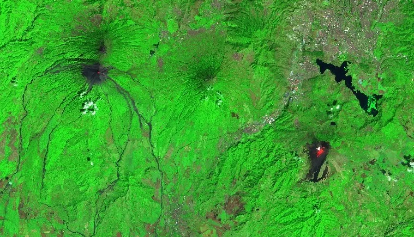
Two volcanoes in Guatemala – Fuego and Pacaya - have recently shown signs of increased activity. According to reports from the Smithsonian Institute Global Volcanism Program and Guatemala’s National Institute of Seismology, Volcanology, Meteorology and Hydrology (INSIVUMEH), both volcanoes have seen high effusive and explosive activity in early February, lofting volcanic ash and gas high into the atmosphere. Fine volcanic ash from Fuego has been reported falling in several nearby communities including Santa Sofía, Panimache, Morelia, and Yucales, Sangre de Cristo, Palo Verde, and Yepocapa.
- Click here for the latest Fuego and Pacaya volcano updates from INSIVUMEH (Spanish)
- Click here for the latest Fuego volcano updates from the Smithsonian Institute (English)
- Click here for the latest Pacaya volcano updates from the Smithsonian Institute (English)
According to analysis from the Socioeconomic Data and Applications Center (SEDAC), both volcanoes pose a high threat to human life due to their close proximity to highly populated areas (view this SEDAC data in NASA Worldview). A 2014 eruption of Pacaya caused significant amounts of ash to fall in Guatemala City, and a 2018 eruption of Fuego led to deaths of nearly 200 people according to media reports.

The NASA Earth Applied Sciences Disasters Program has activated to aid risk reduction efforts for these eruptions, responding to a request for assistance from the Coordination Center for Disaster Prevention in Central America and the Dominican Republic (CEPREDENAC), and working closely with local stakeholders including INSIVUMEH. The Program is working to identify and analyze Earth-observing data which may aid in monitoring the lava flow in the Pacaya volcano, and surface changes of the volcanoes, as well as temperature changes and other relevant data for remotely monitoring the threat.
Researchers from the ROSES A.37 project “Day-Night Monitoring of Volcanic SO2 and Ash for Aviation Avoidance” have shared satellite observations of sulfur dioxide (SO2) from the OMPS and TROPOMI instruments, and other resources for monitoring the volcanoes including the MOUNTS Project, a system that uses artificial intelligence and data from multiple satellites to monitor for increased volcanic activity. Data from the Advanced Spaceborne Thermal Emission and Reflection Radiometer (ASTER) instrument aboard NASA’s Terra satellite is also being used to track thermal anomalies.
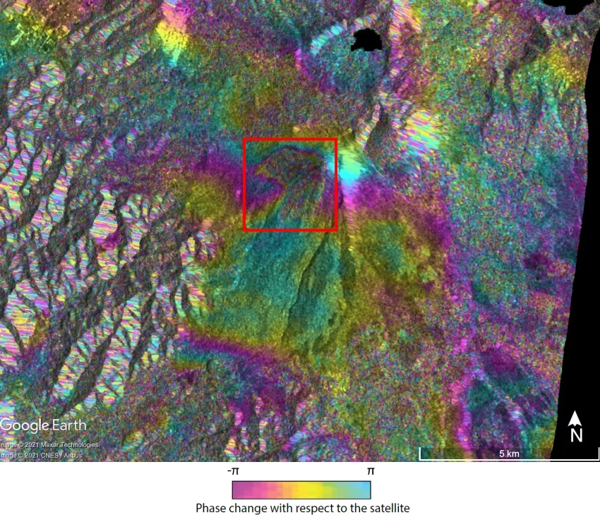
Researchers from Penn State University, with funding from NASA’s Earth Surface and Interior Program, used short-wave infrared data from the European Space Agency (ESA) Sentinel-2 satellite to monitor the progression of lava flows on Pacaya, and used ESA Sentinel-1 Interferometric Synthetic Aperture Radar (InSAR) data to study the surface deformation of the Pacaya volcano over time. It is valuable to combine several satellite datasets when monitoring episodes of volcanic unrest, because precursors to a change in volcanic activity are often detected through one type of monitoring technique but not others. A combination of observations from InSAR, shortwave, and thermal infrared satellite instruments can help differentiate between ground displacement signals related to sub-surface magma transfer versus those due to surface emplacement of lava. According to these observations, up to February 4 the ground deformation on the southwest flank of Pacaya detected by Sentinel-1 InSAR was likely due to the emplacement of lava flows, with no clear signal of broader edifice-scale deformation despite the elevated thermal activity near the summit.