SUMMARY
Date: Dec. 4, 2021
Type: Volcanoes
Region: Oceania, Indonesia
Info & Resources:
- NASA Disasters program resources for volcanoes
- Updates from NASA Earth Observatory: A Deadly Day on Mount Semeru
- View Products on the NASA Disasters Mapping Portal
Update Dec. 13, 2021
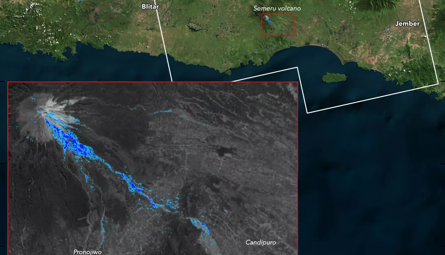
On Saturday Dec. 4, the Mt. Semeru volcano in Indonesia violently erupted, triggering a series of deadly pyroclastic flows and blanketing nearby villages with ash and debris. About 2,000 people were evacuated from the region, and media reports indicate the deaths of 34 people as of Tuesday Dec. 7.
As part of the “Ring of Fire” and one of Indonesia’s most active volcanoes, Semeru has experienced volcanic activity throughout 2021. However, based on initial observations of the conditions around the eruption, researchers from Michigan Technical University have speculated that this recent destructive eruption was caused by dome collapse event rather than a conventional explosive eruption. This dome collapse triggered pyroclastic density currents (PDC’s) - dangerous and fast-moving avalanches of hot ash, gas and debris – which combined with recent heavy rainfall to produce hot lahars (mudflows) that caused much of the destruction. It is also notable that satellite observations did not detect the significant sulfur dioxide emissions that typically accompany a volcanic eruption, which further reinforces the dome collapse theory.
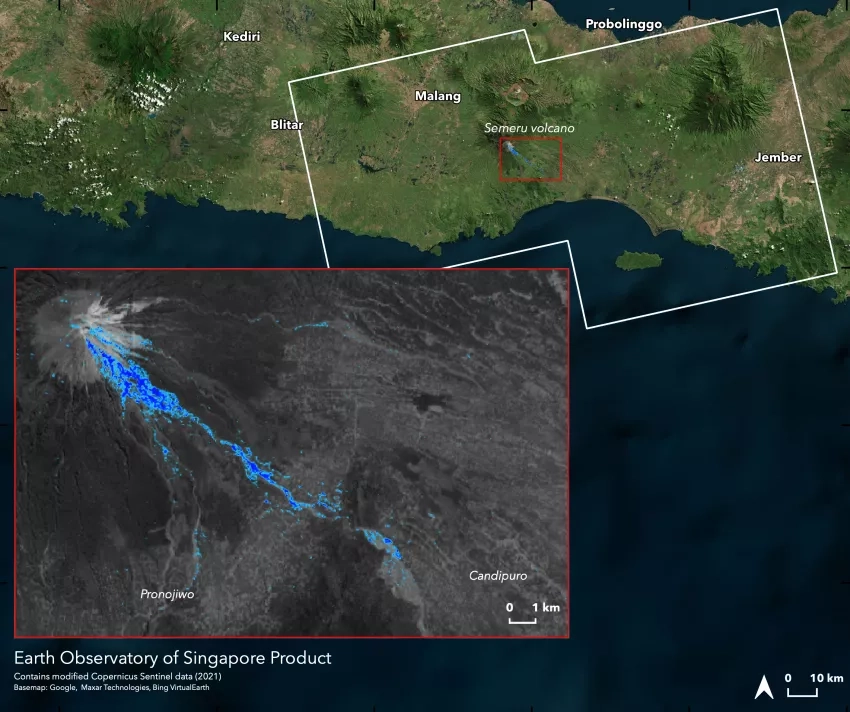
The NASA Earth Applied Sciences Disasters program area has activated efforts to monitor the eruption and provide Earth-observing data and analysis in support of risk reduction and recovery for the eruption. The program is supporting stakeholders from the USGS Volcano Disasters Assistance Program (VDAP), who are coordinating with local disaster response agencies in Indonesia. The Earth Observatory of Singapore, supported by NASA’s Advanced Rapid Imaging and Analysis (ARIA) program and the NASA ROSES A.37 research project “Global Rapid Damage Mapping System with Spaceborne SAR Data, has provided Damage Proxy Maps (DPM’s) of the region to aid in identifying the location of ash, PDC’s, and regions damaged or destroyed by the volcanic activity.
The program is also investigating satellite-based rainfall estimates to determine potential connections with recent heavy rainfall in the region, and monitoring “hot spots” with the NASA/NOAA Suomi-NPP satellite’s Visible Infrared Imaging Radiometer Suite (VIIRS) to monitor for potential further volcanic activity.