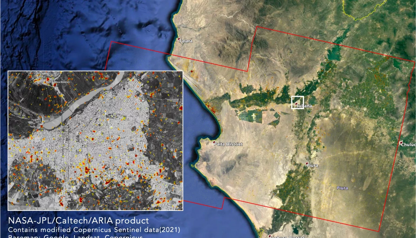
On Friday, July 30, the German Research Centre for Geosciences (GFZ) reported a magnitude 6.1 shallow earthquake near Sullana, Peru. According to GFZ, the earthquake was at a depth of 10 km (6.21 miles). Shallow earthquakes are closer to the surface and are usually felt more strongly than deeper ones and reports indicate that this earthquake was also felt in southern Ecuador. Local media reported dozens of mostly minor injuries and some damage to regional infrastructure, including a cathedral built in the 16th century.
The NASA Earth Applied Sciences Disasters program area activated in support of the event and determined what NASA resources and capabilities may be available to aid response and recovery. Synthetic aperture radar (SAR) data collected by satellites lets scientists compare ground surface changes from before and after a major event. Responding to a request from the Space Agency of Peru (CONIDA), NASA's Advanced Rapid Imaging and Analysis (ARIA) team produced damage proxy maps (DPMs) showing likely damage to the area from the earthquake.
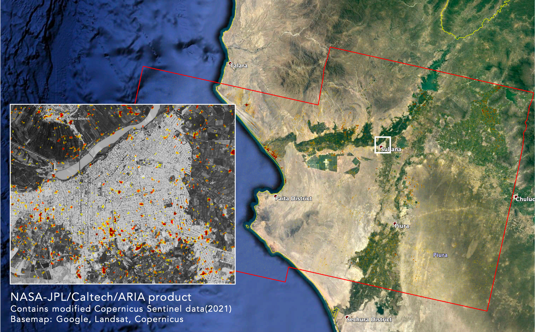
The maps were provided to CONIDA who distributed it to the National Institute of Civil Defense (INDECI), Peru’s National Emergency Operations Center (COEN), for use by participating institutions of the National Disaster Risk Management System (SINAGERD). Based on the DPM provided by NASA, INDECI created other maps that helped affected communities to complete the damage assessments caused by the earthquake.
CONIDA shared images of the high-resolution (0.7m or 2.3 ft) optical satellite PERUSAT1 with NASA Disasters that served to compare the results of the DPM created.
View more details about this product on the NASA Disasters Mapping Portal.
ARIA is a collaboration between NASA's Jet Propulsion Laboratory (JPL) and the California Institute of Technology (Caltech). It is funded in part by the Disasters program area of NASA Earth Applied Sciences through the NASA ROSES A.37 research project “Global Rapid Damage Mapping System with Spaceborne SAR Data.”