Georgia Disasters II (2023 Spring)
Team: Shakirah Rogers (Project Lead), Nathan Tesfayi, Matthew Murray, Clarence Jackson
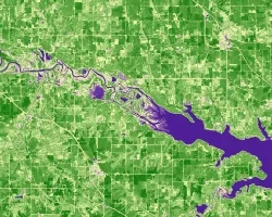
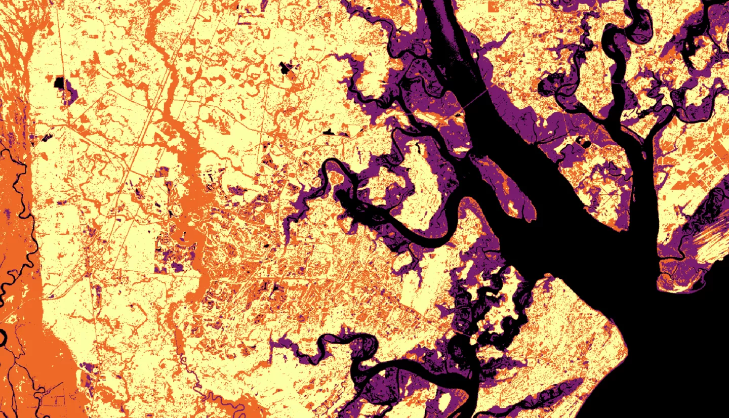
Summary: Heirs property owners are especially vulnerable to natural and manmade disasters. This group of people have inherited property left with no clear title and thus have unclear group ownership with the other legal owners, which are all spouses, children, etc. After Hurricane Irma made landfall in Georgia in September of 2017, heirs property owners were more likely to be denied access to federal relief due to the legal status of their property title. To observe how this group was impacted by Hurricane Irma, the NASA DEVELOP team partnered with The Georgia Heirs Property Law Center, a non-profit law firm that works with heirs properties owners. The team used computer assisted mass appraisal (CAMA) data to identify likely heirs property owners. This map was cross referenced with a flood map produced with surface reflectance and backscatter imagery from Landsat 8 OLI, Sentinel-2 MSI, and Sentinel-1 C-SAR, sensors to identify communities in need for relief or assistance. The flood extent maps were validated against United States Geological Survey Hurricane Irma High Water Mark in situ data taken the same day Irma crossed into Georgia. To further evaluate the impacted group, the team correlated the flood and heirs property likelihood maps to FEMA denials based on titles issues. The team’s end products were handed off to the Georgia Heirs Property Law Center for use in community outreach, educational materials, and directing where the Georgia Heirs Property Law Center prioritizes its limited legal resources.
Related Impact