Imagen
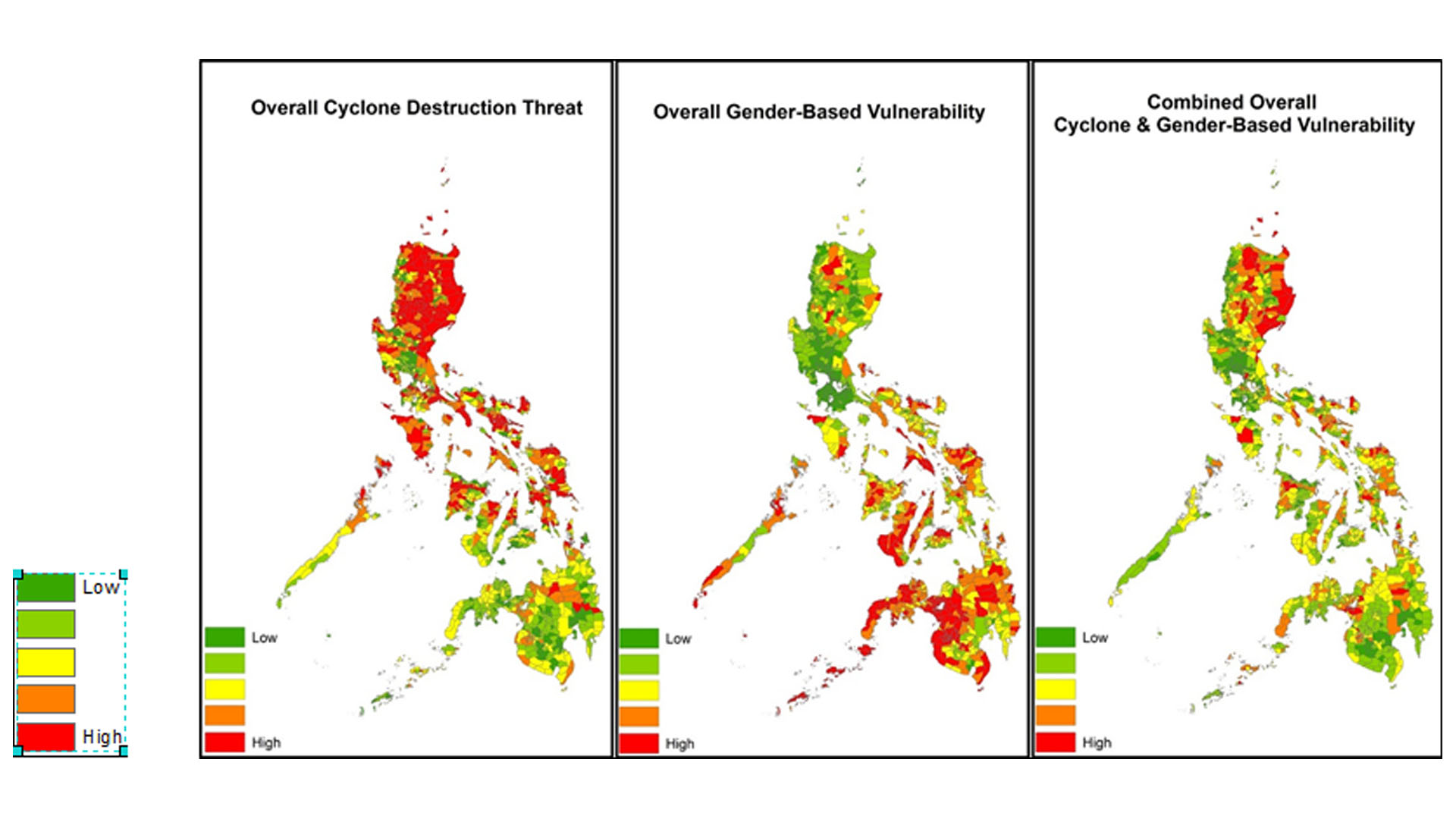
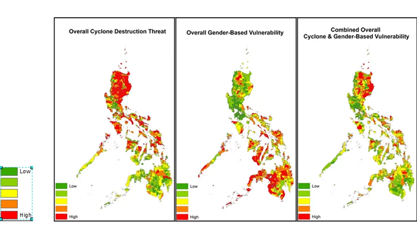
A comprehensive understanding of where sensitive populations and demographics are threatened by natural hazards is necessary for the assessment and prevention of disasters. The island nation of the Philippines is often threatened by tropical cyclones, which have had disastrous consequences in the past (e.g., Tropical Cyclone (TC) Haiyan in 2013 claimed over 6,000 lives). This project aimed to assess areas of greatest disaster risk in the Philippines with a special focus on gender. Using a combination of archived tropical cyclone data from the International Best Track Archive for Climate Stewardship (IBTrACS) dataset, precipitation estimates from both the Global Precipitation Measurement Mission (GPM) and the Precipitation Estimation from Remotely Sense Information using Artificial Neural Networks Climate Data Record (PERSIANN-CDR), and population demographic data from the Philippines, this project aimed to determine where intense tropical cyclones are most prone to make landfall and what areas and populations are most sensitive to cyclone events of a given strength based on gender and socioeconomic status. These results will be used by the United Nations Office for the Coordination of Humanitarian Affairs (OCHA) to target areas of greatest need for further development in disaster response and mitigation techniques.