Displaying 171 - 180 of 3630
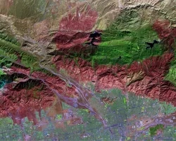
SERVIR partners with leading organizations around the world to help developing countries use Earth-observing data to manage environmental risks and land use.

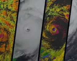
When disaster strikes, we put NASA satellites to work to help decision-makers, communities and governments pinpoint the places where help is needed most.
Our team provides disaster information and visualizations that help decision-makers plan ahead, protect people and property and minimize community damage.
Learn how you can leverage our resources to help your community or organization, and how to partner with us for research, data sharing, training and more.
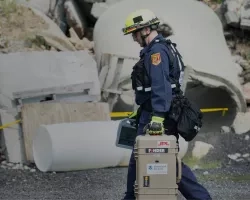
When disasters occur and our team is activated, they provide critical data and imagery to support real-time decisions that save lives and mitigate damage.
Demand for disaster risk-reduction and community resilience measures is on the rise. We help communities better prepare for the next time disaster strikes.
Reducing Risk & Building Resilience
Disaster risk reduction and the building of community resilience have emerge
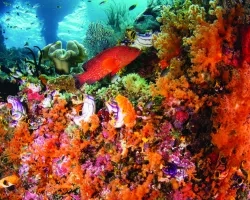

To protect our natural land, marine and freshwater resources, we promote the use of Earth observations in conservation, sustainability and resource management.
We provide Earth-observing data to enhance decision-making for resource management, conservation and sustainable communities.