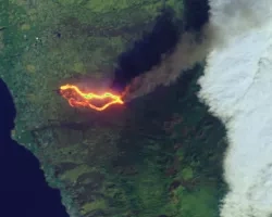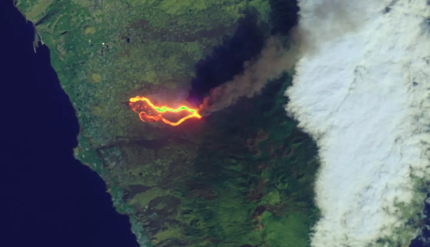
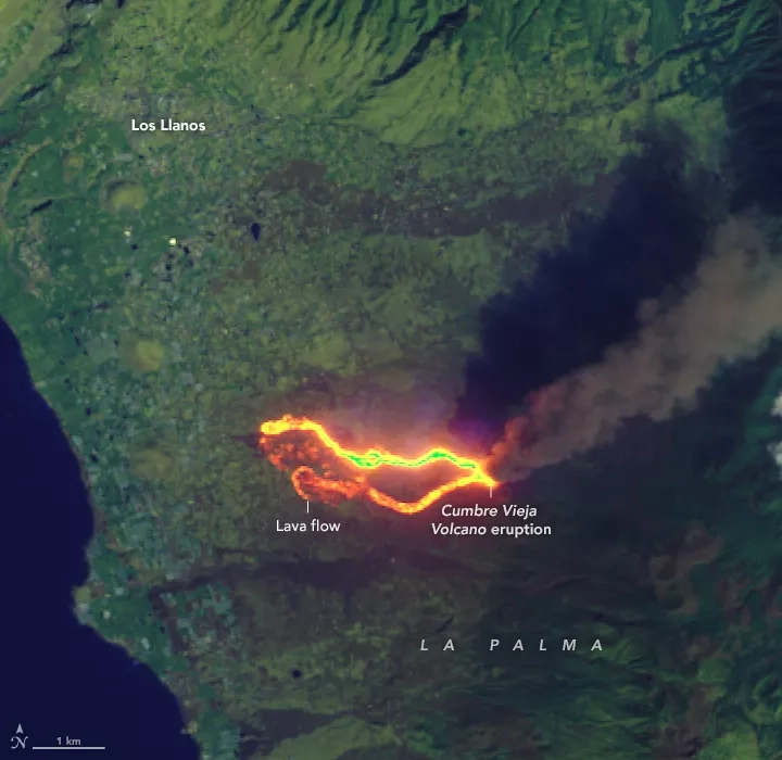
After Cumbre Vieja split open and began erupting on September 19, 2021, a slow-moving wall of basaltic lava began bulldozing its way through populated parts of La Palma. Lava flows have destroyed nearly 400 homes, buried dozens of kilometers of roads, and consumed farmland as molten rock creeps down the western flank of the volcanic island toward the ocean.
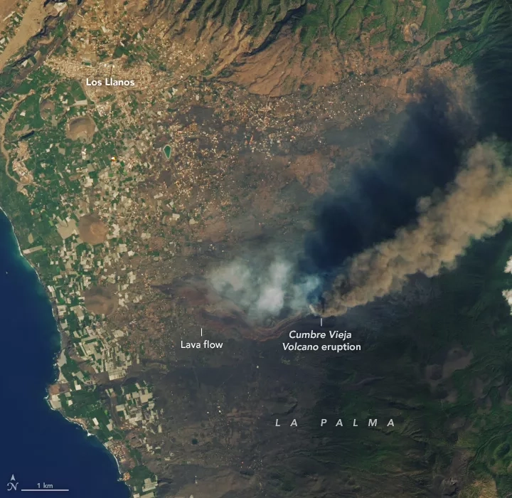
The Operational Land Imager (OLI) on Landsat 8 captured a natural-color image (above) of lava flowing through the communities of El Paraiso and Todoque on September 26, 2021. Though the inside of the lava flow was hot and molten, cooling on the surface left a dark crust that made the flow appear black in natural-color imagery. Observations of infrared wavelengths (second image below) reveal the hottest parts of the flow.
Read the full story at NASA's Earth Observatory: Lava Burns a Path Through La Palma
The newest satellite in the NASA / USGS Landsat program, Landsat 9, successfully launched on September 27, 2021, continuing Landsat's 50-year legacy of monitoring Earth from space.
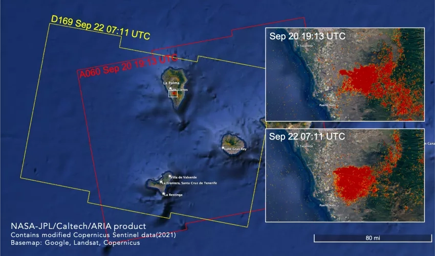
The Advanced Rapid Imaging and Analysis (ARIA) team at NASA's Jet Propulsion Laboratory and California Institute of Technology in Southern California produced these Damage Proxy Maps (DPM) depicting areas that were likely damaged or strongly affected by the volcanic eruption on the island of La Palma. The image shows two DPMs produced with data from Sept. 20 and 22, 2021. Each pixel of damage detection measures about 98 feet (30 meters) across, with yellow pixels indicating likely moderately damaged areas and red indicating likely severely damaged areas. This work was funded in part by the NASA ROSES A.37 research project “Global Rapid Damage Mapping System with Spaceborne SAR Data.”
Learn More