Water is scarce and drought is pervasive in the American southwest where The Navajo Nation is located. The Water Resources program area is collaborating with the Nation on ways of managing their water and responding to water issues using valuable, reliable data. The Water program area supports NASA's Western Water Applications Office (WWAO).
WWAO's Navajo Nation Drought Project has built a cloud-based web application - the Drought Severity Evaluation Tool (DSET) - to improve drought reporting and management in the Navajo Nation. The drought reports combine satellite data, modeled inputs, and in-situ data from the Navajo in a web-based platform, which harnesses Google Earth Engine. The drought tool is the result of a collaboration between WWAO, the Navajo Nation Department of Water Resources and the Desert Research Institute.
Nikki Tulley is a member of the Navajo Nation and summer 2020 intern with WWAO. This is her first-person account of working on the project and what water means to the Navajo nation.
---
Imagine a hot summer day spent herding sheep in the semi-arid desert of southwest America. The idea of cooling down in a community swimming pool to escape the summer heat is unthinkable, with the closest water source being the livestock well water troughs. While jumping into one of the troughs would be immensely refreshing, there’s an unspoken understanding about respecting water and livestock in the area. It’s well-known that the livestock well water trough is one of the limited water sources shared by the Navajo Nation community. So, slightly wetting the face and hair will have to be sufficient enough to cool down in the summer heat before returning home.
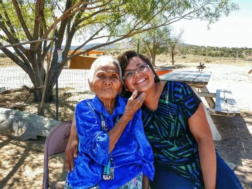
This is a typical summer experience for many children of the Navajo Nation who were raised around livestock in the vast rural areas of the reservation. This memory in particular is from my childhood. My name is Nikki Tulley. I’m a member of the Navajo Nation on a mission to help my community protect its most vital resource: water.
This summer, I worked closely with Amber McCullum, a research scientist at NASA Ames Research Center, on the Navajo Nation Drought Project as part of my internship with NASA’s Western Water Applications Office (WWAO). The project aims to provide the Navajo people with useful data to better manage their water resources through the Drought Severity Evaluation Tool (DSET).
On the reservation there is a common phrase: “Water is Life.” Those three words encompass the fundamental mentality in sustaining the way of life for the Navajo Nation and its people. The Navajo Nation lifestyle heavily consists of agriculture, owning livestock and hauling water. In creating DSET, it was critical to acknowledge the cultural and spiritual values of the Navajo Nation alongside the hydrologic cycle, agriculture, ranching, rangeland management and domestic and livestock water usage.
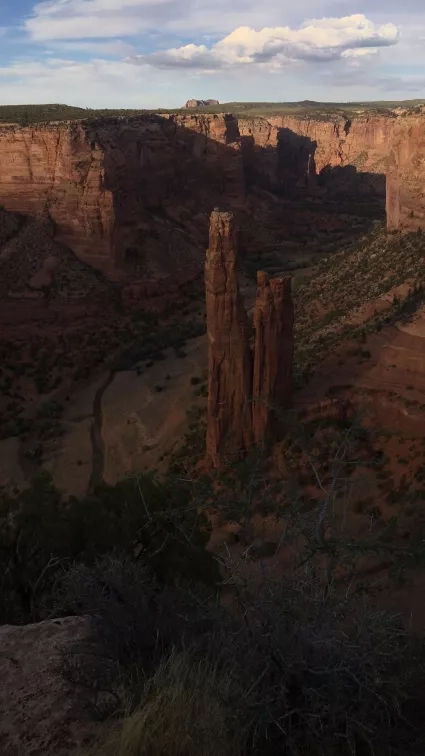
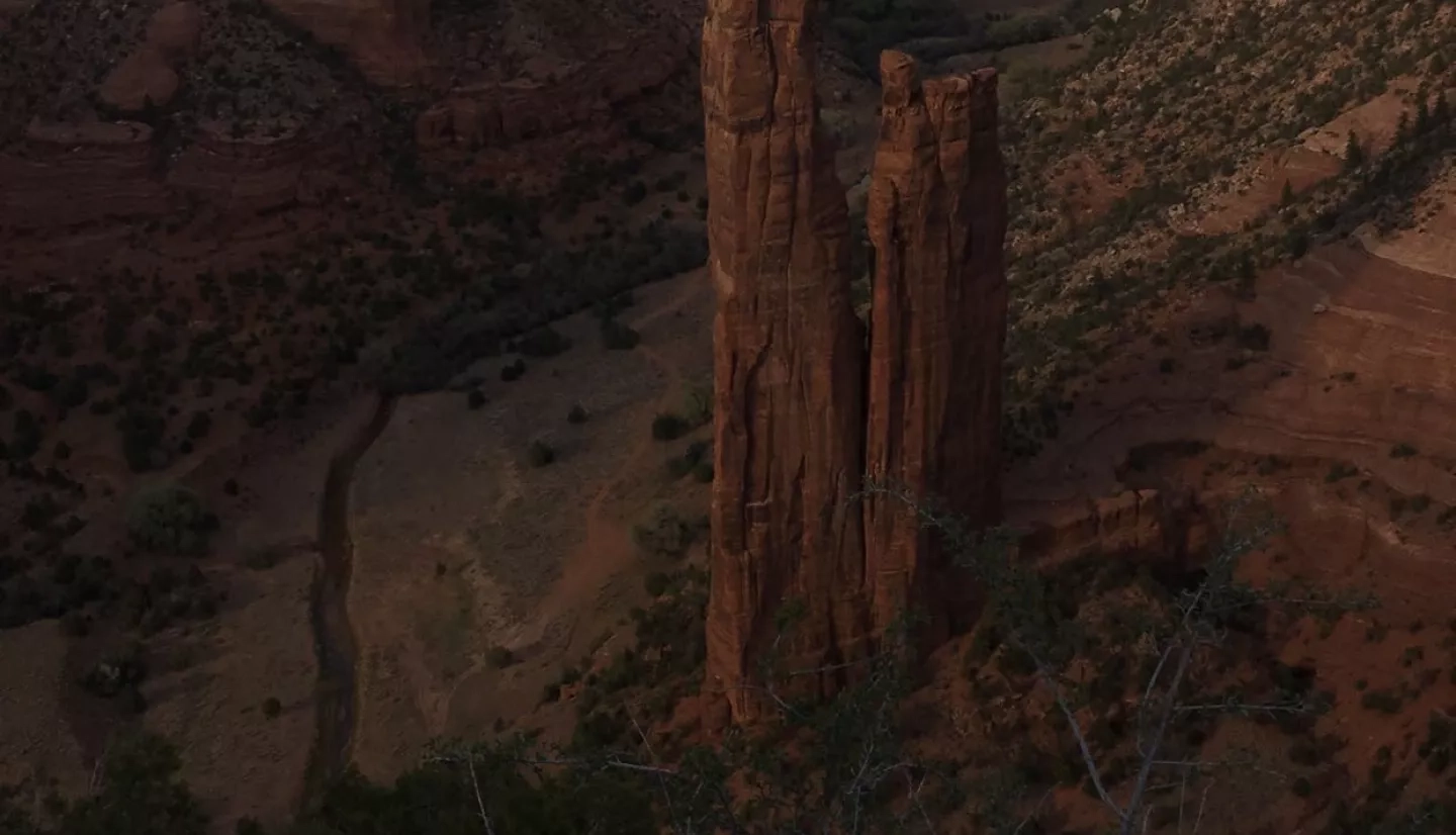
The Navajo Nation is a Native American reservation that encompasses over 27,000 square miles and spans into Arizona, New Mexico and Utah. The landscape varies dramatically driving across the reservation. Iconic geological formations such as the Grand Canyon, Antelope Canyon, Monument Valley and Canyon De Chelly are scattered across the area. The reservation also includes forested areas such as the Chuska Mountain, Lukachukai Mountain and Navajo Mountain.
However, the vast majority of the reservation is semi-arid to arid desert. In this particular part of the country there is still a strong reliance on the use of groundwater. Surface water or neighboring rivers and snowpack runoff from the mountains do not reach all areas of the Navajo Nation, and water resource management plays a key role in mitigating water shortages. Due to frequent droughts on the Navajo Nation, there is a need for resources and tools to evaluate drought conditions to help decision-making on a local scale as opposed to a regional scale. DSET aims to address that need.
DSET is a web-based drought reporting tool co-developed between the Navajo Nation Department of Water Resources (NNDWR), the Desert Research Institute (DRI) and WWAO. The tool aims to help the Navajo improve its ability to monitor and report drought through a combination of precipitation data from NASA satellites, drought indices and ground-based rain measurements. DSET will serve as a long-lasting resource for making maps and conducting time series analysis for climate variables and drought indices that can be used for water management and decision making.
DSET is currently available and was completed in fall 2020. The team created an interactive user guide to increase the accessibility and use of this tool. It includes step-by-step guides and demonstration videos for the application areas of drought, agriculture, wildfires, and snowpack. The user guide is available on the WWAO website, and the videos are available on NASA’s YouTube Playlist titled NASA Western Water Applications Office - Navajo Drought Tool.
As a co-developed tool with the Navajo Nation, DSET is unique in seeking to understand how Indigenous knowledge and western science can be viewed side-by-side.
“One of the biggest goals of DSET is building capacity,” said McCullum, who is also the lead for WWAO’s Navajo Nation Drought Project. “Building capacity is connecting what data and tools are available to the people that can use them to make their own decisions. Providing context of the value of Earth observations and bringing Indigenous knowledge to NASA is important, is a two-way street that includes Indigenous knowledge and Indigenous science.”
This relationship began in 2015, when McCullum and Cindy Schmidt, Associate Program manager for the Applied Sciences Program and the lead for NASA’s Indigenous Peoples Capacity Building Initiative, visited with NNDWR. Their visit marked the starting point for a two-term NASA DEVELOP feasibility project in 2016. The DEVELOP program spearheads strategic partnerships seeking solutions to environmental and other Earth-science issues.
These DEVELOP projects set the stage for the current project by creating a prototype Drought Severity Assessment Tool 2.0. Once these projects were complete, WWAO stepped in to support the current work of refining the tool and launching it on a user-friendly platform.
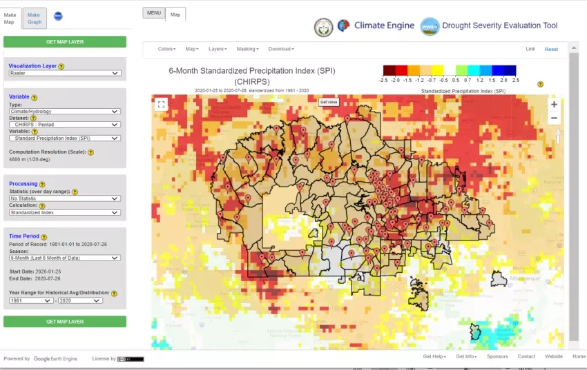
DSET was created as a spin-off of Climate Engine that creates on-the-fly maps and time series through Google Earth Engine. Prior to DSET, NNDWR and other tribal entities have relied on regional scale data for drought indices such as the Standardized Precipitation Index (SPI).
However, using regional scale data creates a lack of detail specific to the Navajo Nation climatic conditions. To provide better data for specific locations, Carlee McClellan, senior hydrologist for the NNDWR, worked to expand the project. A major component of DSET is the inclusion of Navajo Nation ground-based precipitation data provided through 85 rain gauge stations unevenly distributed across the Nation.
DSET includes data from these rain gauge stations along with a number of climate models remotely-sensed and gridded weather and climate data sets. Those include the Sentinel-2 and Landsat series of satellites, Earth-observing instruments like the Moderate Resolution Imaging Spectroradiometer (MODIS) aboard NASA's Terra satellite and various data analysis tools, including the Modern-Era Retrospective Analysis for Research and Applications, Version 2 (MERRA-2).
DSET was created with the user needs in mind, which has included continuous dialogue and feedback sessions about useful features including the ability to generate area-averaged values for the 110 Navajo Nation Chapters, which are similar to U.S. counties.
More importantly the co-development of DSET has created a supportive environment for collaboration between the Navajo Nation, one of the largest Native American sovereigns in the United States, and scientists, helping fill the need for science to better address drought conditions and other climatic variables.
As a child growing up on the reservation, I never would have imagined that my path would lead me to NASA and give me the opportunity to work on a drought monitoring project for the Navajo Nation. I’m currently pursuing a PhD at the University of Arizona, and in a few short years my name will include a couple more letters to become Dr. Nikki Tulley.
Despite having the opportunity to live or study anywhere in the world – it is the love and respect I have for my family and community that has led me to dedicate my research to finding solutions for hydrological difficulties in the southwest. More specifically, I’m constantly looking for ways to serve the Navajo Nation as a Navajo hydroscience researcher.
Projects like DSET open up opportunities to monitor water efficiently, lightening the load of many people who work tirelessly on water issues and understand how precious water is in sustaining life in an ever-changing environment.


