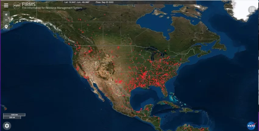
Tracking and monitoring wildfires require having the best, most up-to-date information possible. Now, satellite-derived active fire data across the U.S is available within one minute, thanks to NASA’s Fire Information for Resource Management System (FIRMS)
FIRMS has been providing active fire data within three hours of observation from Earth observing satellites, to users worldwide in FIRMS and NASA’s Worldview. Now, for the continental U.S., the active fire data are now available in real-time (within one hour of satellite observation), and in ultra-real-time – in this case within one minute, using direct broadcast data and the new software developed by University of Wisconsin-Madison’s Space Science and Engineering Center (SSEC).
Direct broadcast is a term used to describe the capability of some satellites to immediately broadcast raw data to the ground. As the Earth is observed by the satellite, the data are formatted and transmitted to any user below with an antenna and other equipment necessary to receive and process the data. Usually, data granules are downloaded before processing begins but a new approach at SSEC processes micro-granules as they are received. “[This] is the first routine service for detecting wildfires over the continental United States from low-Earth orbit satellites with a latency of less than 60 seconds from Earth observation to wildfire detection,” said Liam Gumley, the lead scientist with the Cooperative Institute for Meteorological Satellite Studies at the University of Wisconsin-Madison’s SSEC.
The addition of real-time (within an hour) and ultra-real-time active fire data to FIRMS is part of an ongoing effort by NASA and the U.S. Forest Service to strengthen its data resources in US and Canada.
“The more timely the data, the higher its value when assessing the location, extent, and intensity of newly detected fire activity,” said Brad Quayle, program lead for the Disturbance Assessment and Services (DAS) Program at the USDA Forest Service.
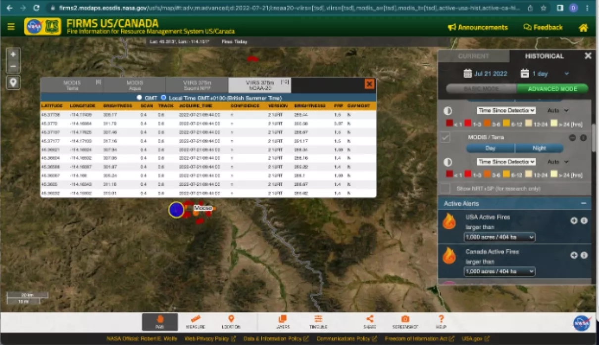
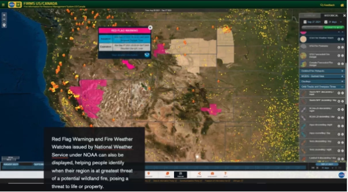
FIRMS US/Canada is tailored to support strategic wildland fire monitoring and response by the interagency fire management community and to inform the general public. To meet these needs FIRMS US/Canada includes additional features not available in the global version of FIRMS. These features include US and Canada specific data incident information, situation reports, customized administrative boundaries, fire perimeters, fire danger ratings and red flag warnings and weather watches. More information about these features can be found in the FIRMS story map and the Earthdata article “NASA, Forest Service Partnership Expands Active Fire Mapping Capabilities.”
“FIRMS gives us an ‘at a glance’ understanding of where fires are and the location of a fire’s active area,” said Everett Hinkley, National Remote Sensing Program Manager with the Geospatial Management Office of the U.S. Forest Service. “In some remote areas, it’s our only window into what is going on with fires and lets us track their growth.”
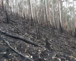
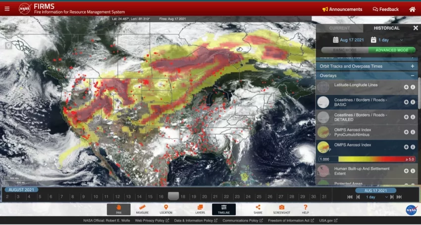
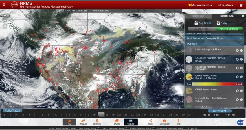
FIRMS began including ultra-real-time data in the summer of 2022, when unusual heat and dry weather led to more than 200 fires in the Yukon and Northwest Territories, according to the Canadian government. Many of these areas experienced record-breaking heat which dries out vegetation and makes it easier for fires to ignite and burn. In extreme cases, when wildfires burn hot enough to produce strong updrafts it can lead to fire-induced thunderstorms, also known as Pyrocumulonimbus events.
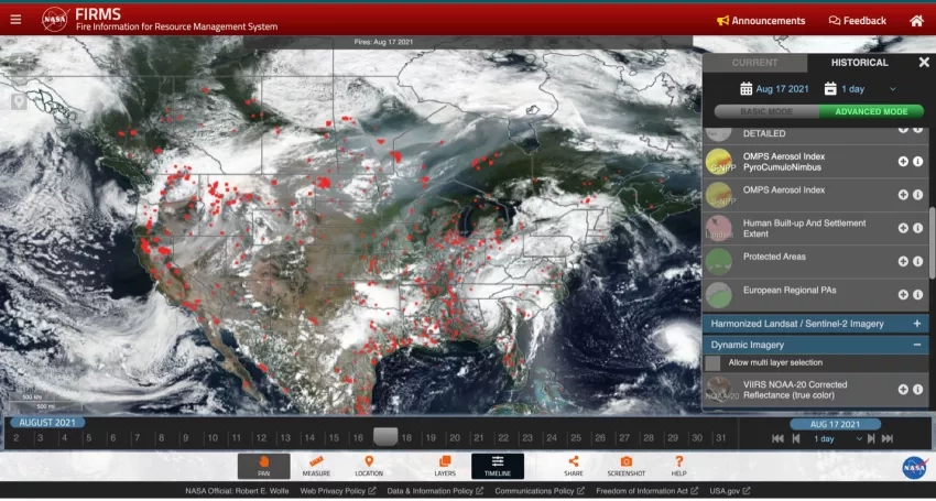
The active fire data available through FIRMS are acquired from Moderate Resolution Imaging Spectroradiometer (MODIS) instruments aboard NASA’s Aqua and Terra satellites, the Visible Infrared Imaging Radiometer Suite (VIIRS) instruments aboard the Suomi National Polar-orbiting Partnership satellite (Suomi NPP), a joint project by NASA and the National Oceanic and Atmospheric Administration and the NOAA-20 satellite.
FIRMS is part of NASA’s Land, Atmosphere Near real-time Capability for EOS (LANCE). Diane Davies, the LANCE operations manager notes that in addition to information on active fires, “LANCE provides a wide range of near-real time data and imagery from NASA’s and other Earth science satellite missions to support users monitoring hazards and disasters including fires, smoke, air quality, dust storms, and flooding.”
FIRMS data is incorporated into NASA’s Actionable Fire Science Information Hub (AFSI). “This is a resource for stakeholders to share insights and information to adapt to, manage, and live with fires by mapping common ground,” said Tian Yao, NASA’s Applied Sciences Program-LANCE coordinator. Yao leads the NASA’s Applied Sciences work in promoting the use of LANCE near real-time satellite data products to users and stakeholders.
“Fire is an essential process for many ecosystems and yet fires can also quickly become uncontrolled and spread rapidly,” said David Green, program manager of NASA’s Wildland Fires program area.
“We are working to provide decision makers with applications and tools like FIRMS with the goal of helping communities manage fire, before, during and after an event,” Green said. “We’re also working to create a network of collaborators with the goal of growing a global community of practice dedicated to better understanding fires that connect federal agencies, universities, fire response organizations and others to share knowledge.”
Green adds, “The goal is making FIRMS even more useful to the community responding to and studying wildland fires.”
Tutorials on using FIRMS can be found at the Earthdata website.