Displaying 21 - 28 of 28
![Normalized Difference Snow Index (NDSI) Image calculated from a May 2021 Landsat 8 top-of-atmosphere (TOA) reflectance image. The purple area depicts areas without snow and the yellow area represents areas with snow cover. This information can be used by refuge managers to monitor snow conditions and prepare for the ecological, cultural, and landscape impacts caused by snow.](/sites/default/files/styles/lis/public/2023-05/2023Spring_NCEI_NortheastAlaskaClimate_Websiteimage.jpg.webp?itok=vgp5Y_zU)
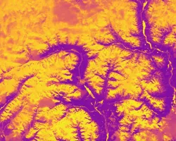
Northeast Alaska Climate (2023 Spring) Team: Kristin Anderson (Project Lead), Omeed Arooji, Isabella Chittumuri, Tom Germann Summary: Alaska is experiencing climate change at an unprecedented...
DEVELOP
Wildland Fires
Climate
Capacity Building
Ecological Conservation
Health & Air Quality
Water Resources
![Normalized Difference Water Index (NDWI) to visualize drainage networks around the Unalakleet River in Alaska, calculated from an August 2021 Landsat 8 OLI image. Yellow represents standing or flowing water and potential flood zones, while the dark blue represents drier, upland regions. Unalakleet's climate resilience planning prioritizes relocation to upland regions while avoiding areas that have experienced significant permafrost degradation.](/sites/default/files/styles/lis/public/2023-10/2023Sum_GA_UnalakleetClimate_WebsiteImage.jpg.webp?itok=9m9RUwoB)
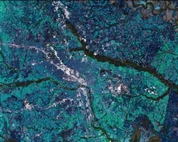
Unalakleet Climate (Summer 2023) Team: Ian Lee (Project Lead), Clara Maxwell, Daniel J. Marsden, M. Jaweed Nazary Summary: The coastal community of Unalakleet is currently...
![Runoff retention values in Richmond, VA estimated by the InVEST Urban Flood Risk Mitigation Model for a June 2, 2018, extreme rainfall event measured by GPM IMERG. Dark blue areas have high runoff retention capacity and absorbed more of the rainfall during the storm; light green areas absorbed less rainfall during the storm, increasing the likelihood of pluvial flooding. Pluvial flood risk maps help inform community planners’ efforts to protect vulnerable populations.](/sites/default/files/styles/lis/public/2023-11/2023Sum_LaRC_RichmondDisasters_WebsiteImage.jpg.webp?itok=17L81iXz)
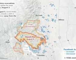
Richmond Disasters (Summer 2023) Team: Kaylee Tanner (Project Lead), Brodie Thiele, Trinity Johnson, Maggie Lincoln Summary: Pluvial flooding is the most frequent and widespread type...
Team Members: Miriam Marlier (University of California, Los Angeles), Claire Schollaert (University of Washington), Diane Garcia-Gonzales (University of California, Los Angeles), Michael Jerret (University of...
![Land surface temperatures for study area (Cuyahoga County, Ohio), as derived from Landsat. Black lines show boundaries of census blocks. Blue dots show the greenspaces and census blocks where the on the ground tree surveys have been conducted, with one census block highlighted as an inset. Image Credit: Rob Moore (Cleveland State).](/sites/default/files/styles/lis/public/2024-05/Mueller%20Project%20Page%20Image_0.png.webp?itok=nYl76fWk)
Topic
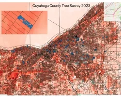
Team: Kevin Mueller (Cleveland State University), Brice Grunert (Cleveland State University), Thomas Hilde (Cleveland State University), Kaiguang Zhao (Ohio State University), Daniel Meaney (Cuyahoga County...