SUMMARY
Date: Oct. 2, 2021
Type: Oil Spills
Region: North America, California
Info & Resources:
- Latest updates from the U.S. Coast Guard & California Department of Fish and Wildlife’s Office of Spill Prevention and Response (CDFW-OSPR): www.SoCalSpillResponse.com
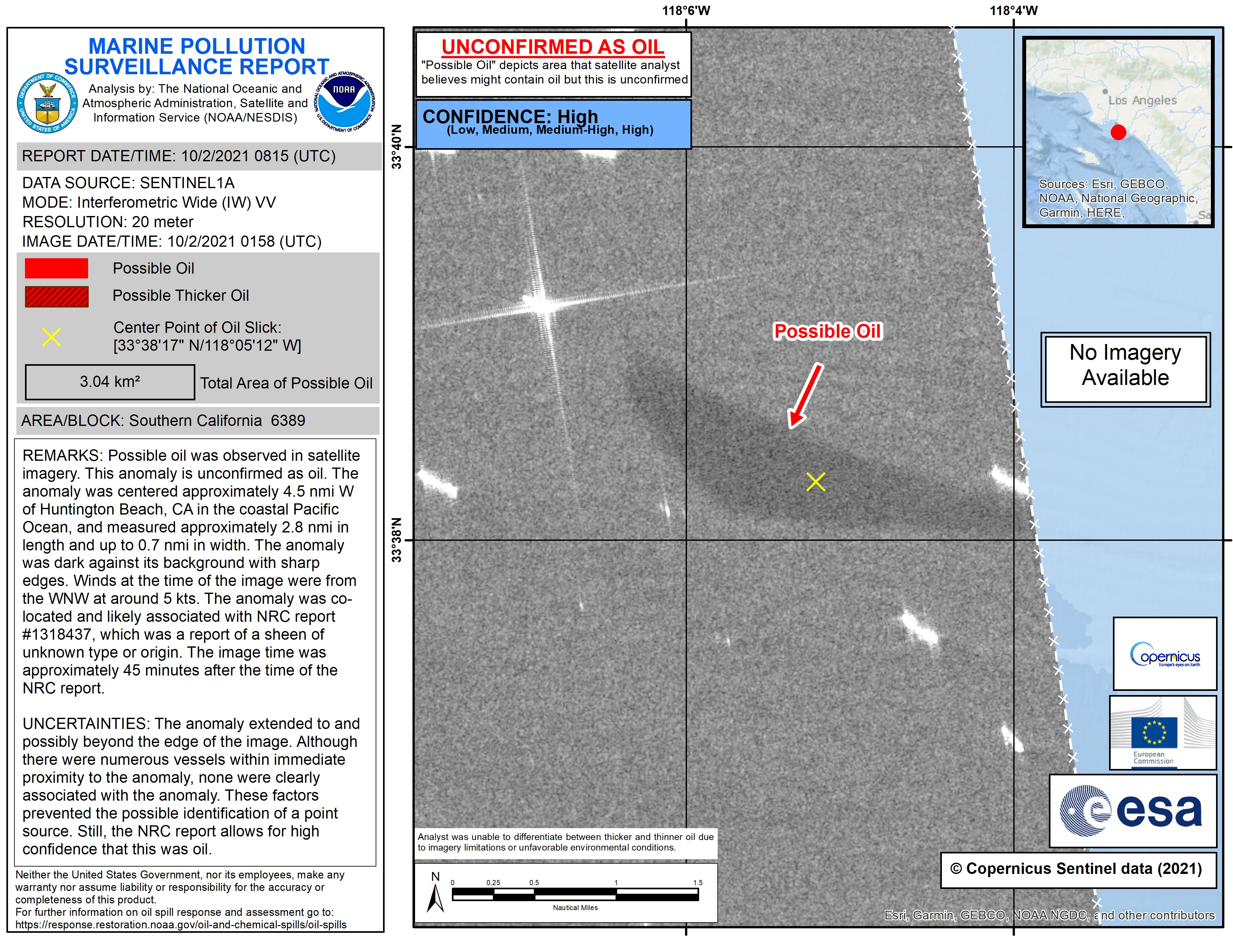
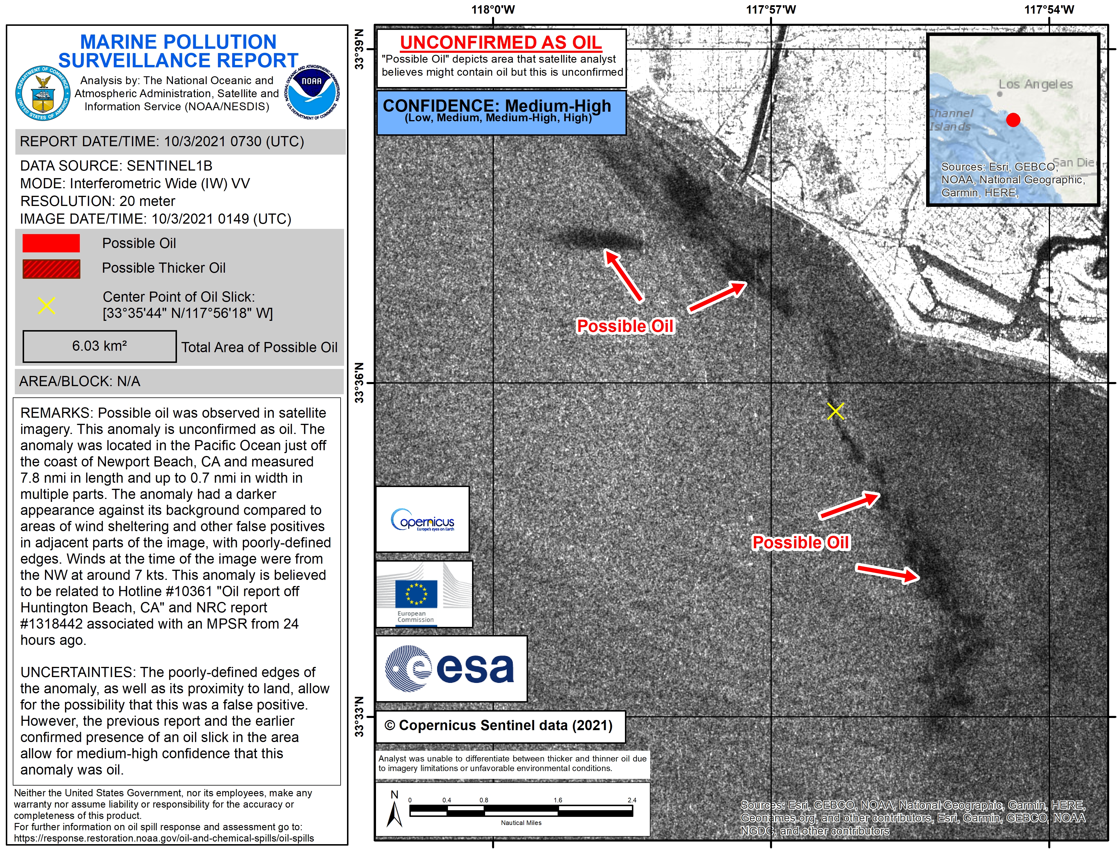
- Latest satellite data from NOAA / NESDIS: Oct 2, Oct 3
- NASA Disasters program resources for oil spills
UPDATE OCT. 15, 2021
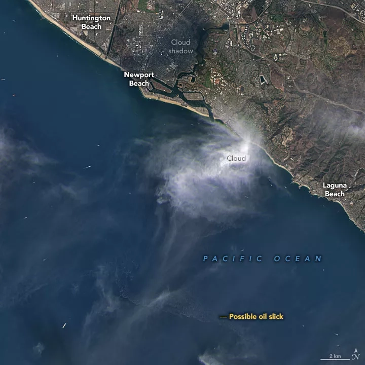
On Saturday, Oct. 2, the U.S. Coast Guard tweeted that they were responding to an oil slick reported to be approximately 13 square miles (8,320 acres) in size, three miles off the coast of Newport Beach, California. By the next day, oil from the leak produced a slick that reached the shores of Huntington Beach and Newport Beach. Reports from local media noted oil from the spill also threatened Talbert Marsh, a 25-acre ecological reserve near Huntington Beach. While the investigation continued into the cause of the spill, media reported that the leak originated from a 17.5-mile (28.16-kilometer) pipeline that operates 80 to 100 feet (24 to 30 meters) below the surface, running from the Port of Long Beach to an offshore oil platform.
NASA Earth Applied Sciences Disasters Program has activated to determine what NASA resources and capabilities may be available to support recovery efforts. The program is actively collaborating with NOAA, who is working with a variety of agencies and organizations to support the damage assessment and response communities.
Enabling more rapid assessments could equip response agencies to deploy resources faster, protecting ecosystems and economies. That’s one reason NASA supports research such as the NASA ROSES A.37 research project, “Development and Implementation of Remote Sensing Techniques for Oil Spill Monitoring and Storm Damage Assessment in an Operational Context.” The project is developing innovative techniques for measuring the thickness of oil spills from space using Synthetic Aperture Radar, or SAR, along with traditional Earth observation platforms. The advanced radar can provide additional perspectives that may help improve response, inform smart recovery, and promote sustainable resilience.
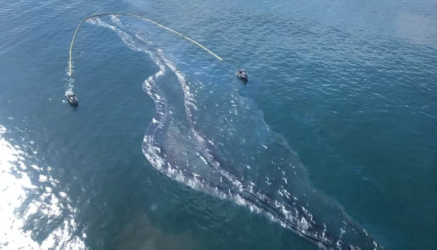
Leveraging collaboration fostered from that project and others, a team from NASA’s Jet Propulsion Laboratory (JPL) and the agency’s Armstrong Flight Research Center (AFRC) has been flying an aircraft equipped with Uninhabited Aerial Vehicle Synthetic Aperture Radar (UAVSAR) to corroborate oil slick locations. Researchers at JPL are processing the data for further use by NOAA’s Satellite Analysis Branch (SAB) and NOAA's Office of Response and Restoration (OR&R). NOAA is uploading select imagery to the web-based Environmental Response Management Application (ERMA) portal. ERMA integrates and synthesizes various datasets into a single interactive map to enable quick visualization of the situation and improve communication and coordination among responders and environmental stakeholders.
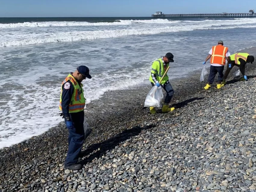
NASA also deployed the Airborne Visible InfraRed Imaging Spectrometer - Next Generation (AVIRIS-NG), which flies on a King Air B200 aircraft, from its home base in Virginia to California. AVIRIS-NG provides access to high signal-to-noise ratio imaging spectroscopy measurements in the solar reflected spectral range to support further analysis of the spill and its impacts along Southern California’s coastal beaches. Spectral analysis can expand scientific survey capabilities beyond visual observation to help researchers gain a more comprehensive picture. Researchers are interested to see if AVIRIS-NG data reveal targets that might be indicative of tar balls or oiled shorelines as that application could later enhance response or recovery in the event of future oil spills.
Flight planning for these NASA assets and other disaster-related activities and research has been informed with input from a coordinated team that includes collaborators from NOAA’s Ocean Service, and Southern California Coastal Ocean Observing System (SCCOOS), as well as commercial entities Capella Space and Water Mapping Associates. Imagery and information characterizing the oil spill continues to be acquired and shared with the oil spill’s incident management team via NOAA.
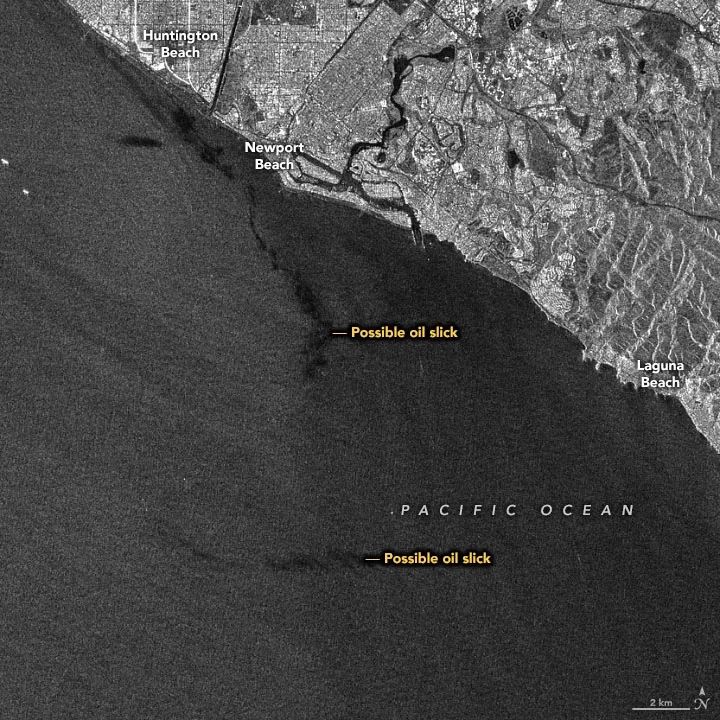
NOAA’s National Environmental Satellite Data and Information Service (NESDIS) Satellite Analysis Branch has been reviewing imagery captured by various Earth-observing satellites, including Sentinel-1A, Sentinel-2B and Landsat 8 to characterize and track oil from the incident.
The unified command for the spill, composed of the U.S. Coast Guard, the California Department of Fish and Wildlife’s Office of Spill Prevention and Response (CDFW-OSPR) and others, has established a website for the response www.SoCalSpillResponse.com.
Related features:
- Satellites View California Oil Spill
- Frank Monaldo: Making the MOST of Technology to Detect Oil Spills
Related disasters:
Related Impact