Date
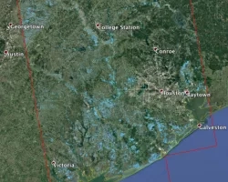
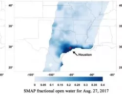
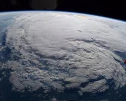
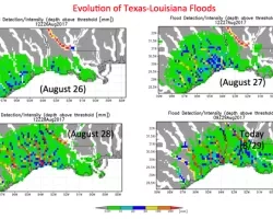
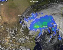
NASA’s Earth Science Disaster Response Team continues to work with interagency remote sensing specialists on the interpretation of NASA and partner-derived products designed to capture the extent of coastal surge and inland riverine flooding throughout the areas impacted by the landfall and torrential, record-setting rains of Hurricane Harvey. NASA and partnering scientists will work with state and federal agency partners to assess the usefulness of imagery and products, look for opportunities to improve the quality, interpretation, and use of products, and support scientific studies on processes related to tropical cyclones and hurricanes, especially for communities at high risk for complex impacts from these storms.
Related Impact
Tagged: Disasters
Tagged: Disasters
Tagged: Disasters
Tagged: Disasters
Tagged: Disasters