Date
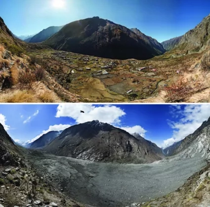
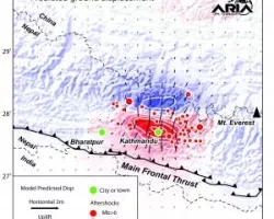
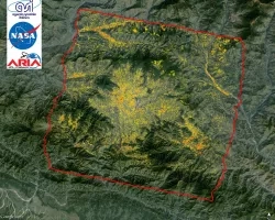
On April 25, 2015, a magnitude 7.8 earthquake in Nepal, referred to as the Gorkha earthquake, struck killing more than 8,000 people and injuring more than 21,000. NASA worked with a number of partners in support of the earthquake response, including the U.S. Geological Survey, United States Agency for International Development (USAID)/Office of U.S. Foreign Disaster Assistance, World Bank, American Red Cross, and the United Nations Children's Fund.
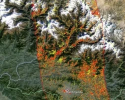
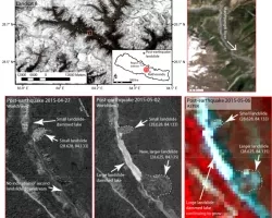
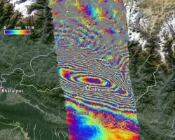
NASA contributions included “vulnerability maps,” used to determine risks that may be present; and “damage proxy maps,” used to determine the type and extent of existing damage. Such products can be used to better direct response efforts.
Related Impact
Tagged: Disasters
Tagged: Disasters
Tagged: Disasters
Tagged: Disasters