Image

NASA
NASA
Tasseled cap greenness transformation derived from Landsat 8 imagery over lodgepole pine forest in the Intermountain West study area
Completed Projects
Andrew Shannon
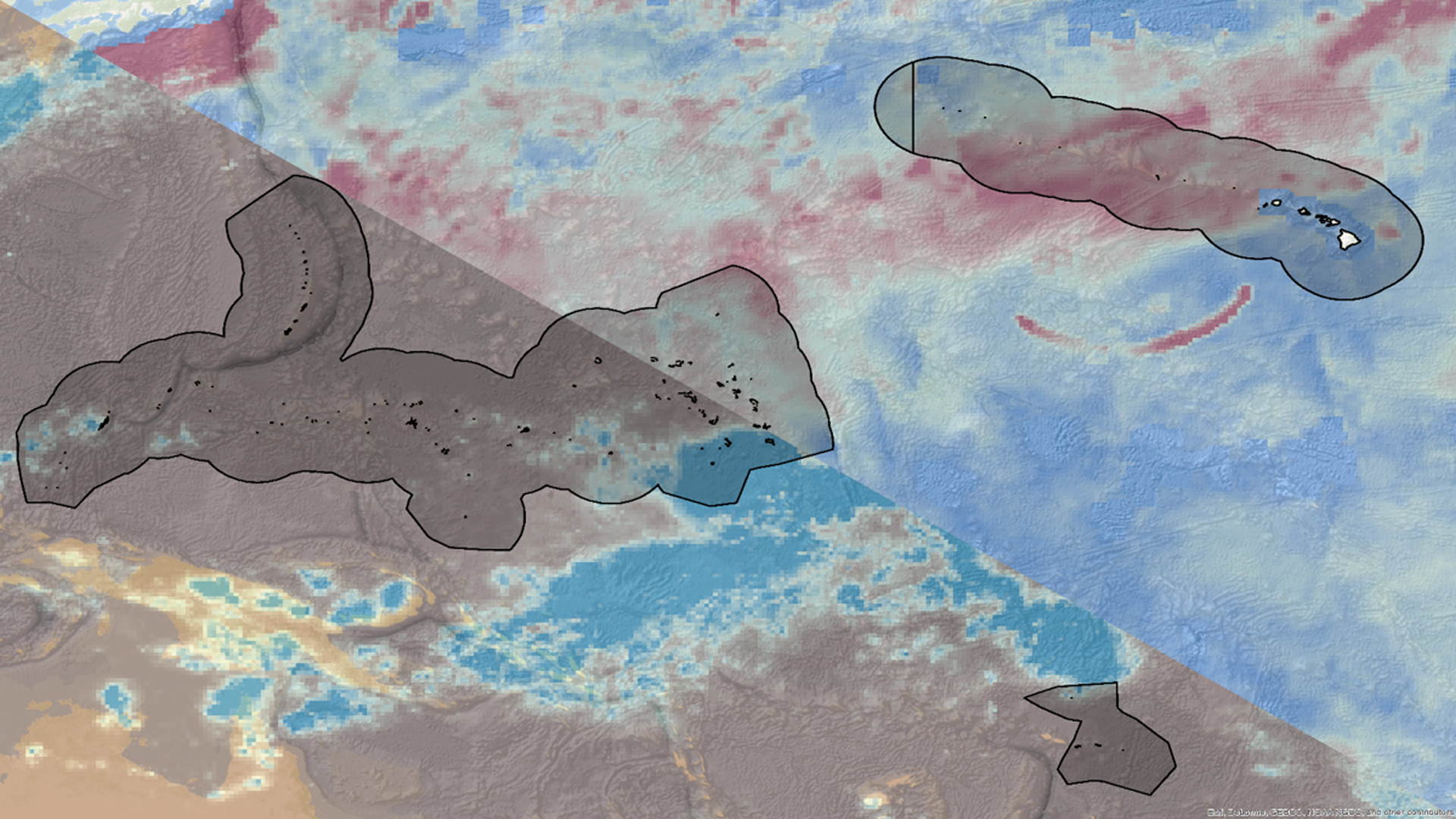
Hawai'i and the U.S. Affiliated Pacific Islands (USAPI) comprise more than 2,000 islands that span thousands of miles of ocean and are home to nearly 1.9 million people. This region is particularly vulnerable to economic, social, and environmental impacts resulting from changes in sea level...
W. Patrick Frier
Portions of Amistad National Recreation Area (NRA) are threatened by the presence of an invasive grass species known as giant cane (Arundo donax), which drastically alters riparian habitats by out-competing native vegetation and depleting vital resources. Giant cane does not provide viable habitat or food...
Eleanor Hunts (Project Co-Lead)

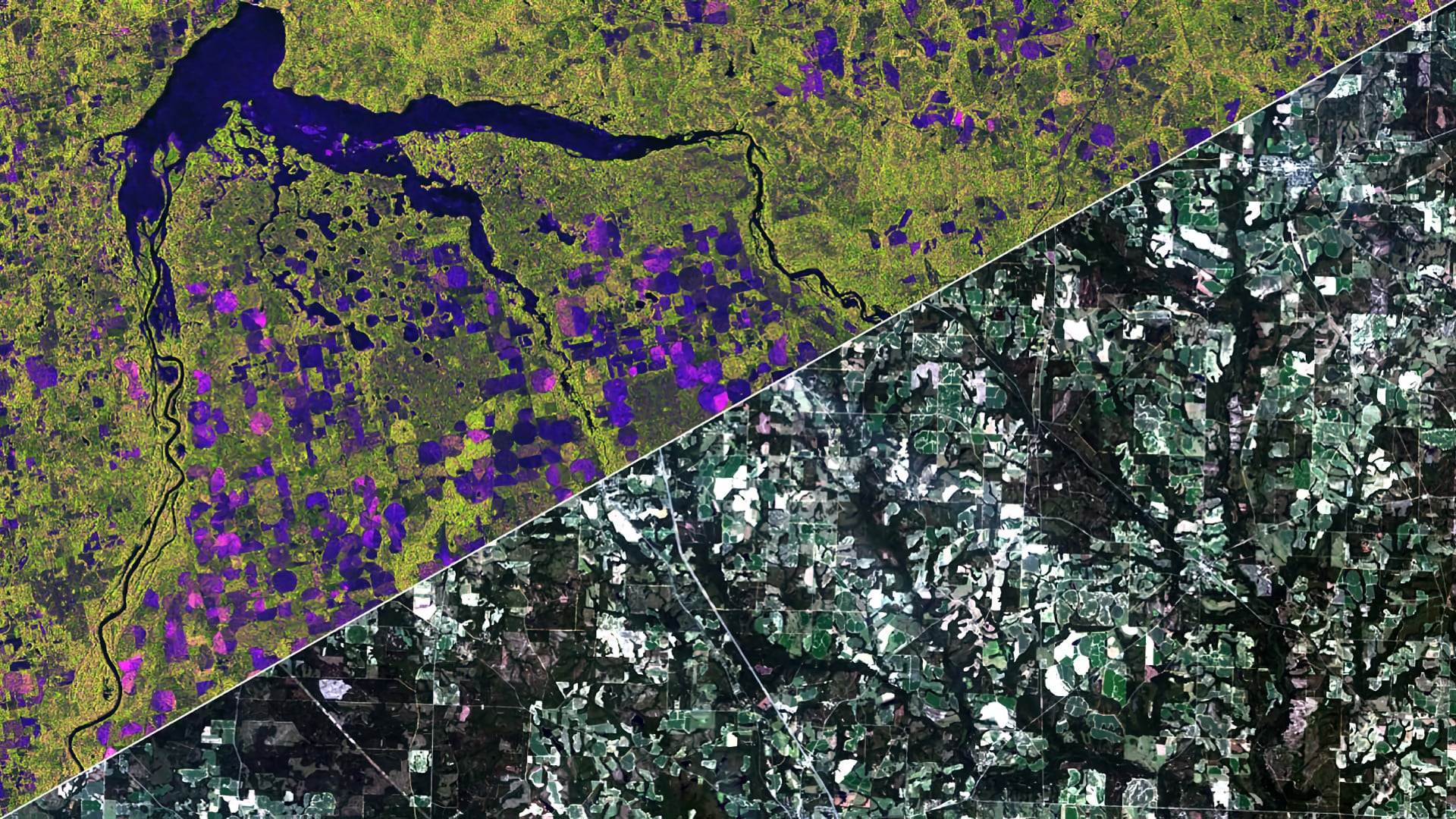
North Dakota and Georgia are two of the largest commercial agricultural producers in the United States, with a combined crop value of over 11 billion dollars. Agriculture management and sustainability practices—such as irrigation patterns and plant and harvest strategies—are crucial to long-term food security. Crop...
Connor Holzmann
Each year, the United States Department of Agriculture (USDA) releases a Cropland Data Layer (CDL) that serves as a nationwide classification system and statistical service for the United States agriculture industry. The CDL is compiled using Landsat 8 Optical Land Imager (OLI) and Sentinel-2 Multispectral...
Tyler Lynn

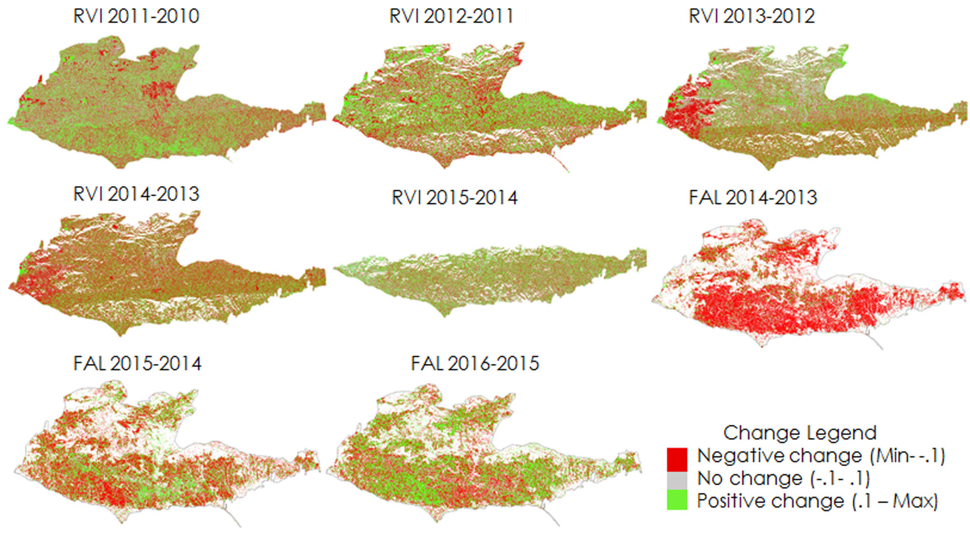
Southeastern Arizona is home to unique mountain ranges known as the Sky Islands. Sky islands are biodiversity hotspots and host various ecosystems, ranging from arid deserts to temperate forests. These mountain ecosystems rely on slow-melting snowpack to sustain themselves during dry periods. However, the...
Natalie Queally
The Santa Monica Mountains stretch along the west coast of California between the coastal city of Oxnard and the populous urban hub of Los Angeles. Despite the close urban proximity, the Santa Monica Mountains still retain 80% native vegetation cover, including precious expanses of...
Vanessa Van Auken
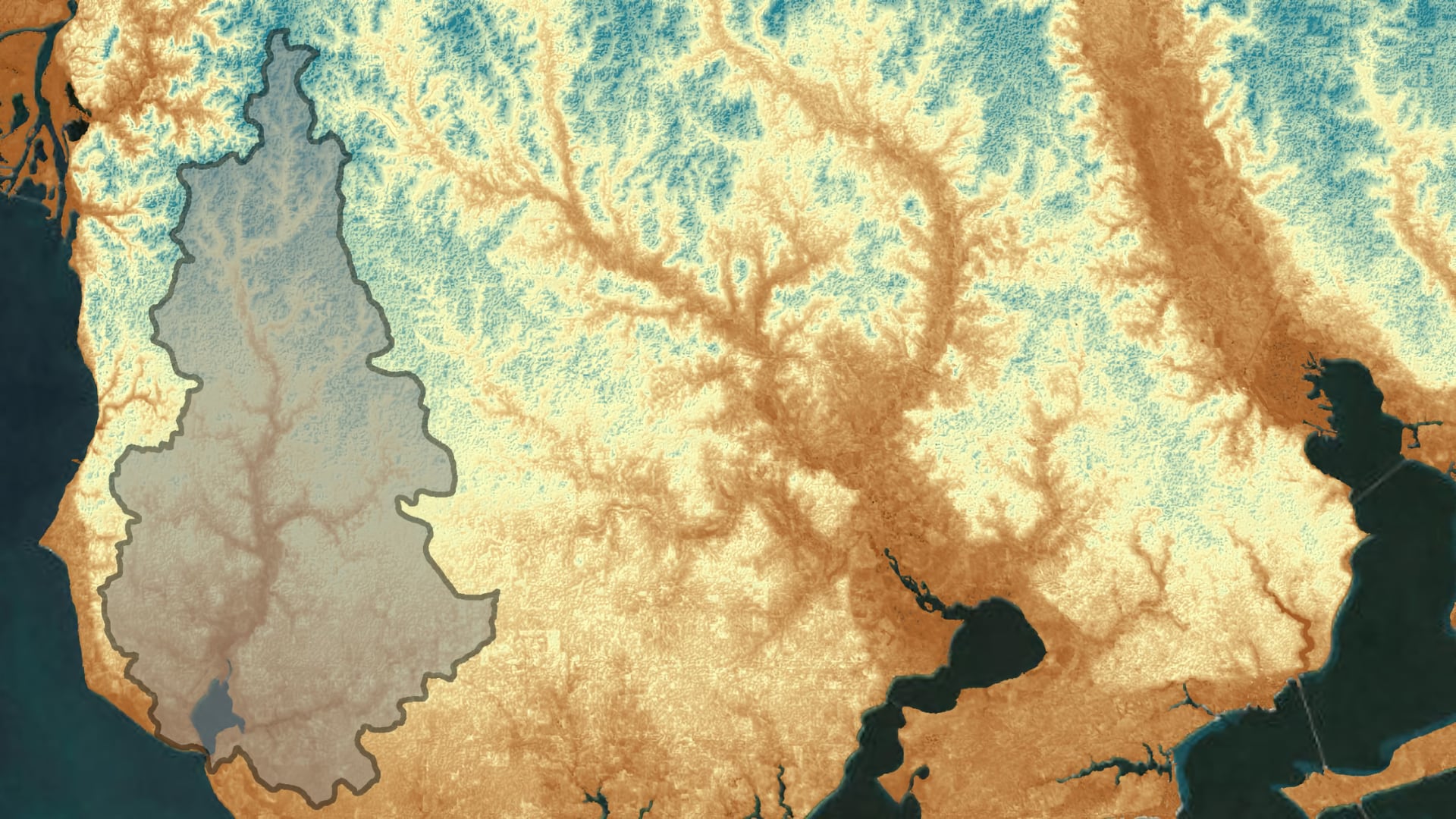
Weeks Bay is an estuarine system located along the southeastern shore of Mobile Bay in Baldwin County, Alabama. Its watershed encompasses approximately 149,000 acres of mixed-use land around the Fish and Magnolia Rivers. Weeks Bay and the surrounding coastal lands...
Mercedes Bartkovich (Project Co-Lead)
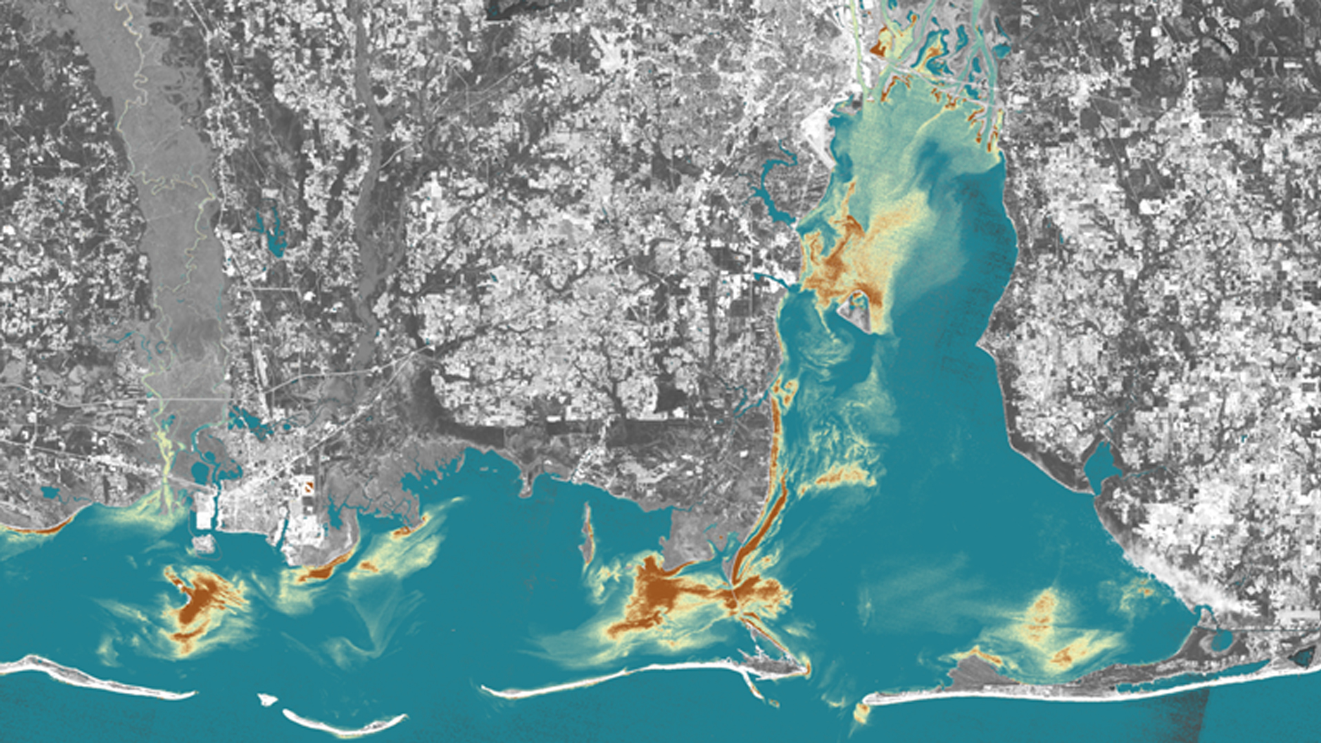
The Mobile Bay and Mississippi Sound are the main coastal estuaries along the Alabama and Mississippi Gulf Coast. They serve as the primary drainage outlets for the Mobile Bay and Pascagoula River watersheds and provide a gradient of coastal water salinity conditions needed for a...
Arina Mardoukhi
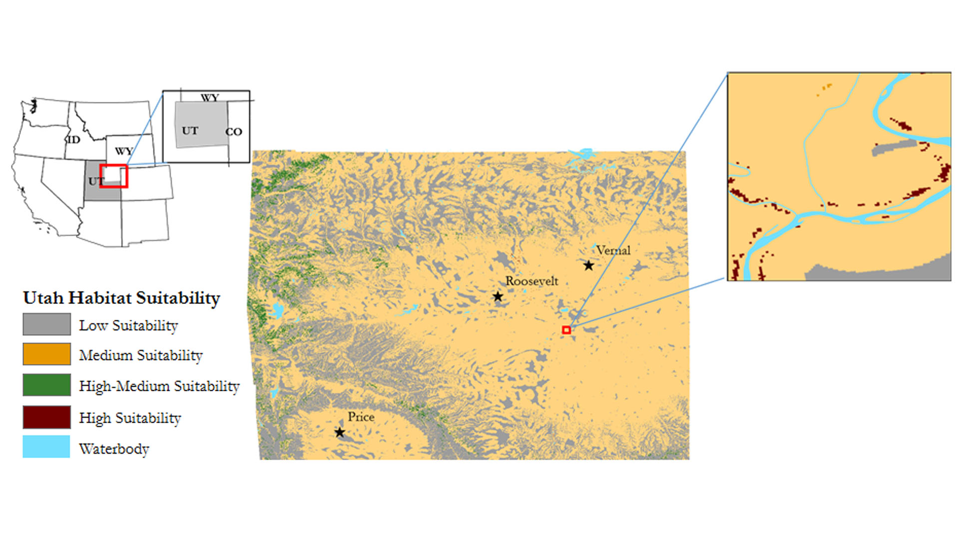
Observations of the threatened western yellow-billed cuckoo (YBC) are rare in Idaho, Wyoming, and Utah. This species can act as an indicator for the overall health of an ecosystem, therefore understanding their habitat is critical to planning and improving land management and ecosystem conservation...
Kaitlynn Hietpas
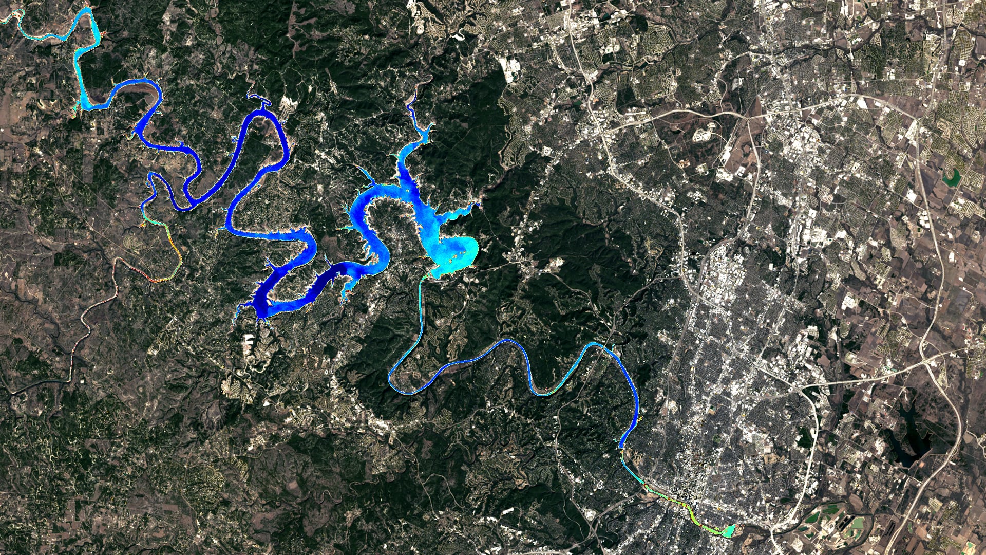
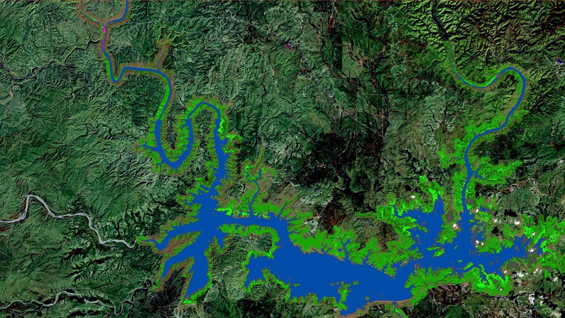
Beginning in 2019, harmful algal events in Austin, Texas, caused canine deaths in the Lady Bird Lake and Lake Travis reservoirs. These reservoirs are part of the larger Highland Lakes chain, managed by the Lower Colorado River Authority (LCRA) and...