Image

NASA
NASA
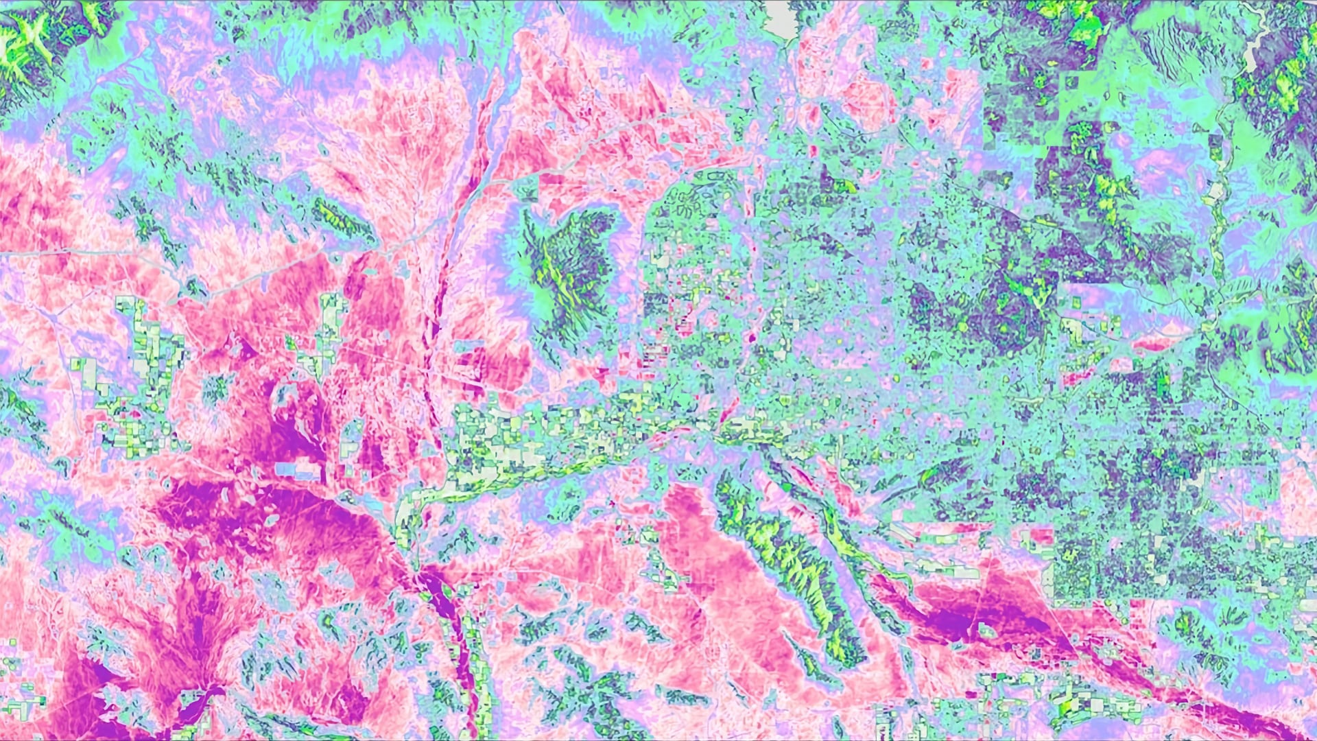
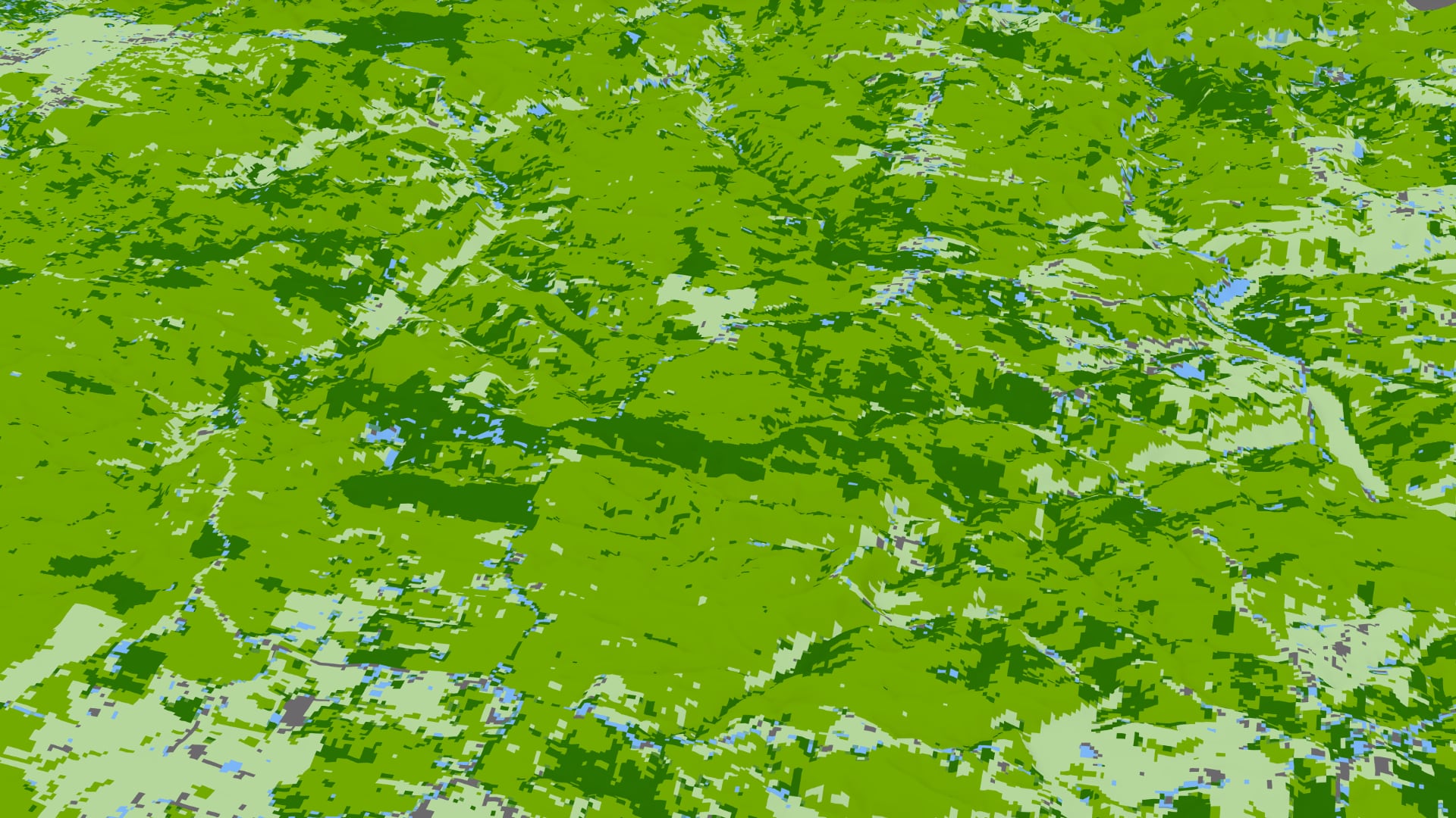
Tasseled cap greenness transformation derived from Landsat 8 imagery over lodgepole pine forest in the Intermountain West study area
Completed Projects
Maria Luisa Escobar Pardo
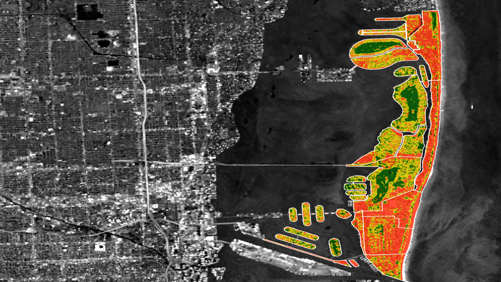
In response to projected sea level rise and extreme weather events, Miami Beach and other urban areas surrounding Biscayne Bay are developing adaptive strategies to mitigate the effects of changing environmental conditions. Because the local economy, especially the tourism industry, is intricately tied to coastal...
Tamara Dunbarr
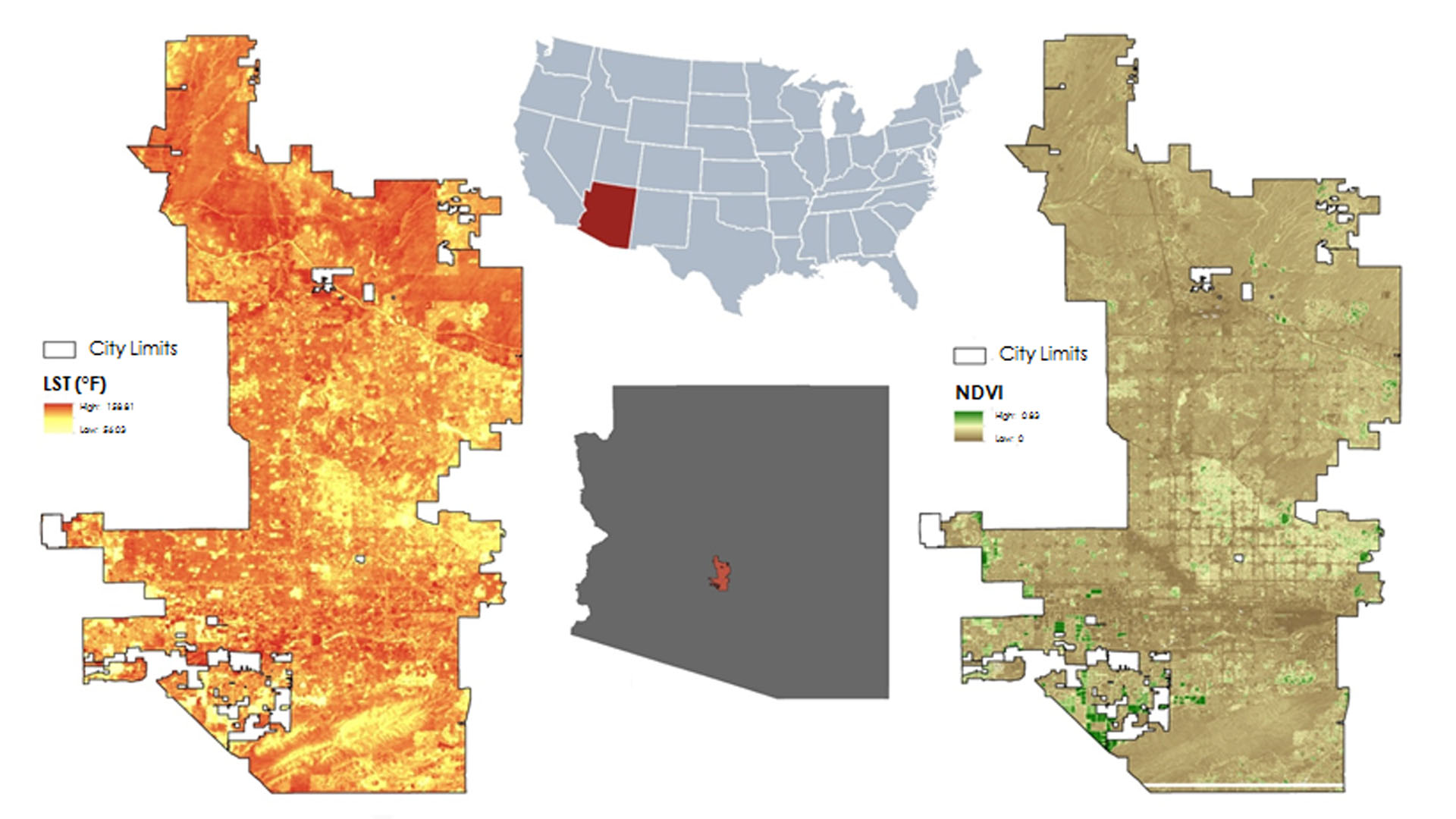
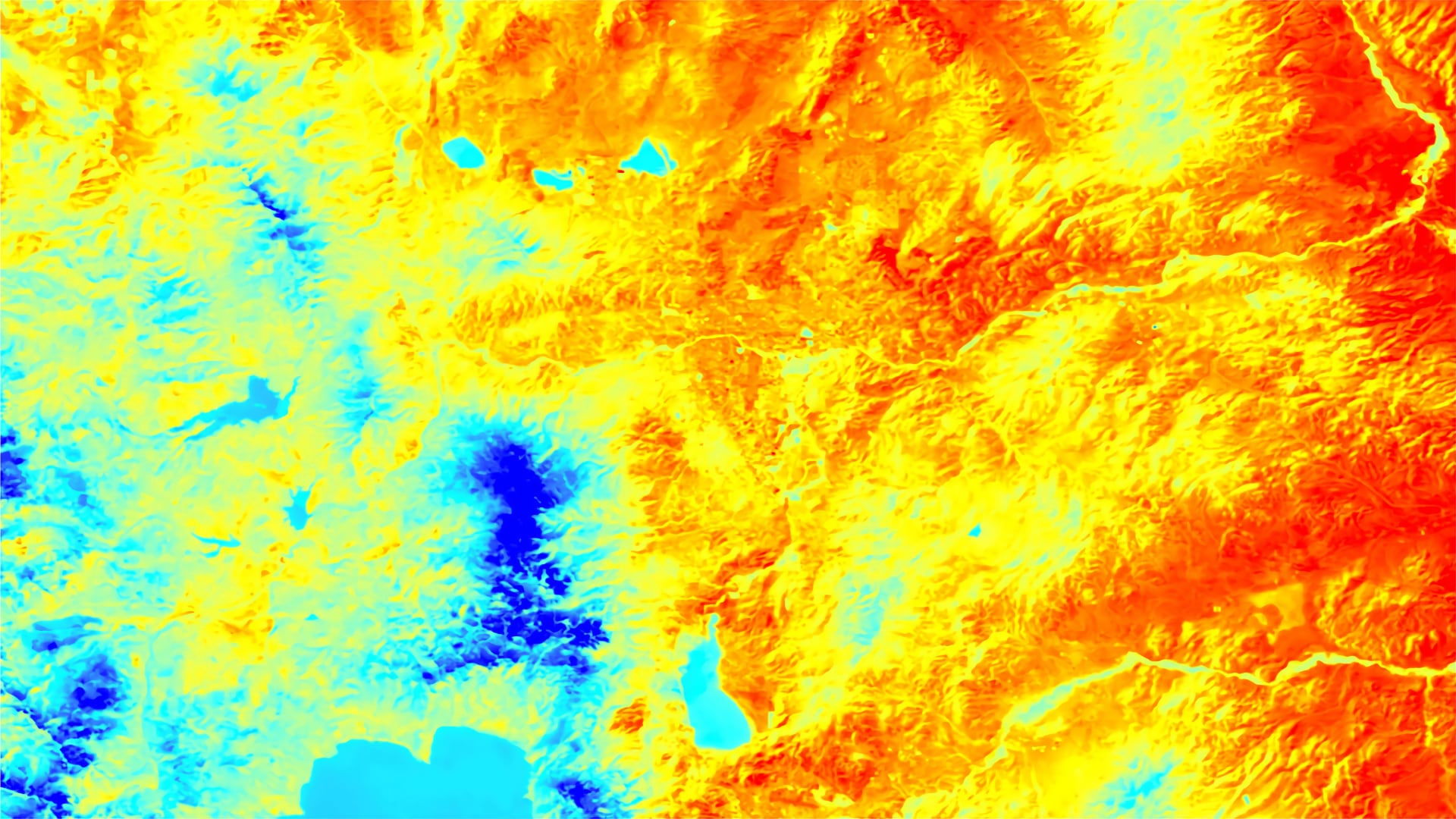
Phoenix, Arizona is home to over 1.5 million people and summer temperatures regularly exceed 106 F (42.1 C). Exposure to extreme temperatures can lead to heat-related illnesses, such as heat stroke and heat exhaustion, and increased heat-related mortality. This has been a chronic public...
Hannah Bonestroo
Located in the northern Sonoran Desert, Tempe, Arizona, regularly experiences extreme heat, with summer daily maximum temperatures reaching over 100°F. The rapid urbanization of the region in the last 50 years has caused a steady increase in the mean daily air temperature due to the...
Huntington Keith
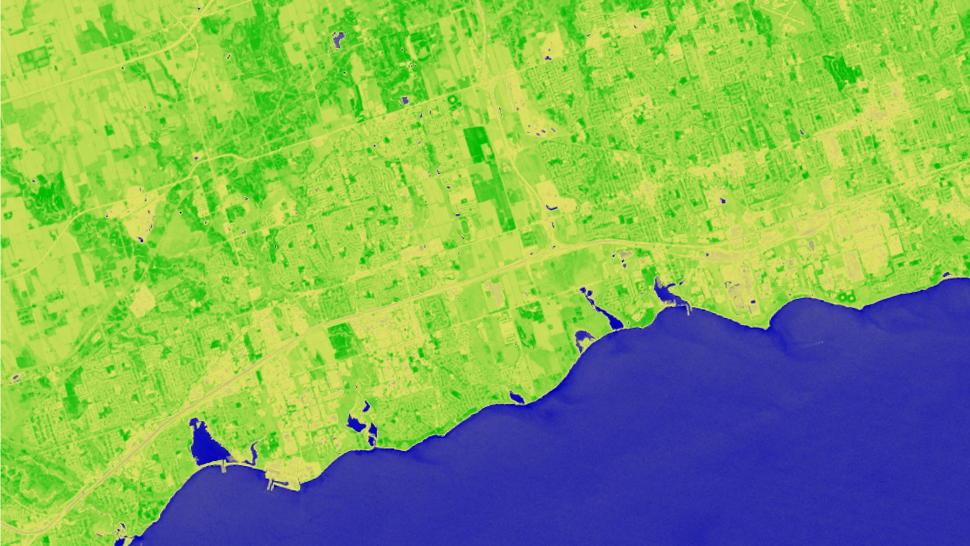
The town of Ajax, Ontario received a report from Specialists in Energy, Nuclear and Environmental Sciences (SENES) Consultants detailing the likely changes in local weather patterns for 2040-2049. The climate model predicts an increase in the frequency and intensity of monthly rainfall, a decrease in...
Julia Heslin
Extreme heat events (EHEs) are one of the leading causes of natural hazard-related deaths in the world. With rising global temperatures, these events will continue to increase in frequency, duration, and magnitude. The urban heat island (UHI) effect exacerbates the consequences of EHEs, discourages active...
Austin Stone (Project Co-Lead)

In response to projected sea level rise and extreme weather events, Miami Beach and other urban areas surrounding Biscayne Bay are developing adaptive strategies to mitigate the effects of changing environmental conditions. City officials are involved with ongoing efforts to reduce storm damage and monitor...
Kaitlyn McHenry

The National Park Service (NPS) currently utilizes an interagency network of in situ aerosol monitoring stations to estimate light extinction and determine visibility across the public lands that it manages. With these well-defined particle masses and concentrations, the NPS makes estimates of visibility; however...
Kaitlyn Bretz
The Mark Twain National Forest (MTNF) encompasses 1.5 million acres of public land in the Ozarks region of southeastern Missouri. The industrial boom between the 1880s and 1920s had devastating effects on the shortleaf pine (Pinus echinata), Missouri’s...
Nicholas McVey
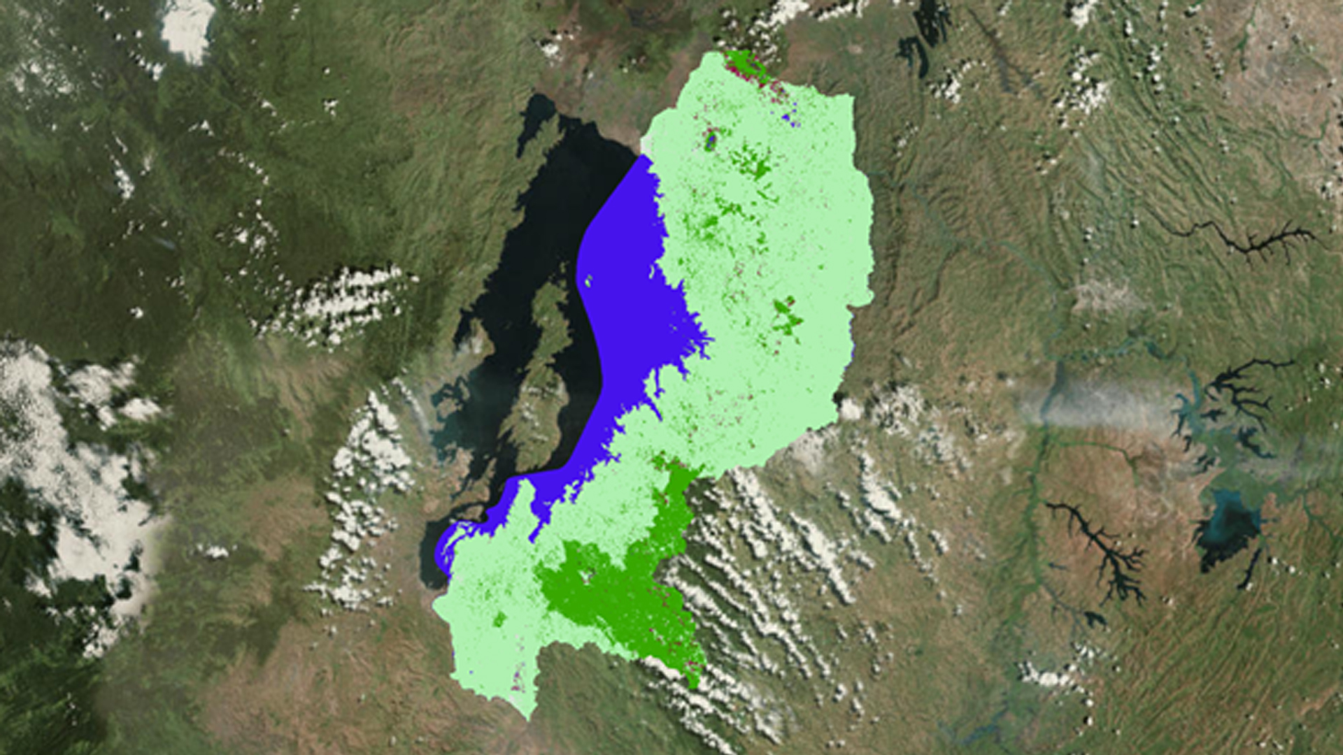
Balancing the demands of economic development and environmental protection is a challenge which requires policy-makers to be well informed about the extent and value of key natural ecosystems. Wetlands have long been known to regulate hydrological processes, reduce erosion and flooding, safeguard local biodiversity, mitigate...
Mercedes Bartkovich
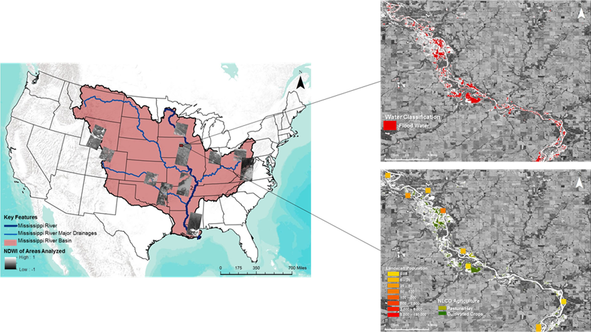
The Mississippi River Basin is the fourth largest drainage basin in the world, and is susceptible to multi-level flood events caused by heavy precipitation, snow melt, and changes in water table levels. Conducting flood analysis during periods of disaster is a challenging endeavor for...