Water utility managers face the difficult daily task of safeguarding the public health and complying with state and federal water quality regulations, while minimizing costs and environmental impacts. Add to that continued water quality degradation from human activities, increasingly strict regulatory standards for water quality, and emerging micro-pollutants; it is clear that a utility manager’s understanding of water quality must increasingly look beyond the treatment plant intakes to the broader watershed, wherein a variety of physical, chemical, and biological processes are actively creating, transforming, and mobilizing potential contaminants.
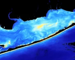
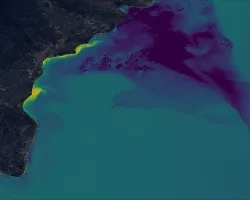
While it is well-established that terrestrial conditions within the watershed influence surface water quality, most water utilities do not currently have the capability to monitor watershed sources of contamination with great temporal or spatial detail. In most cases, a water utility’s knowledge of source water quality is limited to monthly or even quarterly measurements at a few discrete locations, typically within the water body itself. While useful, these data are not sufficient to allow for full characterization of seasonal trends or annual variations in concentrations or character of critical water quality constituents. Satellite data, on the other hand, can provide frequent observations across an entire watershed of the subtle changes to environmental conditions that drive water quality.
Geographic Focus
Utilities throughout US
Principal Investigator
Ben Stanford (PI)
Josh Weiss (Co-PI)
Project Team
Amita Mehta (Co-I), UMD
Rob Allen, Riverside Technology
Collaborators & Stakeholders
Ben Zaitchik, JHU
David Reckhow, UMass
Greg Schwarz and Kernell Ries, USGS
Kenan Ozekin, Water Research Foundation
New York City DEP
City of Raleigh Public Utilities Department
Northern Water Colorado Conservancy District
Lower Colorado River Authority, TX
Bloomington, IL Water Department
Cary, North Carolina, DWR
Technical Summary
This work will develop a web-based Remote Sensing-Water Quality Decision Support System (DSS) that gives water utilities ready access to NASA’s satellite remote sensing data, filtered for the watershed of interest, and presented in a way that is easy for utility staff to analyze and summarize for use by decision-makers. The DSS will provide end users with statistical analysis tools to help them identify correlations among remote sensing data sets (primarily land use/land cover, may expand to optical properties) and the utilities’ own in situ monitoring data, including variables such as nutrients, total suspended solids, and total organic content. For statistically significant correlations, the DSS will present the user with a proposed model for predicting in situ water quality from remote sensing observations. This model could then be used for future watershed monitoring with remote sensing data to forecast near term water quality conditions.
This project is proceeding along two paths: (1) data analysis and development of statistical models to predict water quality based on remote sensing observations and other data sources; and (2) development of software and user interfaces for end user interaction with data and statistical tools. Major accomplishments thus far include:
• Acquired and processed water quality and meteorological data for four case study utilities – located in Colorado, New York, North Carolina, and Texas – in different climatological zones across the United States.
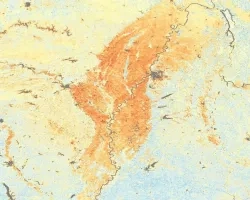
• Downloaded historical NASA MODIS and Landsat data for each case study utility. These data include many different products, but are primarily related to land cover and vegetation indices.
• Developed scripts to clip rectangular gridded remote sensing data to irregularly shaped watershed of interest and calculate basin-aggregated statistics for use in subsequent analysis and model prediction.
• Developed routines to build statistical models (multiple linear regression and partial least squares regression [PLSR]) to predict in situ water quality data based on selected remote sensing and meteorological data.
• As part of a larger effort to automate data processing and analysis tasks, created a tool to automate statistical model building.
• Developed and improved algorithms for variable selection (i.e., which data to include in models) and cross-validation (i.e., verification) of statistical models.
• Investigated statistical models that predict nutrients (nitrogen and phosphorus), sediment (turbidity and total suspended solids), algae (chlorophyll) and organics (total organic carbon). Saw improvements in regression model skill, particularly for in situ nitrogen concentrations.
• Completed preliminary work on pooling multiple water quality sites into a single regression model.
• Performed preliminary software development tasks. Achieved substantial progress on user interface and back-end data downloading, processing, and storage routines. Project software and data analysis teams have held numerous meetings to collaborate on software’s potential data handling, analysis, and visualization capabilities.
Next steps will focus on developing beta versions of software components for testing and additional case study data analysis; further refinement of statistical models; and development of a user interface/dashboard.
Related Impact