Displaying 141 - 150 of 305
Topic
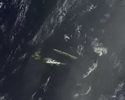
When an earthquake occurs, seismic data provides an initial estimate of magnitude and location. However, for large earthquakes, we can improve our situational awareness once...

Topic
Artisanal and small-scale gold mining (ASGM) is responsible for a large fraction of deforestation and disturbance in Amazonia. These activities cause severe impacts on the...
Topic
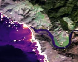
Estuaries are dynamic environments that provide a host of vital ecosystem services. California’s Marine Life Protection Act protects such ecosystems by creating Marine Protected Areas...
Topic
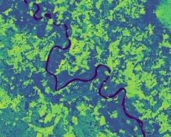
Nearly a quarter of California's fresh water supply flows through the Sacramento-San Joaquin Delta, an area comprised of tidal marshland and reclaimed land in the...
Topic
Colombia contains a variety of endemic species, making it one of the most biodiverse regions in the world. Due to a recent peace treaty between...
Topic
Project Description: The goal of this work is to improve the quality and usefulness of groundwater models by incorporating information derived from interferometric synthetic aperture...
Topic
The gopher frog (Lithobates capito) is an endangered species facing extinction within the next century due to loss and alteration of its habitat. With limited...
Topic
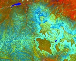
Fisher’s Peak is a 77.5 km2 property southeast of Trinidad, Colorado that is planned to become Colorado’s newest state park. The area has experienced limited...
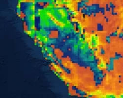
Topic
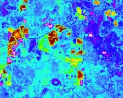
California’s Central Valley is one of the most productive agricultural areas in the world, producing approximately $20 billion in crops annually. The recent California droughts...