Displaying 121 - 130 of 305
![Magnitude of largest model break in Continuous Change Detection Algorithm harmonic regression model, indicative of clearcut logging in the Oregon coast range forests. Imagery from Landsat 4-5 TM, Landsat 7 ETM+, and Landsat 8-9 OLI from across the study period 2000-2021 over standard hill shade. Patches of blue show clear cut areas with lavender then yellow indicating higher magnitude. Green areas represent forests untouched during the study period.](/sites/default/files/styles/lis/public/2024-01/2023Sum_MA_OregonCoastRangeEco_websiteImage.jpg.webp?itok=sGJs5DSB)
Oregon Coast Range Ecological Conservation (Summer 2023) Team: Emily French (Project Lead), Uma Edulbehram, Sarah Hughes, Madison Arndt Summary: Logging operations are widespread across the...
![Predicted cheatgrass green-up imagery from Landsat 8 OLI data. This composite image of the western portion of the Mullen Fire Study Area is from June 2022. Shades of green and yellow indicate an earlier green-up time, while orange, brown, and white areas show later predicted green-up times. This data was used to create NDVI difference maps which will help managers predict when and where to apply treatments to limit the spread of cheatgrass.](/sites/default/files/styles/lis/public/2023-10/2023Sum_CO_SouthernWyomingEcoII_WebsiteImage.jpg.webp?itok=Ht2hUpEj)
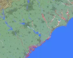
Southern Wyoming Ecological Conservation II (Summer 2023) Team: Bryan Graybill (Project Lead), Lillian Gordon, Estelle Lindrooth, Sarah Sathe Summary: Cheatgrass (Bromus tectorum) is an invasive...
Podest, E.; McCartney, S.; McNair, H.; Jiao, X.; Banks, S.; Behnamian, A. (2019).
Learn how you can leverage our resources to help your community or organization, and how to partner with us for research, data sharing, training and more.
![Mt. Nyiragongo Lava Pool. Credits: Cai Tjeenk Willin (CC BY-SA 3.0)](/sites/default/files/styles/lis/public/2021-06/volcano-pool.jpg.webp?itok=IRc1gu9N)