In May 2022, NASA’s Earth Applied Sciences Disasters program area teamed up with the U.S. Geological Survey (USGS) and the University of Puerto Rico, Mayagüez to hold a workshop on landslide disaster response and planning in Puerto Rico. Working with local authorities to improve landslide research and share NASA resources before disaster strikes is crucial to the region’s disaster preparedness. The insights gained from the workshop will inform landslide risk assessments for the USGS and will strengthen Puerto Rican communities to be better equipped to mitigate the impacts of future landslides. The workshop also helped build capacity within the Disasters program to apply these techniques to other communities around the world affected by landslide and earthquake risk.
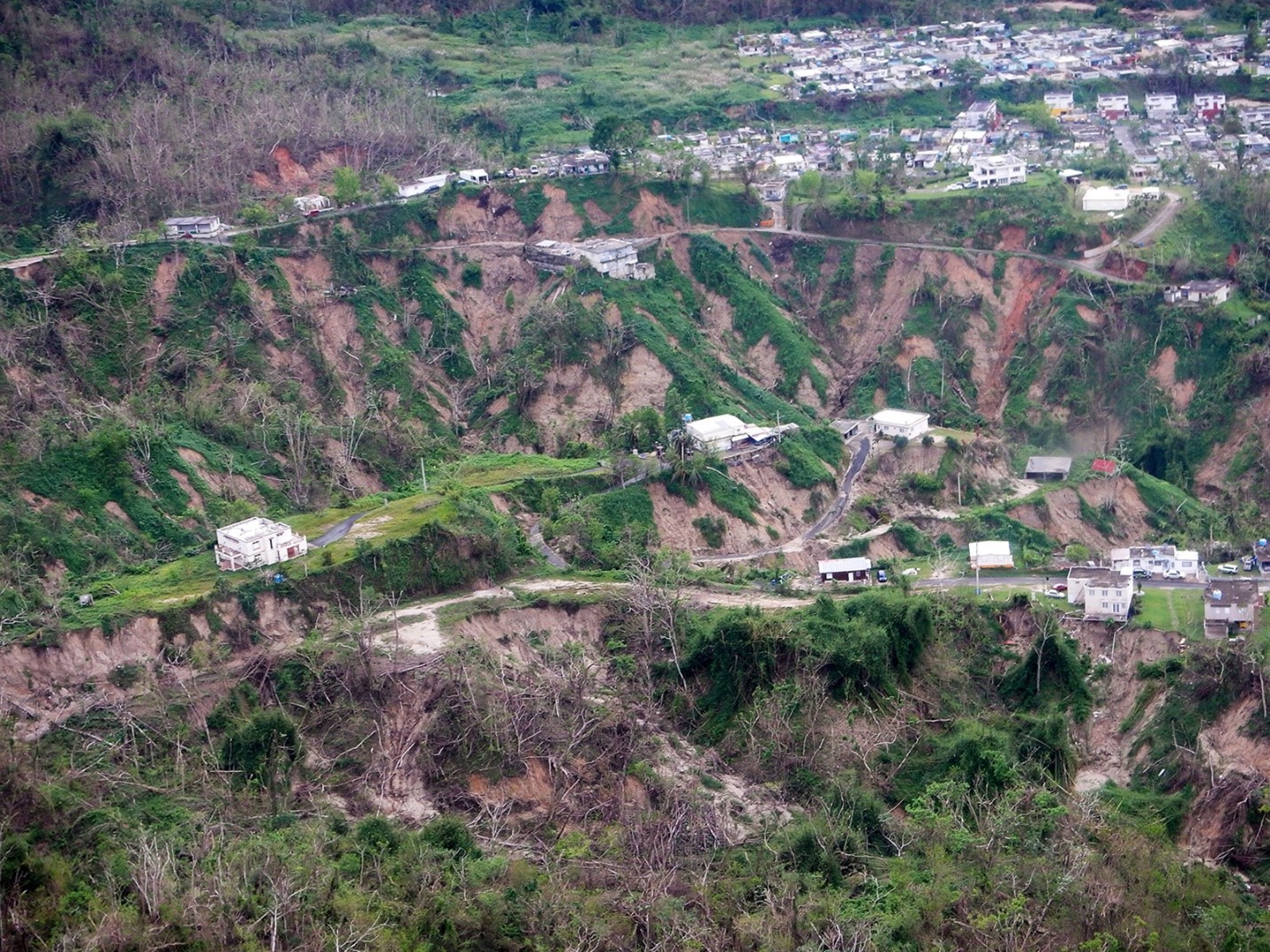
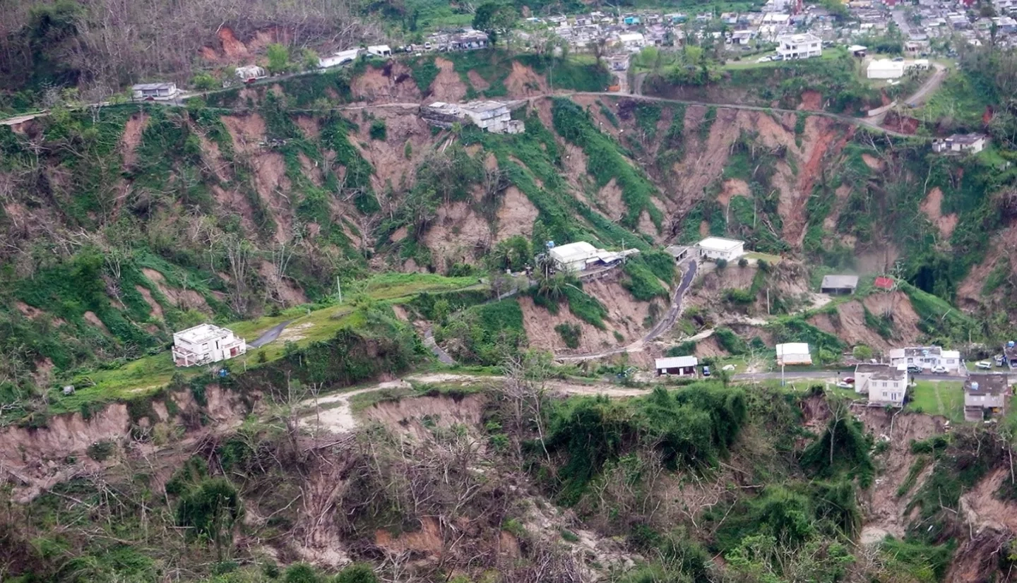
With mountainous terrain, frequent tectonic activity, and a tropical climate prone to extreme weather, it’s no surprise that Puerto Rico is a hotspot for landslides. In fact, according to the USGS, about one-third of the island is at high risk for landslides from extreme rainfall. The island is also home to many economically disadvantaged populations who are highly vulnerable to the impacts of landslides and other disasters, making the region a high priority for integrated and equitable disaster research.
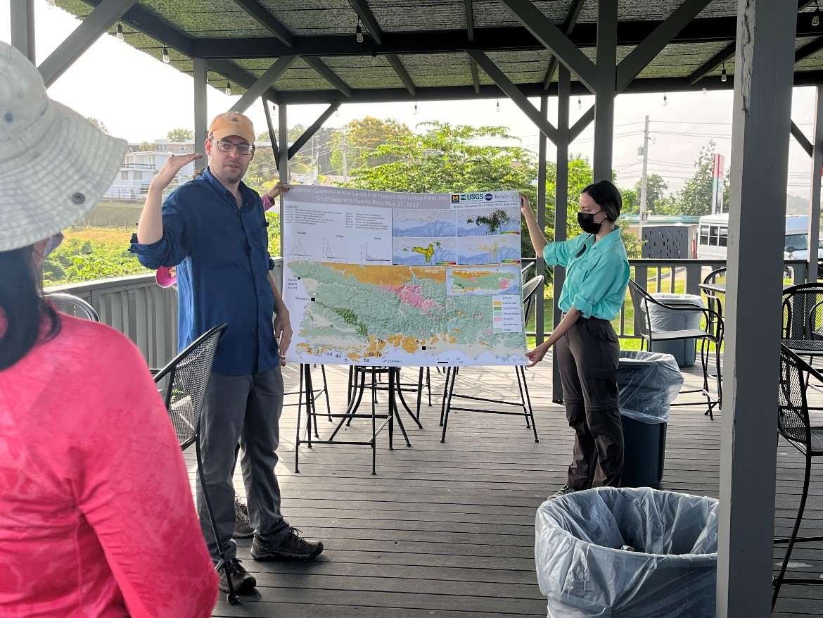
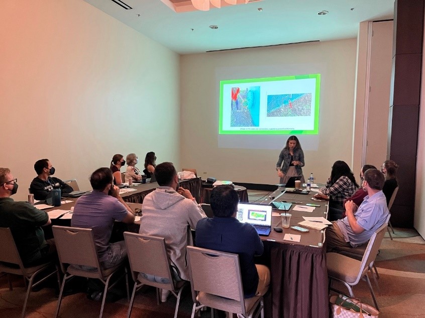
The landslide workshop focused on multi-agency and academic coordination, with participants from the University of Michigan, University of California Berkeley, University of Puerto Rico, Mayagüez, NASA Goddard Space Flight Center (GSFC), the USGS, and other regional stakeholders. After a field trip to southwest Puerto Rico to study areas impacted by the 2019–2020 earthquakes, the team engaged in discussions and work sessions about advancing scientific research into landslide hazards. They discussed topics including the impacts of local rock types on landslides, as well as how to combine Earth observation-based modeling and historical knowledge and apply these approaches to different areas of landslide research. They also developed a landslide response playbook to guide agencies in effectively responding to future landslide threats and engaged with local stakeholders to learn more about their specific needs when managing landslide risk. In addition to informing USGS landslide assessments, the lessons learned from the workshop will aid other regional and global agencies focused on landslide planning, response, and recovery.
“This marrying of different approaches is an exciting avenue that will help us to bridge scales in understanding landslide behavior and impacts,” says Dalia Kirschbaum, principal investigator for the Disasters research project, “Enabling Landslide Disaster Risk Reduction and Response throughout the disaster life cycle with a multi-scale toolbox.”
While the workshop was impactful, there is still much work to be done to reduce landslide risk. Future planned scientific collaborations with the University of Puerto Rico will help build landslide resilience by developing of new tools and capabilities for identifying potential landslides and preparing communities for landslide impacts. These partnerships will focus on collaborative solutions to complex disaster issues, while fostering leadership and equity in the next generation of scientists and engineers.
Although the exercise focused on Puerto Rico, many questions the team addressed while developing the landslide response playbook are applicable elsewhere. For example, how can disaster management teams coordinate and share information where bandwidth, internet access, or power are in short supply? Answering these types of questions will inform NASA’s approach to support future landslide-stricken communities. The team also worked to create more efficient communication channels among NASA, the USGS, and academic institutions. This coordination will help agencies avoid duplicating efforts, leading to a more streamlined and efficient landslide response process.
“This helps us to consider what types of information are most valuable to share with people on the ground in the affected areas, and what may be less useful in terms of distribution, information, and access,” explains Kirschbaum.
This collaborative exercise was a significant step toward improving Puerto Rico’s landslide resilience. The workshop strengthened regional partnerships and improved NASA and the USGS’s capabilities to support landslide response and risk reduction efforts around the globe.
Learn more about how NASA supports landslide risk reduction.