Displaying 161 - 170 of 305
Topic
Nearly a quarter of California's fresh water supply flows through the Sacramento-San Joaquin Delta, an area comprised of tidal marshland and reclaimed land in the...

Unalakleet Climate (Summer 2023) Team: Ian Lee (Project Lead), Clara Maxwell, Daniel J. Marsden, M. Jaweed Nazary Summary: The coastal community of Unalakleet is currently...
Topic
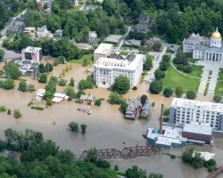
The Charles River watershed intersects 35 municipalities within the Boston Metropolitan Area and has a population of 1.2 million, making it one of the most...
Okefenokee Water Resources (Spring 2022) Team: Brianne Kendall (Project Lead), Kyle Steen, Hailey Schmidt, Laramie Plott Summary: The Okefenokee Swamp is a vital ecosystem known...
Topic
Description: This project provides a range of surface water products related to lakes, reservoirs, and wetlands in a near real time framework. It also offers...
Topic
Description: This project provides a range of surface water products related to lakes, reservoirs, and wetlands in a near real time framework. It also offers...
Topic
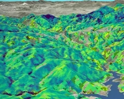
Forest composition and structure in the Colorado Front Range has been altered by changing wildfire regimes. In particular, increased moderate- and high-severity fire significantly reduces...
Topic
This proposal aims to expand a lake and reservoir monitoring program. This program is on-line, operational, with an existing decision support system (DSS) in place...