Image

NASA
NASA
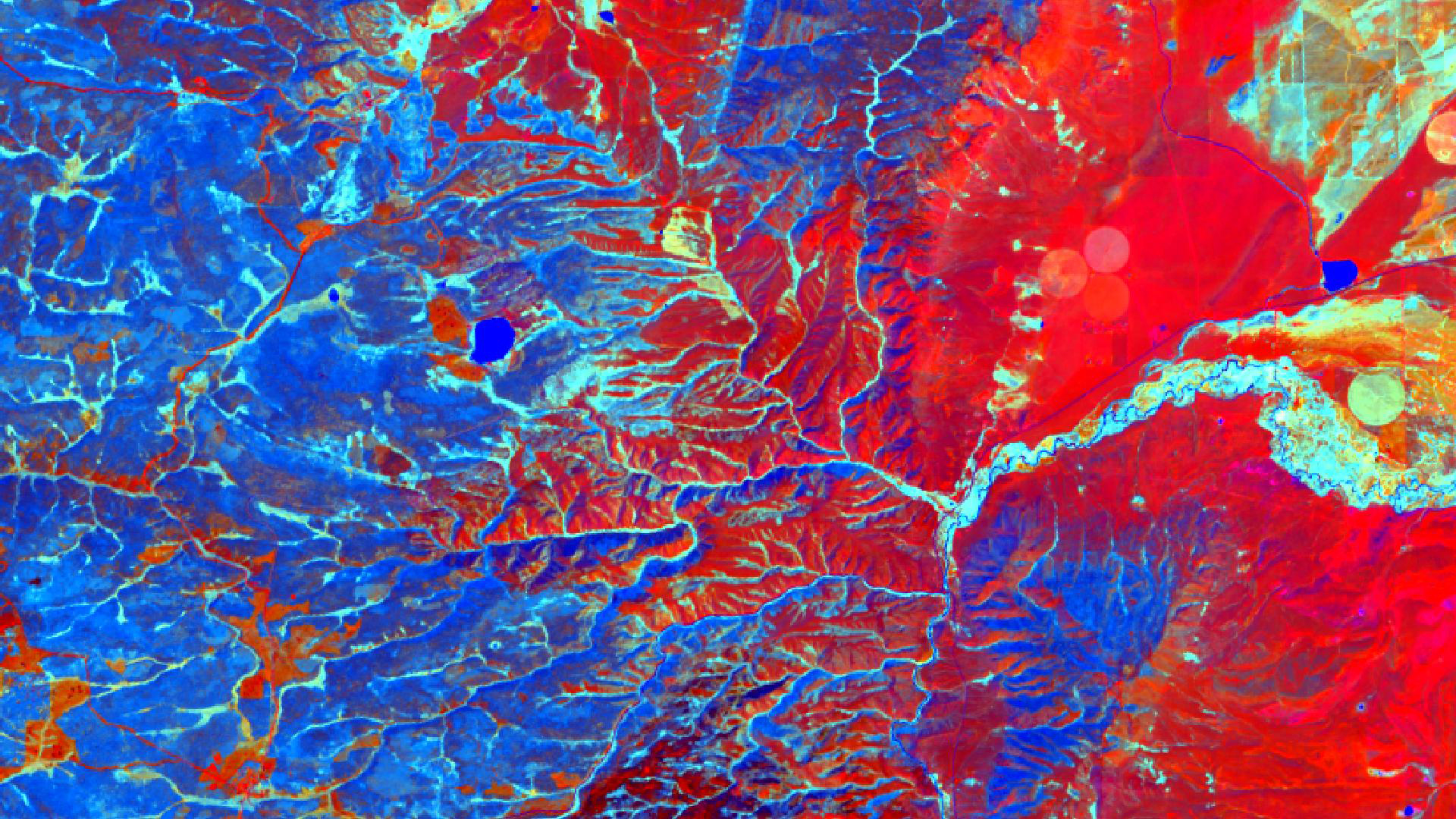
Tasseled cap greenness transformation derived from Landsat 8 imagery over lodgepole pine forest in the Intermountain West study area
Completed Projects
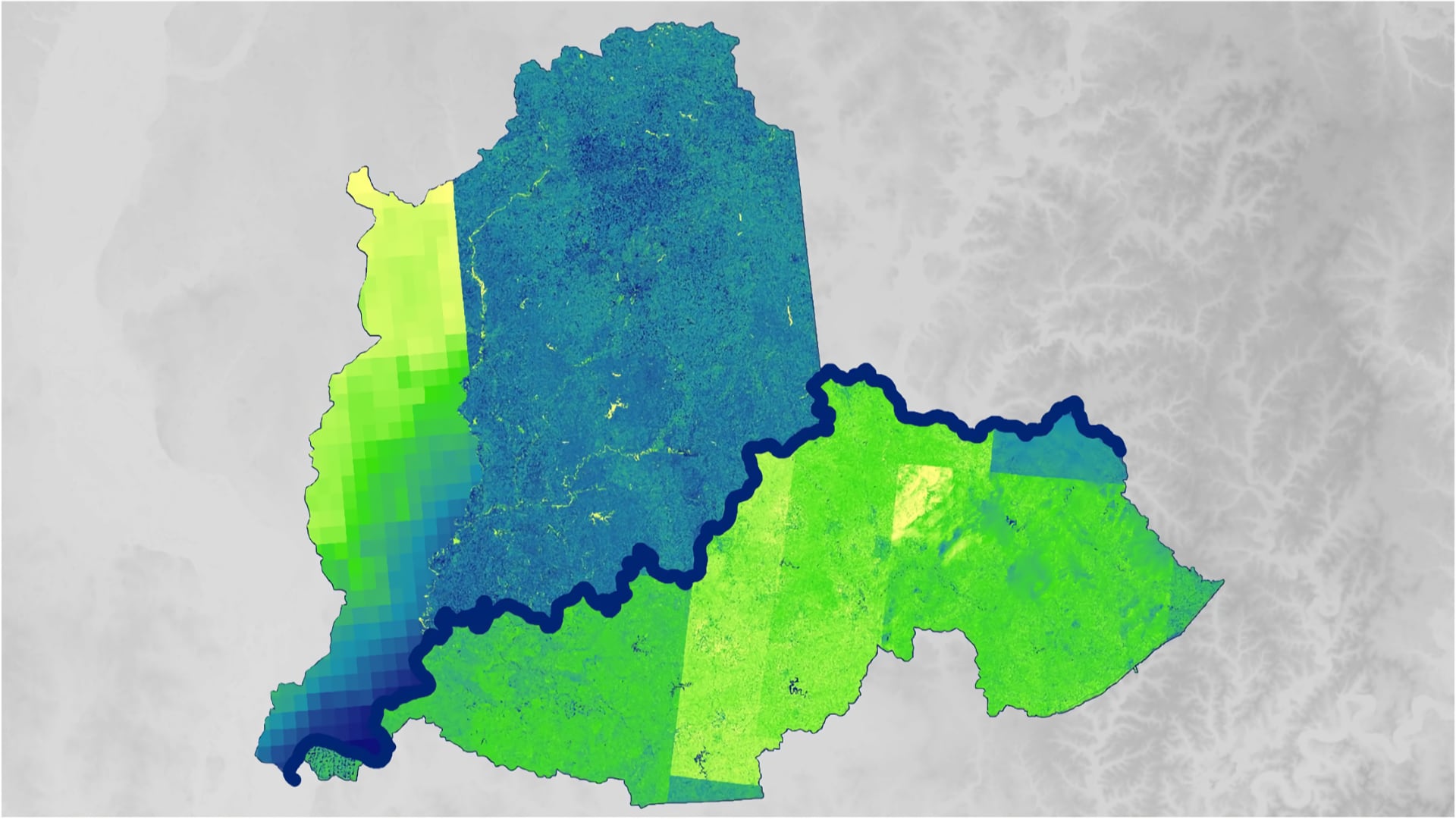
Thinley Yidzin Wangden

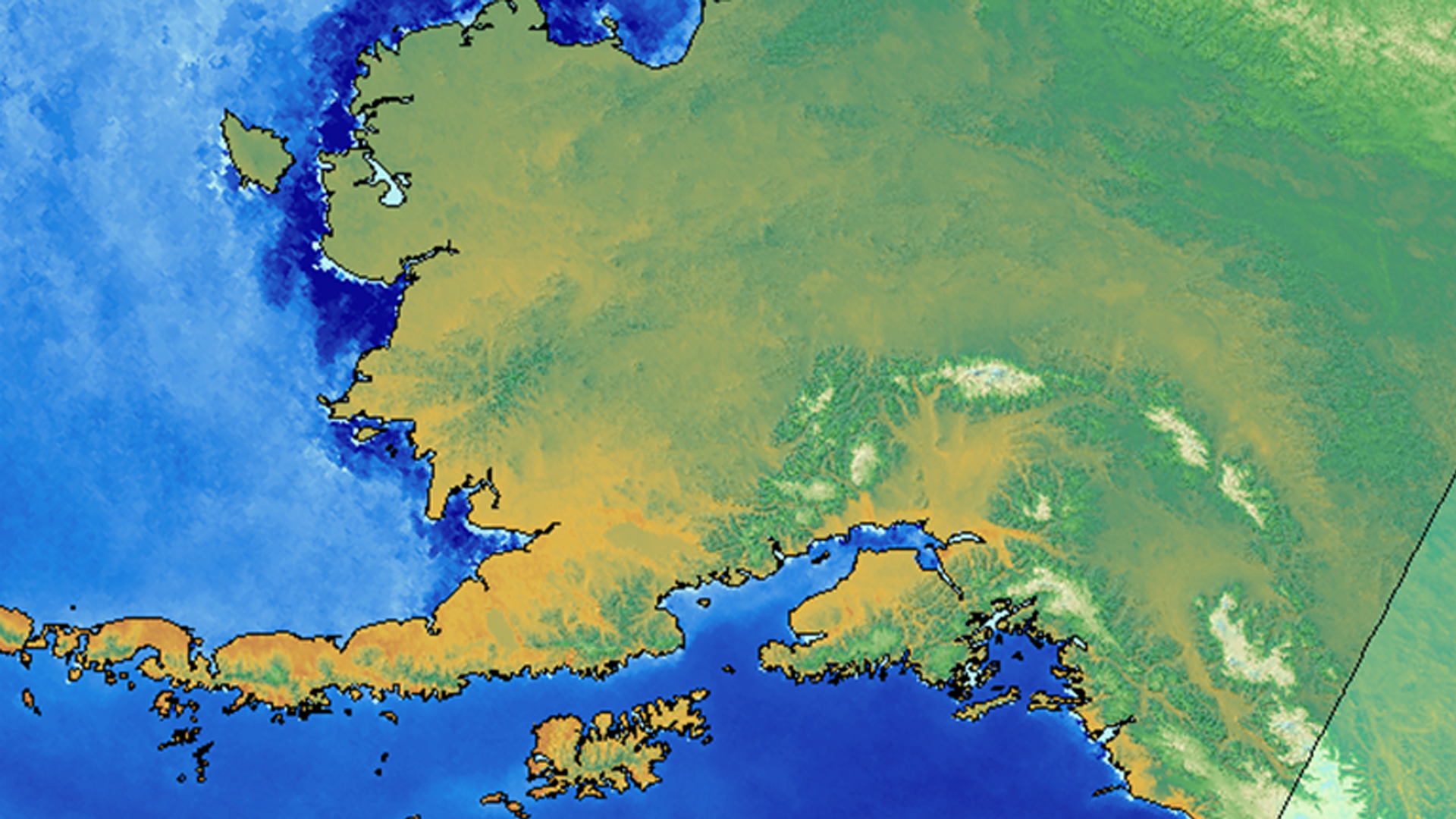
The diverse landscapes of Bhutan host a rich biodiversity of animal and plant species. Asian elephants (Elephas maximus) are a flagship keystone wildlife species whose conservation is essential for the functioning of Bhutan’s forest ecosystems. Despite this, increasing habitat loss...
Emma Hatcher
The rapid expansion of purple loosestrife (Lythrum salicaria) and reed canarygrass (Phalaris arundinacea L.) into aquatic and wetland systems has reduced native plant abundance, decreased species diversity, and degraded wildlife habitats for birds and amphibians throughout North America. The expansion of these invasive species into...
Victor Lenske

Tidal wetlands, such as marshes, are among the Chesapeake Bay's most protective natural features. Not only do they provide vital ecological services such as breeding grounds and water purification, but wetlands also deliver direct benefits to coastal communities through water absorption, wave attenuation, and sediment...
Nara McCray
Toa Baja, located just west of San Juan in Puerto Rico, is known as “the underwater city” due to its propensity to flood. The city contains the mouth of the island’s longest river, Río de la Plata, which drains...
Andrew Shannon
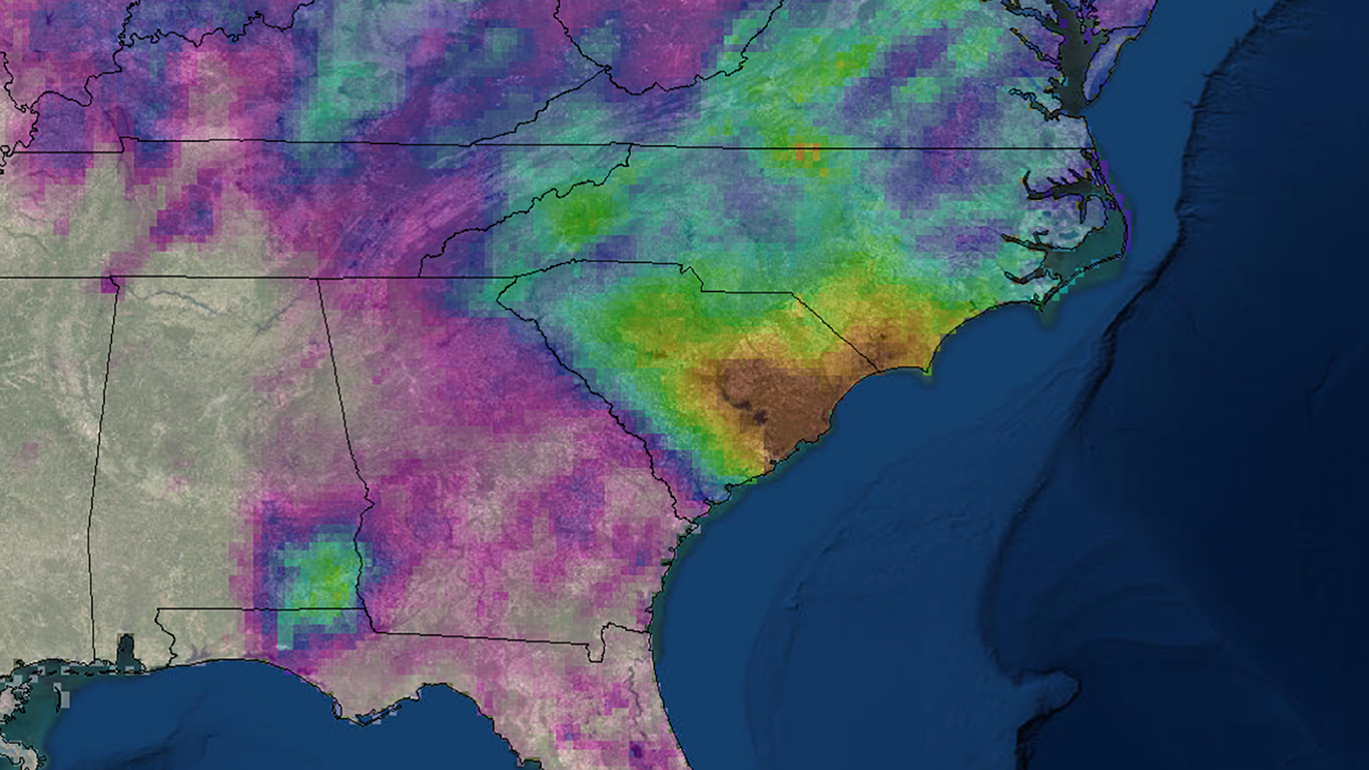
In October 2015, the state of South Carolina experienced a recording-breaking precipitation event leading to detrimental flooding that caused 19 fatalities and over one billion dollars of damages, which has prompted researchers and resource managers to enhance their understanding of extreme precipitation. This project explored...
Chiara Phillips
The Medicine Bow National Forest (MBNF) consists of approximately 1,383,790 acres of forested land, grassland, and sagebrush steppe in southeastern Wyoming. Cheatgrass (Bromus tectorum), an invasive plant species in the Western US, occurs in the grasslands throughout MBNF. Cheatgrass is...
Rachel Green
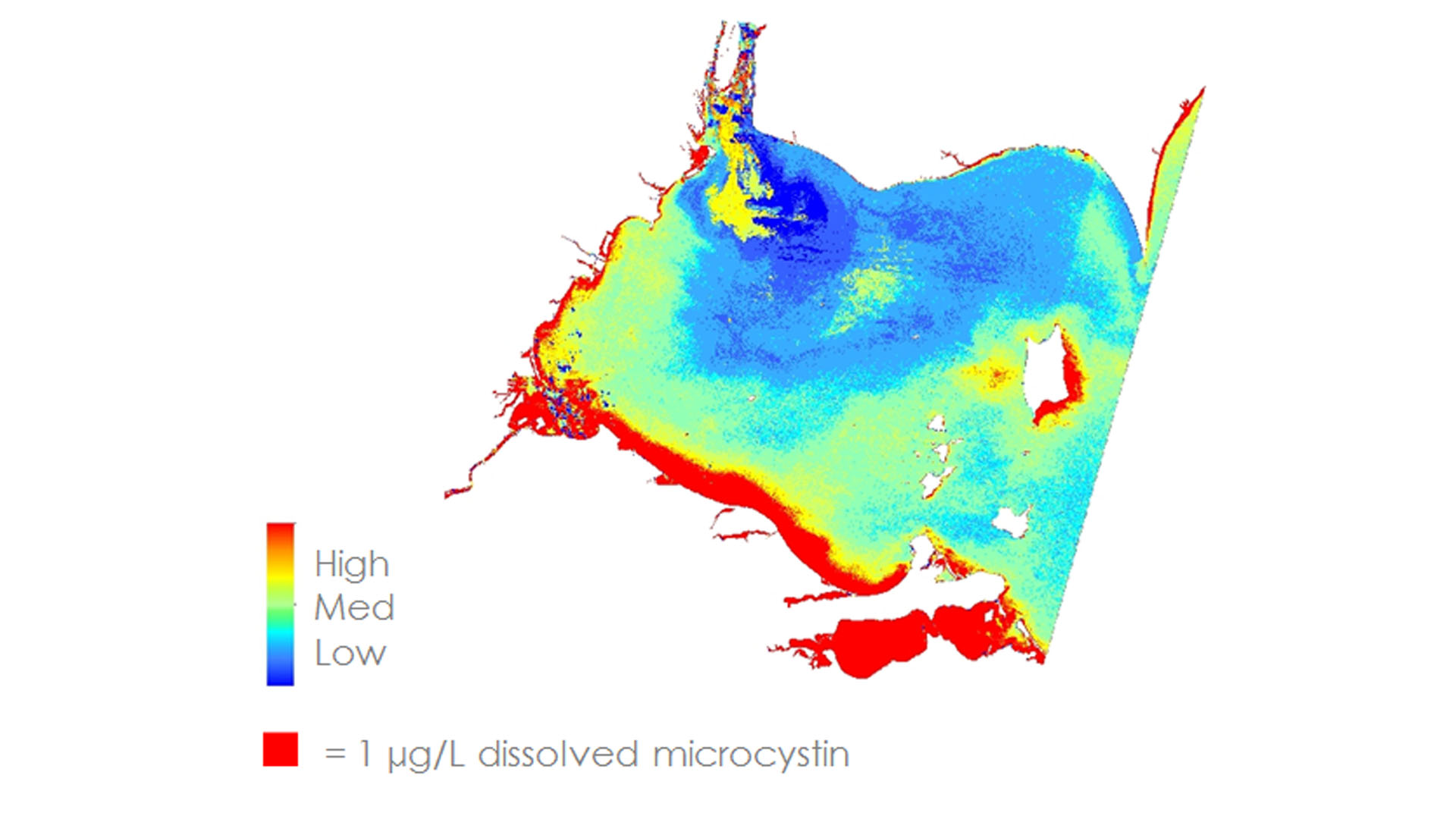
Harmful algal blooms (HABs) in the Western Basin of Lake Erie have been increasing in frequency and severity over the past decade. Cyanobacteria is the dominant phylum in the blooms that occur in Lake Erie. Microcystis, a species of cyanobacteria, is of particular concern...
Rachel Luo

The expansion of cities and infrastructure networks has raised concerns regarding the impact of growing artificial light pollution on wildlife and human well-being. In addition to degrading night skies for aesthetic viewing, this ‘skyglow’ interferes with ecosystems by disrupting plant...
Helen Baldwin (Project Co-Lead)

While poverty in Thailand has decreased from 67% in 1986 to 13% in 2012, 6.7 million people were still living within 20% of the poverty line in 2014. Economic uncertainty caused by recurring droughts and decreasing agricultural prices puts this vulnerable part of the population...
Kane Cook
The Ohio River provides the 13-state region of the Ohio River Valley with economic and social benefits through power generation, industrial manufacturing, drinking water, and recreational uses. While the river is an important environmental and economic resource, the valley is prone to numerous flood events...