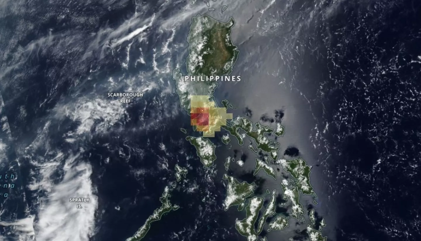
In late June 2021, Taal Volcano, located in the province of Batangas in the Philippines, has experienced increased volcanic activity, prompting the evacuation of thousands from surrounding towns. Taal had been dormant for 43 years until it became active again in January 2020.
In early July 2021, Taal experienced a series of phreatomagmatic eruptions – explosive interactions of water and magma. On July 7 the Taal Volcano Network reported 55 volcanic earthquakes in a span of 24 hours, and the volcano released high levels of sulfur dioxide into the air. All travel to the Taal Volcano Island is prohibited due to the risk of pyroclastic density currents and volcanic tsunamis, and nearby communities are advised to remain vigilant and prepare for evacuation if necessary. Currently, the primary concerns are impacts to local air quality and the potential for another stronger eruption to occur. Although Taal is one of the world’s smallest active volcanoes, it still has the potential to be deadly – a 1911 eruption of Taal killed over 1300 people.
The NASA Earth Applied Sciences Disasters program area has activated efforts to monitor Taal Volcano with Earth-observing data for air quality concerns, surface deformation, or any signs that could indicate the potential for a larger eruption. The Disasters program is working with the USGS Volcano Disaster Assistance Program (VDAP), which is supporting regional stakeholders including the Philippine Institute of Volcanology and Seismology (PHIVOLCS) and USAID’s Bureau of Humanitarian Assistance (BHA). Researchers from the Earth Surface and Interior Group at NASA’s Jet Propulsion Laboratory and the University of Pittsburgh are working with the Disasters program to provide data and analysis. Together they are using OMPS data to monitor sulfur dioxide emissions, ASTER data to monitor volcanic hot spots, and SAR data to monitor surface deformation.
The NASA ROSES A.37 research project “Integrating SAR Data for Improved Resilience and Response to Weather-Related Disasters” is providing support for the eruption, and the “Day-Night Monitoring of Volcanic SO2 and Ash for Aviation Avoidance at Northern Polar Latitudes: Enhancing Direct Readout capabilities from EOS, SNPP and NOAA20” A.37 research project produced multiple maps that depict sulfur dioxide levels over the Philippines from before, during, and after the eruption.
By combining analysis from multiple satellites and sensors and coordinating with experts throughout the disaster research community, the NASA Disasters program area can monitor the volcanic activity as an integrated system, and equip local stakeholders with the tools they need to better prepare for a potential eruption and mitigate its impacts.
Learn more about how NASA supports risk reduction, response and recovery for volcanic eruptions.
Previous Volcano Activations:
- Mt. Nyiragongo Eruption 2021
- Saint Vincent and Martinique Volcanic Activity 2021
- Guatemala Volcanic Activity 2021