Image

NASA
NASA
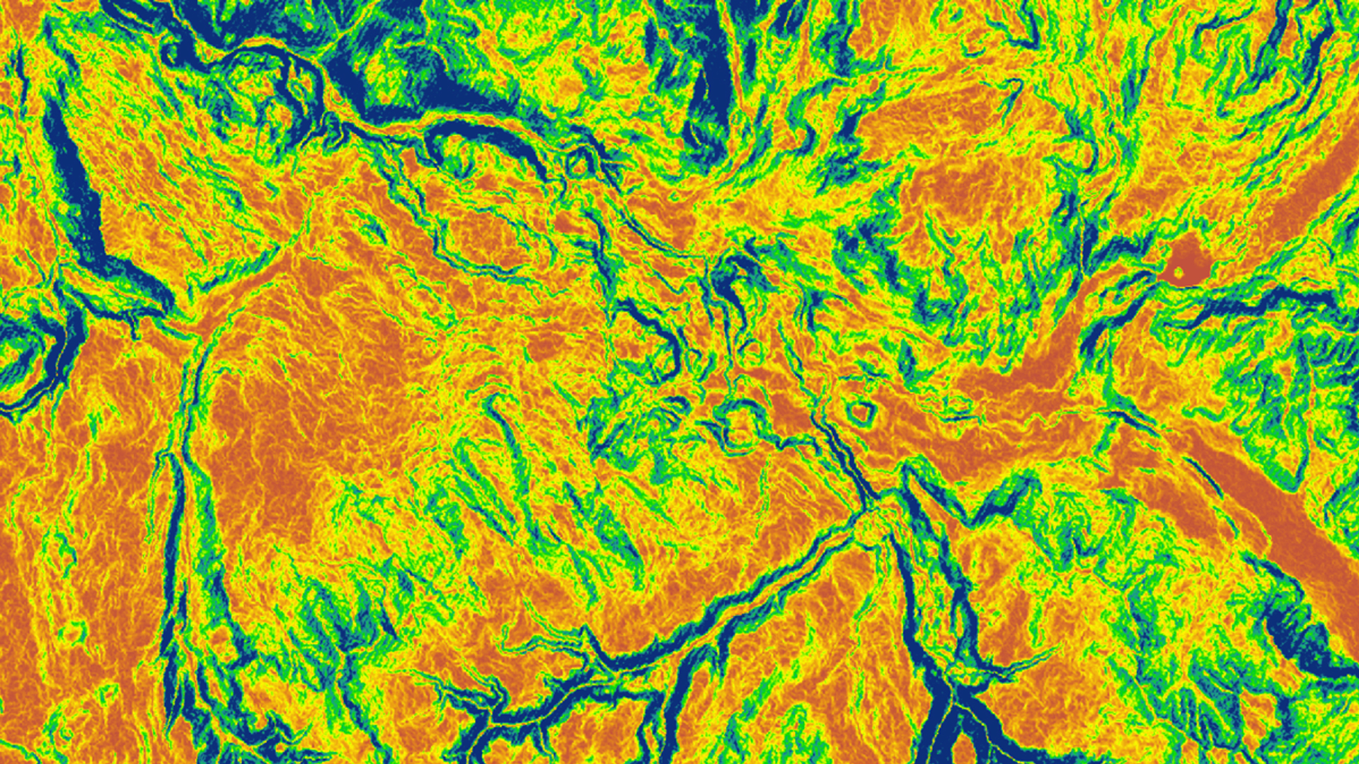
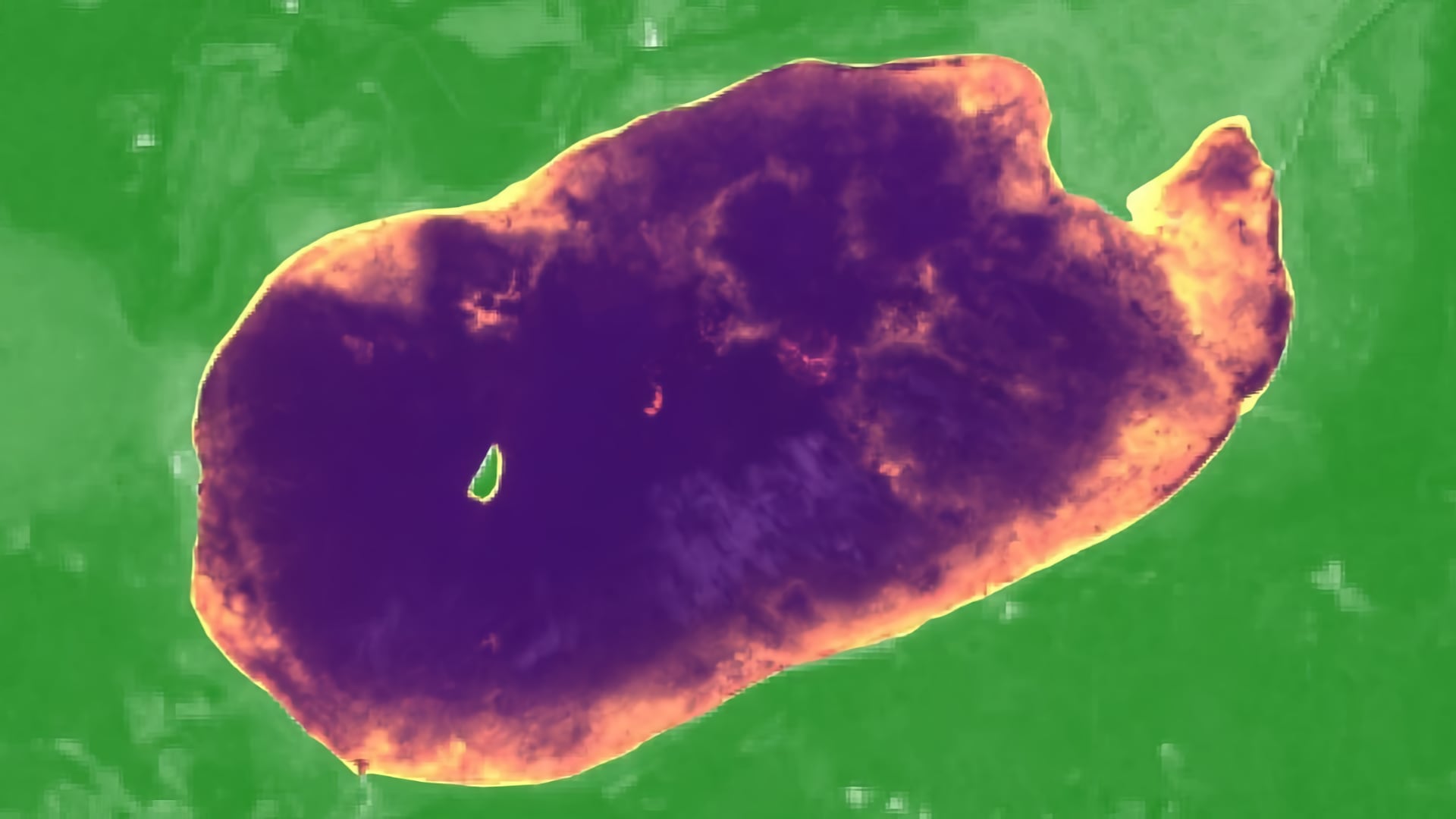
Tasseled cap greenness transformation derived from Landsat 8 imagery over lodgepole pine forest in the Intermountain West study area
Completed Projects
Man Kumari Giri
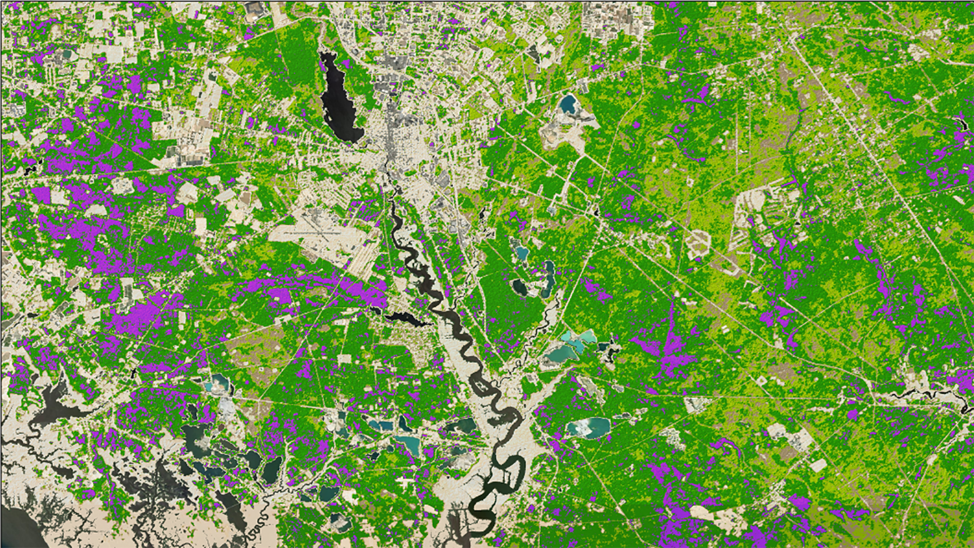
As New Jersey's population increases, more of this population is relocating to the wildland-urban interface (WUI) of the south-central Pinelands region. Due to this increase in human activity coupled with local environmental conditions, local authorities are concerned about an increased possibility of wildfires that could...
Kara Cassano

With the increasing cost and declining availability of fossil fuels, renewable energy, specifically wind power, has become one of the fastest growing sources of energy in New Mexico. To assist with the goals set by the state's Renewables Standard Portfolio established in 2004, the NASA...
Alejandro Soria
Aerosols, fine particulate matter expelled into the atmosphere, have become a major concern due to associated negative health impacts. Aerosols are commonly created by anthropogenic activities such as biomass and fossil fuel burnings, pyrotechnics, vehicle congestion, and mining operations...
Patrick Saylor
A rapidly warming Arctic has compromised the structural integrity of critical infrastructure through accelerated permafrost thaw and thermokarst development underlying these areas. Infrastructure, including roads, bridges, and airports across the state of Alaska are particularly at risk, as permafrost...
Man Kumari Giri
Monitoring early-season invasive (ESI) annual grass species is of great significance to Yellowstone National Park as their spread threatens wildlife populations and biodiversity. Field enumeration of large grasslands with limited personnel is costly and time consuming. In response, this study tested use of NASA Earth...
W. Pierce Holloway
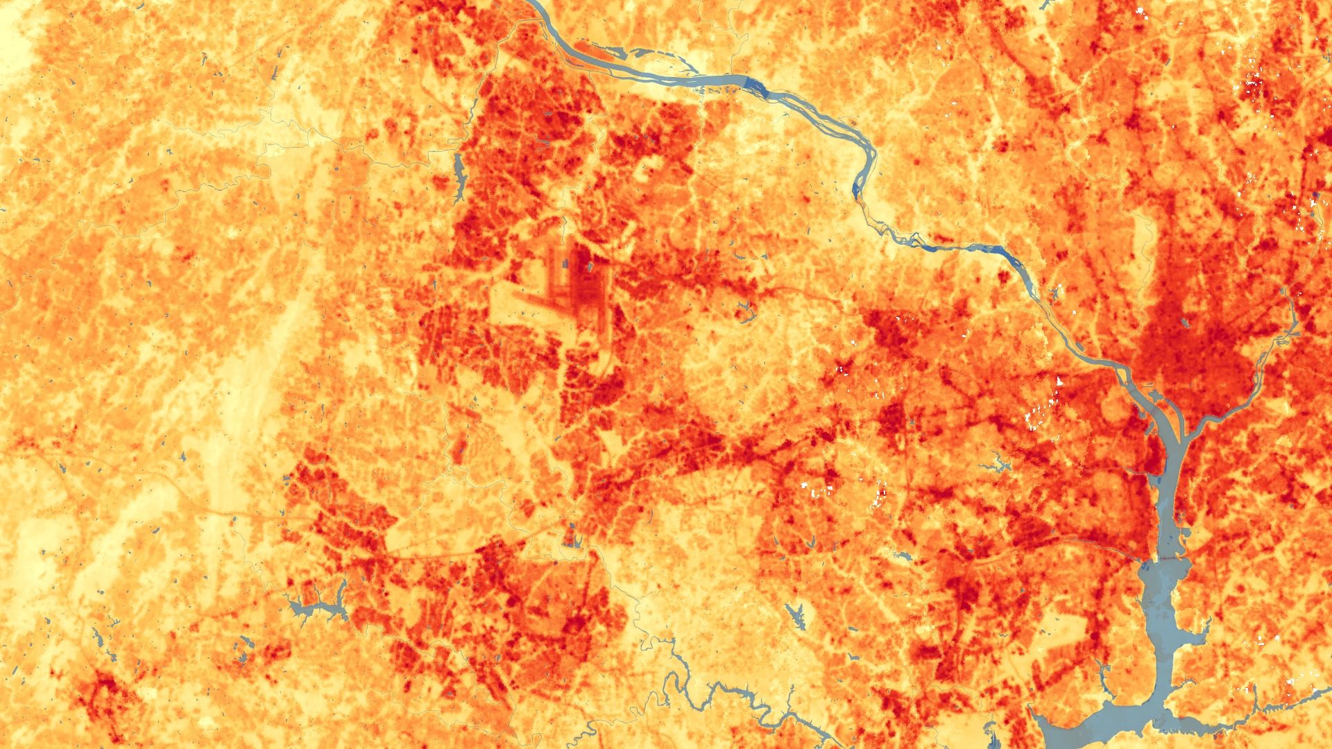
Extreme high temperatures lead to increased instances of cardiovascular disease, pulmonary disease, and even death, as well as increased energy consumption and infrastructure costs. People in urbanized areas experience higher temperatures than rural areas due to diminished vegetation and increased...
Jared Tomlin
Global water resources are important for societies, economies, and the environment. In Niger, limited water resources restrict the expansion of communities and agriculture. Mercy Corps currently works in over 40 countries around the world to address a variety of stresses which include water resources and...
Vanesa Martín
Crop wild relatives (CWRs) are genetically related to cultivated crops and function as repositories for genetic diversity. These plants have the potential to improve the yield, nutritional value, and resilience of crops, thereby buffering against widespread crop failure and supporting...
Adriana Le Compte
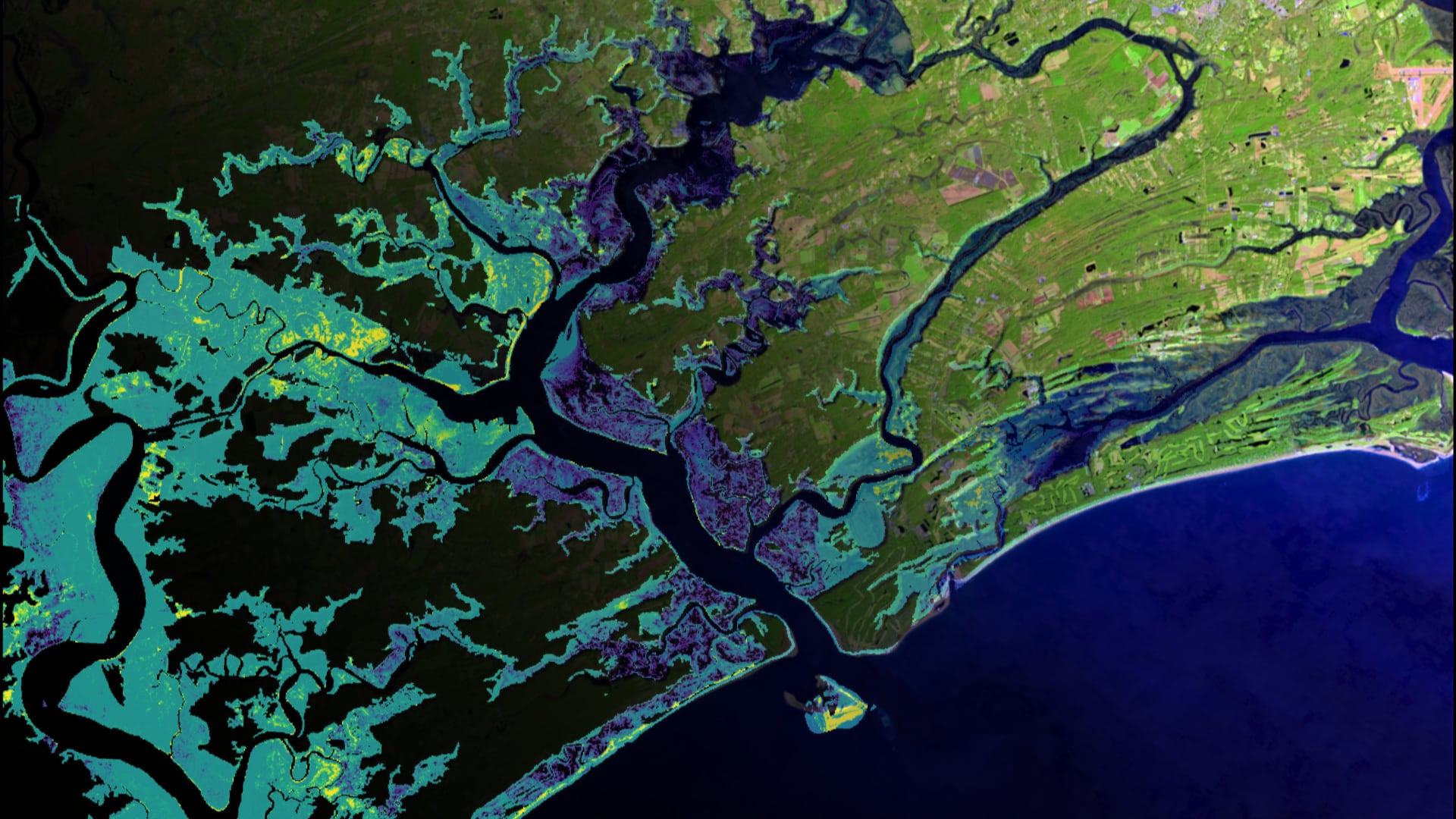
Among the most productive ecosystems on earth, salt marshes provide crucial ecosystem services including water filtration, shoreline protection, storm surge buffering, and flood mitigation. Marshes are largely dependent on their sediment budget which can significantly vary across a region. Upstream...
Forrest Corcoran
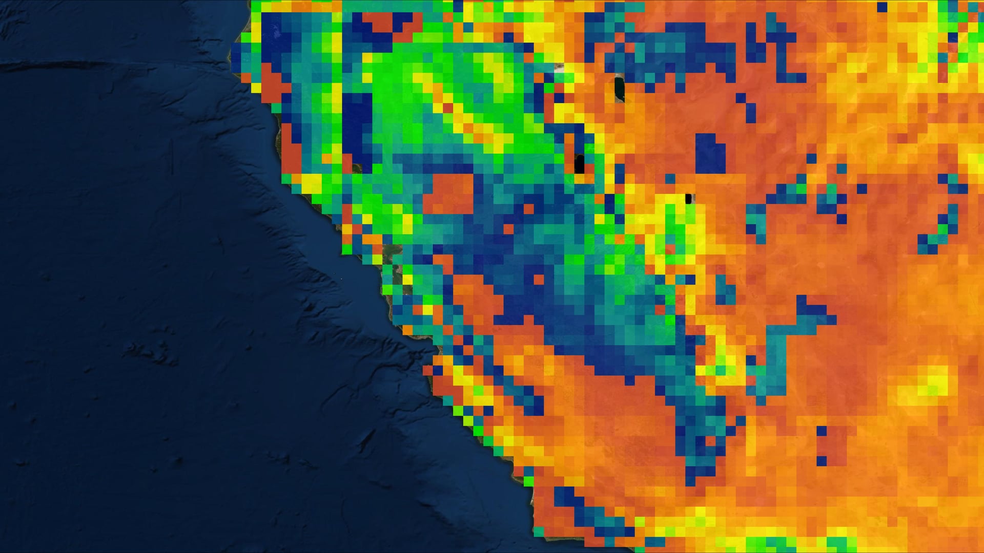
California’s Central Valley is one of the most productive agricultural areas in the world, producing approximately $20 billion in crops annually. The recent California droughts of 2007-2010 and 2011-2017 resulted in increased groundwater pumping in the Central Valley to adequately...