Image

NASA
NASA
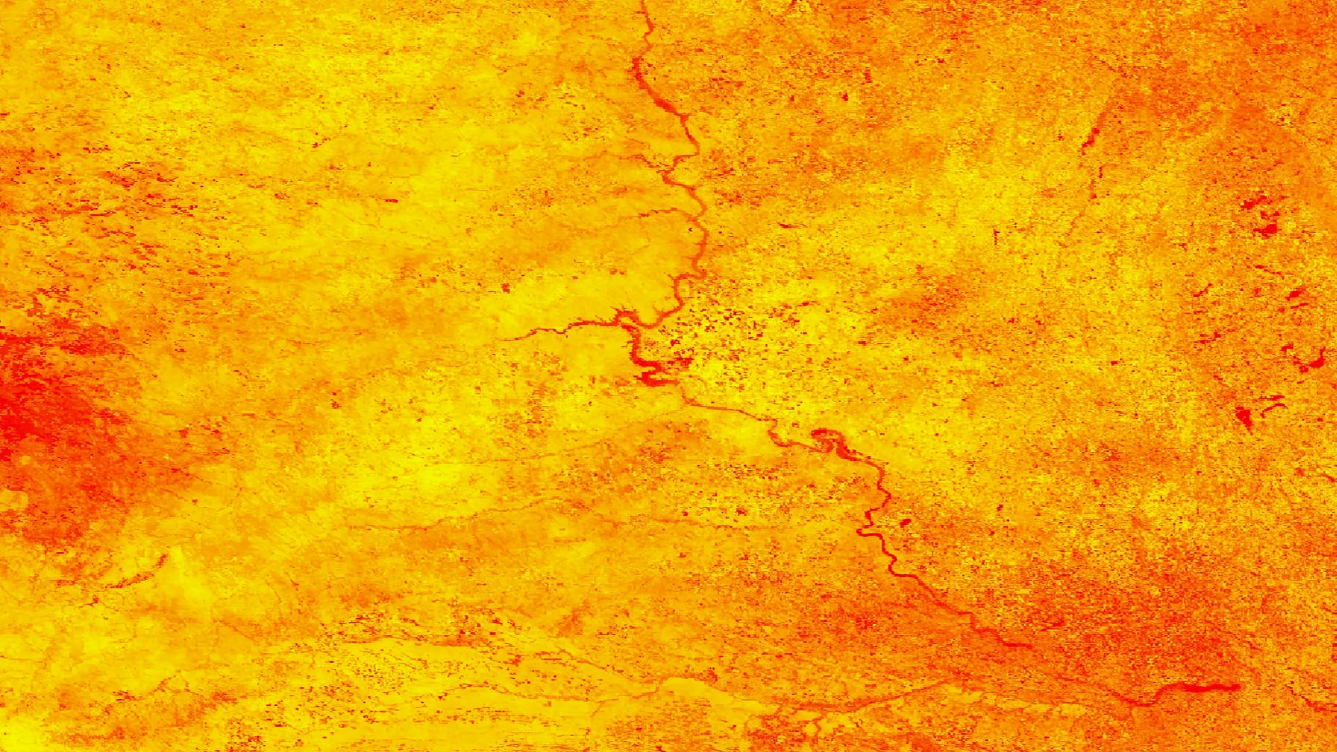
Tasseled cap greenness transformation derived from Landsat 8 imagery over lodgepole pine forest in the Intermountain West study area
Completed Projects
Jerrold Acdan
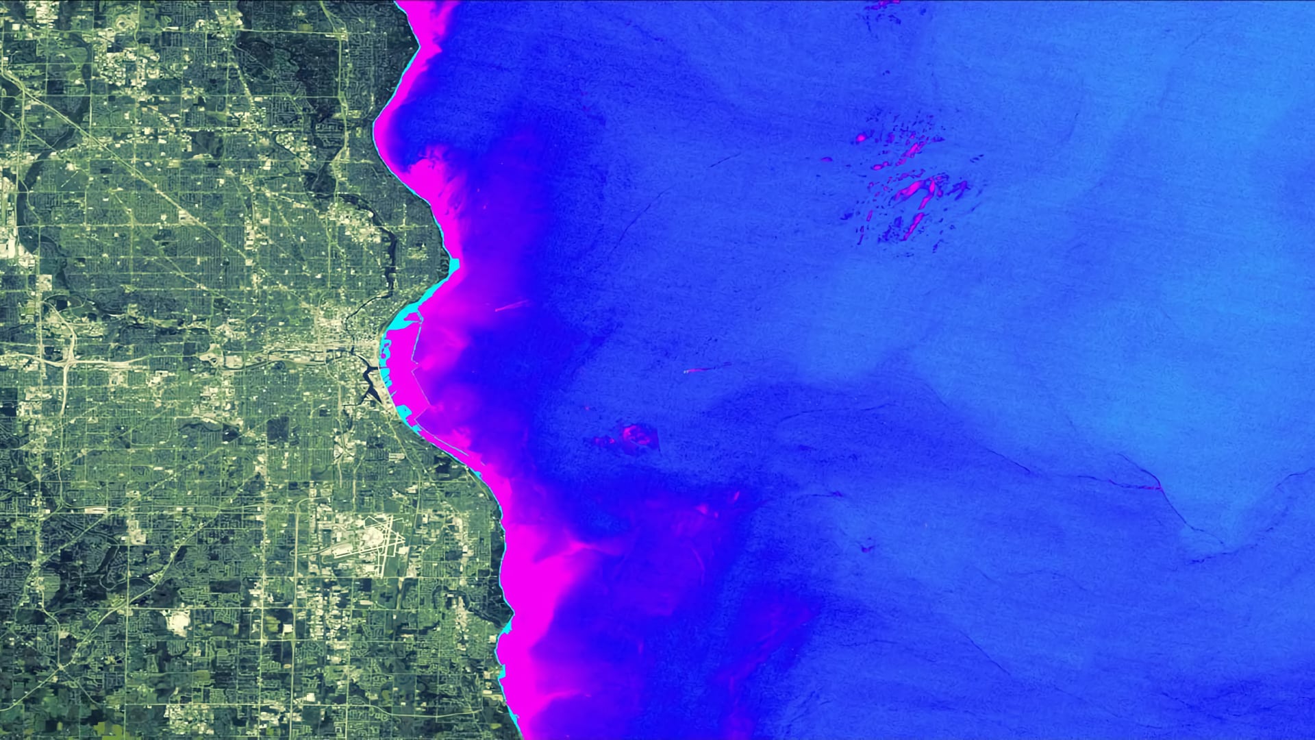
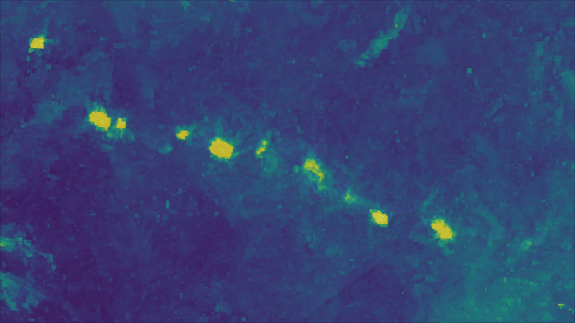
Although Cladophora is naturally occurring and nontoxic, the accumulation and decay of this green macroalgae creates salient socioeconomic issues for communities situated along the shoreline of Lake Michigan. When Cladophora washes ashore and decays, it creates unaesthetic and unpleasant smelling beaches, potentially endangering public health...
Lance Watkins
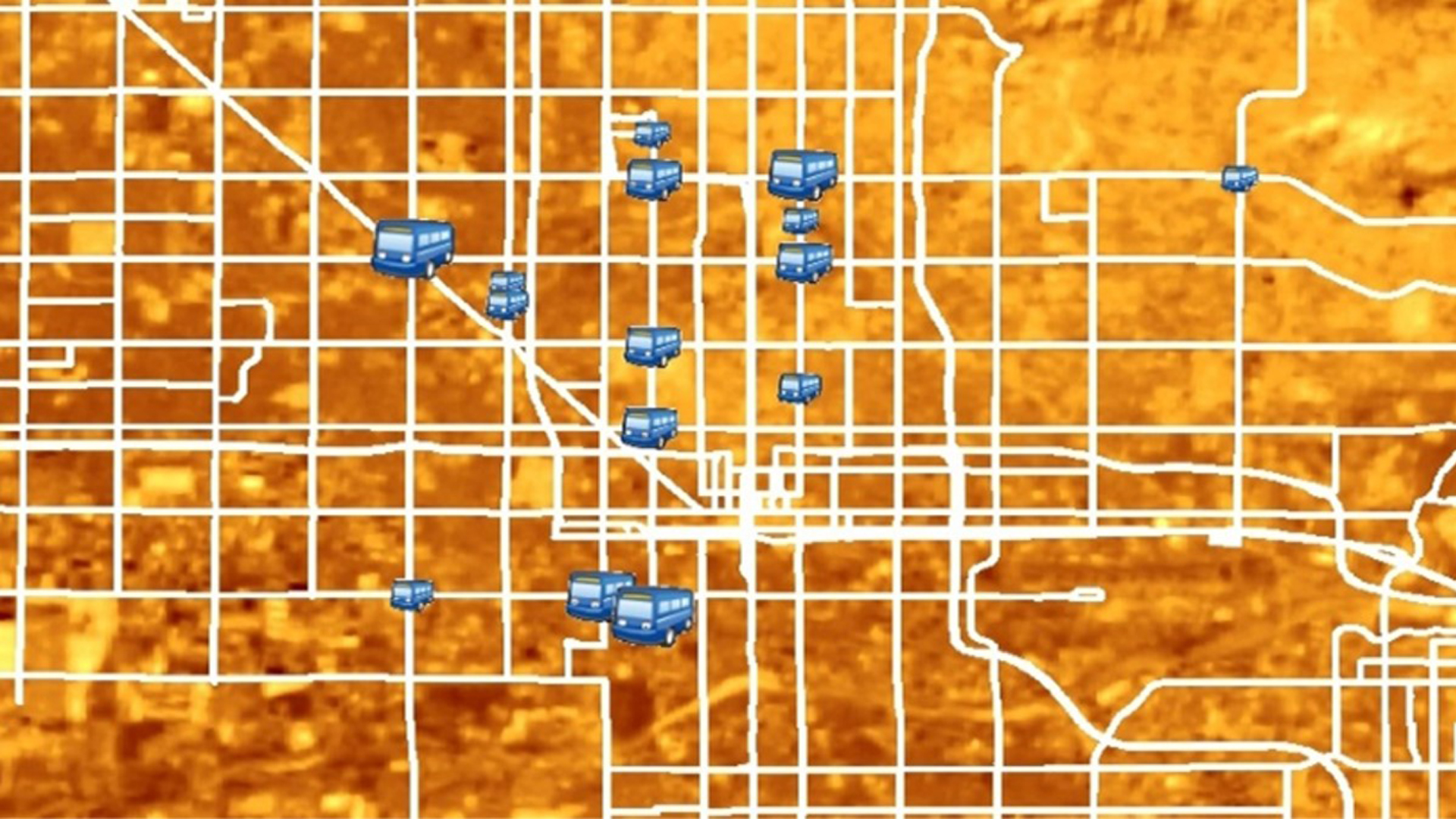
Phoenix, Arizona, a city with 1.5 million residents, experiences extreme heat every year from May through October, with summer daily maximum temperatures regularly rising over 100°F and a record high temperature of 122°F. Residents are prone to thermal discomfort during these summer months, especially those...
Alexa Kennedy
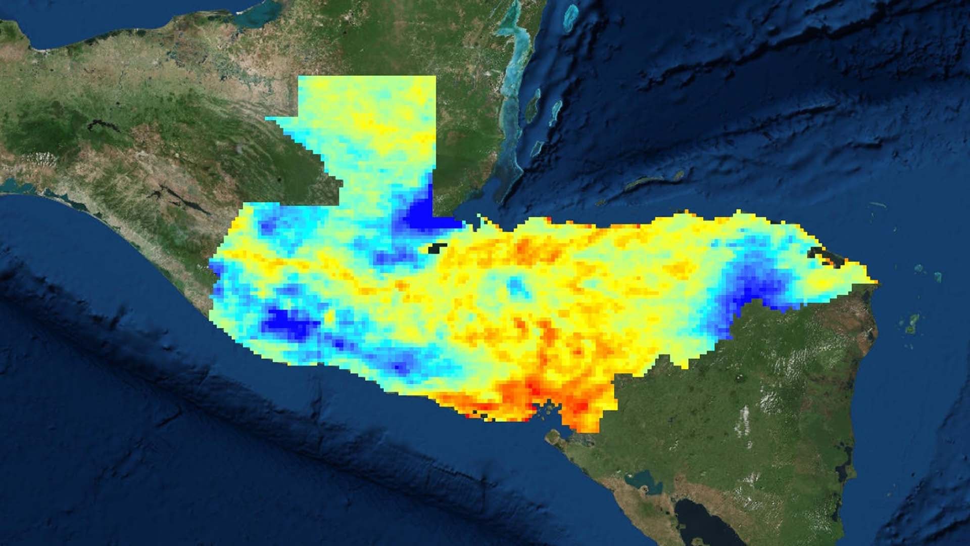
In November of 2017, Guatemala, Honduras, and El Salvador produced over 12 million kg of coffee combined, accounting for half of Central America's total output. However, in the last 20 years Central America has experienced crop declines between 50% and 90%, due largely to drought...
Kimberly Berry
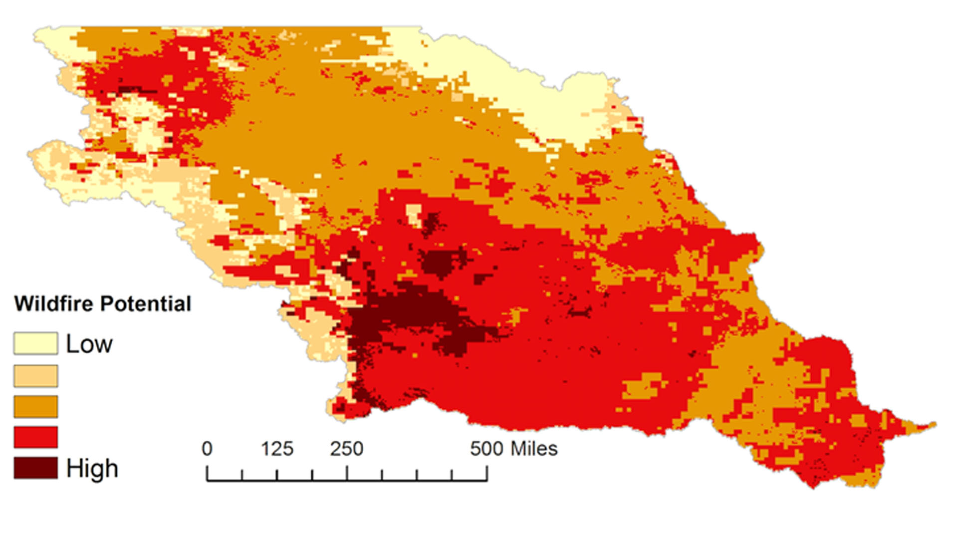
Grasslands in the Missouri River Basin (MRB) cover the majority of the landscape and are essential for livestock grazing and agriculture. However, they are susceptible to wildland fires, with each year averaging approximately 6.6 million acres (2000-2010 average - National Interagency Fire Center) burned...
Natalie Belew
The grasslands of the Great Plains that span the Dakotas and Nebraska are crucial for the region’s agriculture and livestock grazing. In the face of increased variability in regional climate, their susceptibility to drought conditions, wildfires, and extreme weather events are expected to increase. Building...
Ryan Good

Many regions of Kenya historically and regularly experience severe drought, necessitating a robust and well-informed response to drought events to protect agricultural production and minimize drought impact on food security. The National Drought Management Authority currently publishes monthly Early Warning...
Ani Matevosian
The Pacific Northwest region of the United States and Canada has become more vulnerable to intense wildfire regimes due to years of fire suppression and climatic changes. Smoke from fires exposes communities to hazardous aerosols and pollutants known to trigger...
Rachel Tessier
Delaware’s coastline is a vibrant tourist destination and rich, unique habitat for many vulnerable species. Yet, with the lowest mean elevation of any state, this indispensable stretch of land is threatened by numerous geological and climatic forces, including coastal erosion...
Zachary Bengtsson
Salt marshes provide valuable ecosystem services, including protection from coastal storms, erosion control, carbon sequestration, improved water quality, and ecological diversity. Plum Island Estuary (PIE), the largest salt marsh in the northeast United States, is a two thousand year-old ecosystem located thirty-five miles north of...
Keolohilani H. Lopes Jr.
Chondria tumulosa, a newly discovered red alga, was observed in low abundance in 2016 but has since proliferated and is now smothering and decimating vast expanse of coral reefs in Manawai, located in Papahānaumokuākea Marine National Monument (PMNM). If...