Displaying 31 - 40 of 81
![2022 Spring CO Boulder County Disasters Website Image](/sites/default/files/styles/lis/public/2022-06/2022Spring_CO_BoulderCountyDisasters_WebsiteImage.png.webp?itok=1X2GgkIw)
Boulder County Disasters (Spring 2022) Team: Sarah Hettema (Project Lead), Jennifer Rogers, Ibuki Sugiura, Erin Twaddell Summary: In recent years, record-breaking wildfire activities in the...
![Predicted cheatgrass green-up imagery from Landsat 8 OLI data. This composite image of the western portion of the Mullen Fire Study Area is from June 2022. Shades of green and yellow indicate an earlier green-up time, while orange, brown, and white areas show later predicted green-up times. This data was used to create NDVI difference maps which will help managers predict when and where to apply treatments to limit the spread of cheatgrass.](/sites/default/files/styles/lis/public/2023-10/2023Sum_CO_SouthernWyomingEcoII_WebsiteImage.jpg.webp?itok=Ht2hUpEj)
Southern Wyoming Ecological Conservation II (Summer 2023) Team: Bryan Graybill (Project Lead), Lillian Gordon, Estelle Lindrooth, Sarah Sathe Summary: Cheatgrass (Bromus tectorum) is an invasive...
![](/sites/default/files/styles/lis/public/images/develop-legacy/2020/fall/images/2020Fall_MSFC_Amazonia_Disasters_Website_Image.jpg.webp?itok=8SzNXrl9)
Topic
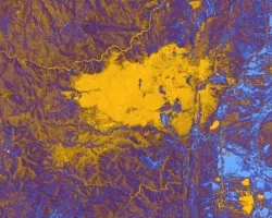
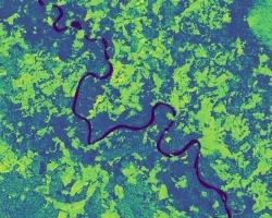
Artisanal and small-scale gold mining (ASGM) is responsible for a large fraction of deforestation and disturbance in Amazonia. These activities cause severe impacts on the...
![The image was collected by Landsat 9 on January 26 of 2023 showing Skidaway Island and waterways on the Georgia coast. The data shows areas of healthy vegetation and urban areas using a Normalized Difference Vegetation Index (NDVI). The darker orange represents grass and urban areas. Yellow and purple represents forested and densely vegetated areas. The black represents open water.](/sites/default/files/styles/lis/public/2023-05/2023Spring_GA_GeorgiaDisastersII_WebsiteImage.jpg.webp?itok=zhMhpiSz)
Georgia Disasters II (2023 Spring) Team: Shakirah Rogers (Project Lead), Nathan Tesfayi, Matthew Murray, Clarence Jackson Summary: Heirs property owners are especially vulnerable to natural...
![](/sites/default/files/styles/lis/public/images/develop-legacy/2021/summer/images/2021Sum_JPL_CoastalCaliforniaWaterII_WebsiteImage.jpg.webp?itok=vq31qia9)
Topic
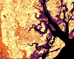
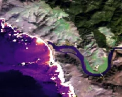
Estuaries are dynamic environments that provide a host of vital ecosystem services. California’s Marine Life Protection Act protects such ecosystems by creating Marine Protected Areas...
![](/sites/default/files/styles/lis/public/images/develop-legacy/2019/summer/images/2019Sum_AL_MobileUrban_WebsiteImage.jpg.webp?itok=581tgURE)
Topic
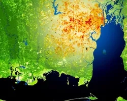
This project utilized satellite Earth observations to assess locations in Mobile County, Alabama, that are vulnerable to the urban heat island effect (UHI) and flood...
![](/sites/default/files/styles/lis/public/images/develop-legacy/2019/summer/images/2019Sum_MSFC_CentralAmericaTI_WebsiteImage.jpg.webp?itok=DWQOzdqL)
Topic
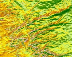
Central America is one of the world’s most vulnerable regions to natural disasters, including landslides and precipitation-driven flooding. In an effort to support disaster management...
![Normalized Difference Water Index (NDWI) to visualize drainage networks around the Unalakleet River in Alaska, calculated from an August 2021 Landsat 8 OLI image. Yellow represents standing or flowing water and potential flood zones, while the dark blue represents drier, upland regions. Unalakleet's climate resilience planning prioritizes relocation to upland regions while avoiding areas that have experienced significant permafrost degradation.](/sites/default/files/styles/lis/public/2023-10/2023Sum_GA_UnalakleetClimate_WebsiteImage.jpg.webp?itok=9m9RUwoB)
Unalakleet Climate (Summer 2023) Team: Ian Lee (Project Lead), Clara Maxwell, Daniel J. Marsden, M. Jaweed Nazary Summary: The coastal community of Unalakleet is currently...
![](/sites/default/files/styles/lis/public/images/develop-legacy/2020/spring/images/2020Spring_JPL_CentralValleyWater_WebsiteImage.jpg.webp?itok=7tG_qPN2)
Topic
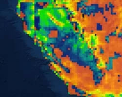
California’s Central Valley is one of the most productive agricultural areas in the world, producing approximately $20 billion in crops annually. The recent California droughts...
![](/sites/default/files/styles/lis/public/images/develop-legacy/2018/summer/images/2018Sum_LaRC_ColombiaEco.jpg.webp?itok=52ywG06n)
Topic
Colombia contains a variety of endemic species, making it one of the most biodiverse regions in the world. Due to a recent peace treaty between...